


![]()
You are here
Tour to Small Aral Sea.


Individual Tours to Aral Sea in Kazakhstan.
«Happy journey and safe returning!»
The unknown author.
Short description of tour route from Kok- Aral dam to village Akbasty:
Aralsk - settlement Zhalanash - settlement Tastubek - of fishermen place Tastubek - settlement Akespe - settlement Akbasty - lake Kombash - Aralsk.
Distance of the route: 409 km
Season: from May 20, 1st till Oktober, 1th.
Best time for travel: June - August.
Duration of tour: 3 days, 2 nights.
Detailed program day by day around of Small Aral Sea:
Expeditions tours on Aral Sea in Kazakhstan.
Day 1. Town of Aralsk - settlement of Zhalanash - settlement of Tastubek - place of fishermen Tastubek (121 km).
Transfer: Aralsk - settlement of Zhalanash (63 km). Departure from Aralsk, our way lies on the northwest, approximately, through 5 kilometers from the town asphalt, a further way to the settlement of Zhalanash reaches a limit, passes on the grader.
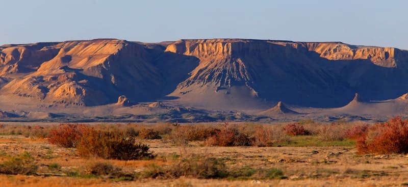
For 27 kilometers before the settlement of Zhalanash, to the left of the road, picturesque breaks of the natural boundary Saryshoky, East cliff of Ustyurt, a stop on photography are located. Arrival in the settlement of Zhalanash, short walk in the neighborhood of the settlement, photography of rural houses with flat roofs.
Transfer: settlement of Zhalanash - the settlement of Tastubek (25 km). The settlement of Tastubek is on the peninsula Koktyrnak. In the east, in 29 kilometers there is a bay Zhalanash, in the southern part of the peninsula low hills Bultuk and Ushshoky are located. It is the usual settlement which is on an eminence, from here to the place of fishermen on the bank of the Aral Sea 3 kilometers.
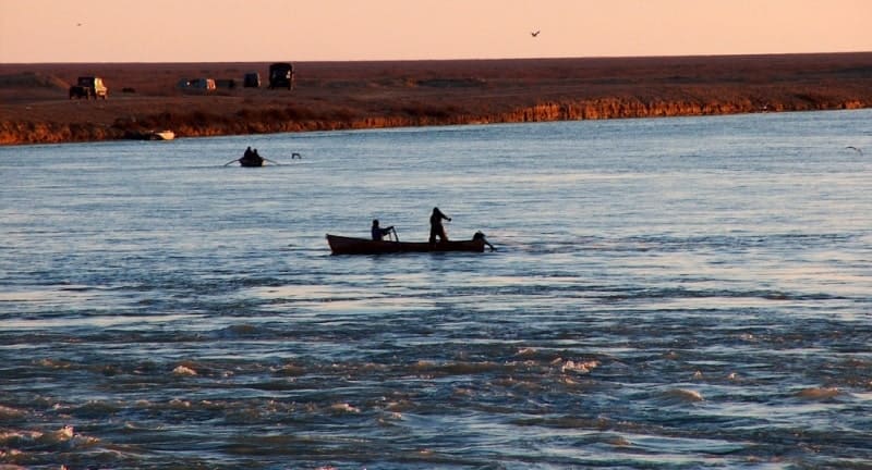
Transfer: settlement Tastubek - on the place of fishermen on the bank of the Small Aral Sea (3 km). Working day of fishermen begins early in the morning. In the morning fishermen departure on motor boats in the sea, put networks, and in the second half of day pull out fishing networks with production. A lunch in way.
Transfer: the place of fishermen at the Aral Sea - Shoshkala valley - mountains Kaltybay (30 km). We transfer the North, to the left of us the gulf Butakov, it is a northern part of the Aral Sea. Approximately, in 2 kilometers from the sea breaks East cliff of Ustyurt, begin here and there are mountains Kaltybay. Walk in vicinities in the mountains Kaltybai. Pitch up a tent, dinner and overnight in tents.
Day 2. Mountains Kaltybay - settlement of Akespe - settlement of Akbasty (67 km).
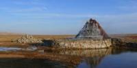
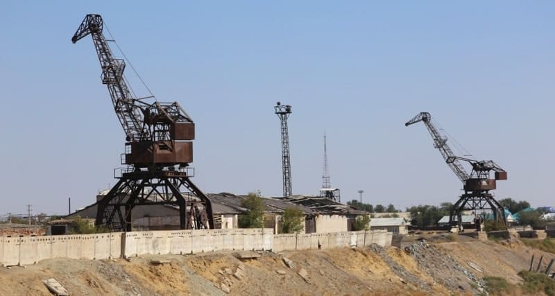
Breakfast. Transfer: mountains Kaltybay - First ship on the bank of the Aral Sea (11 km). We go to the West along East cliff of Ustyurt and along the northern coast of the gulf Butakova. On the right we observe an eminence - mountain Karasandyk 200 meters high above sea level. Through 10 kilometers on cliff of East plateau Ustyurt the mountain Akshoky 215 meters high above sea level towers. Arrival to the first ship, walk in environs. First ship is ashore, the most part of the ship is sorted, wooden parts lie separately from the ship aside, all designs of the ship rusty.
Approximately in 400 meters on the southwest from the First ship there is Second ship. This ship is a shapeless heap of rusty iron, it is difficult to approach it and iron still whole as it is in water, approximately in 70 meters from the coast. The bottom is covered with silt deeply, it is almost impossible to approach the ship. From here, on the East in 3 kilometers, in a coastal zone the Aral Sea is the deepest place in the gulf Butakova - 45 meters. Walk in environs.
Approximately in 120 meters to the west from the Second ship there is Third ship. It, too a shapeless heap of rusty scrap metal which under the name the former ship, also is partially in water and partially on the land. Most likely it was the tow, judging by the remained cabin of the boat. Walk in environs.
Transfer: The Third ship - the Barge on the bank of the Aral Sea (9 km). Our way lies on the northwest along East chink of Ustyurt. We pass the mountain Kenderli 227 meters high above sea level which is the most dominating eminence on coastal cliff. The fourth Barge, is the barge, from all ships, it remained best of all. The most part of the barge is in water, other ashore. Around the barge sand, is a lot of garbage, most likely locals from the settlement of Akespe come here for rest and to bathe. Walk in environs.
Transfer: The fourth barge - the thermal well to Akespe (10 km). A lunch in way. We continue our movement along East cliff of Ustyurt. Gradually we move away from the coast of the Aral Sea, on the way we pass the mountain Kumbulak 210 meters high above sea level which is in a northwest part of cliff. Arrival on a spring to Akespe.
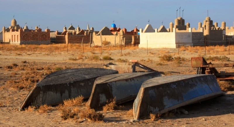
In 1986 geologists from the city of Shymkent drilled the well and from there hot water rushed. Water temperature of 62 degrees, water arrives from depth of 1200 meters. In hot weather in water it is not possible to bathe, water does not form lather. From North side from a source there is a local necropolis.
Transfer: the thermal well to Akespe - settlement of Akespe (2 km). The village of Akespe is located in the Aral district in the most northern part of the Aral Sea at the northwest coast of the gulf Butakova. In 1925 near the village paleontologists Oligocene burial - Aral a mineral was revealed.
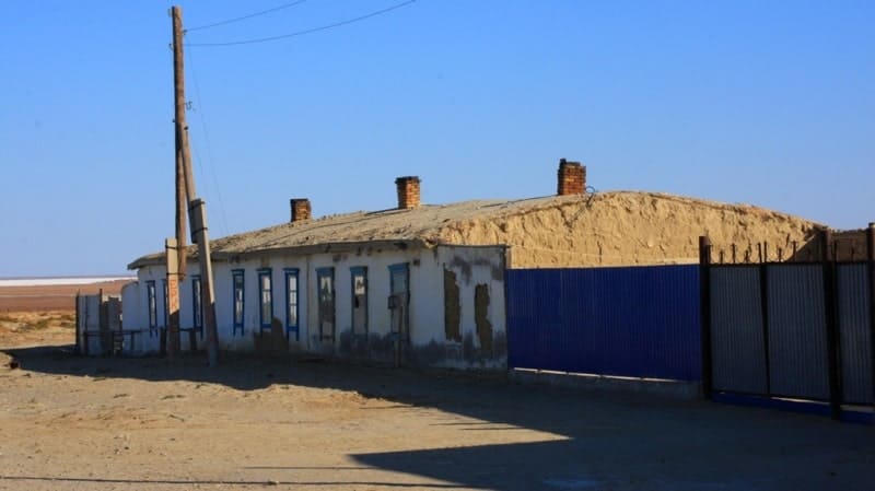
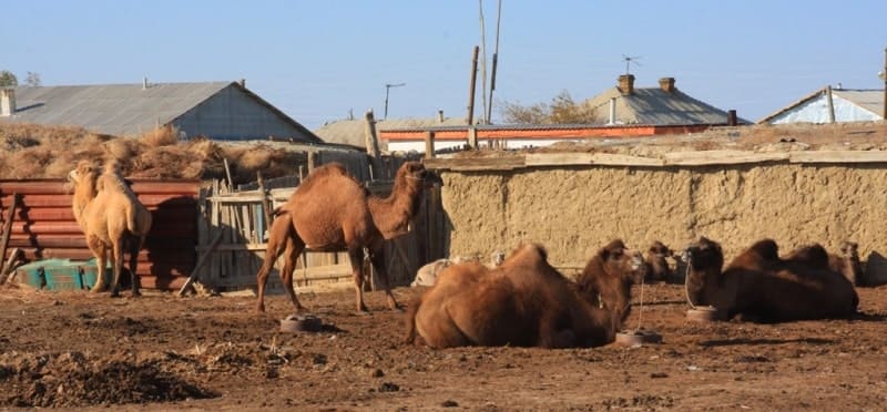
The settlement consists approximately of 30 houses, is in sands, in the settlement there is a school, the antenna of mobile communication. In the settlement of Akespe, generally there live fishermen, there is a refrigerator for storage of fish.
In 2 kilometers to the north from the settlement there is one more settlement of Akespe-2 which was built by inhabitants, there is less sand, the settlement consists of 15 houses.
Transfer: settlement of Akespe - settlement of Akbasty (45 km). Our way lies on the southwest, to the left of us there is a peninsula Shubartarauz. Further, we pass the natural boundary Akbidayyk here nearby there was a small settlement of Kumkuduk from which there were only ruins.
We pass the natural boundary Shomishkol and soon we approach the coast of the gulf of Shevchenko (the former name - the gulf Paskevicha). Shevchenko gulf is the most western part of Small Aral Sea. The largest depth in Shevchenko gulf of 19 meters. We pass the cape Torangyly opposite to which, the mountain Karatas 187 meters high above sea level in the north is located and soon East cliff Ustyurt comes to an end.
Our further way lies along the western part of the gulf of Shevchenko, we pass necropolises Shiniger and Sulley and natural boundary Zhalanash. Near the settlement of Akbasty in the natural boundary Kelmes we will pitch up a tent, dinner and overnight in tents.
Day 3. Valley Kelmes - settlement of Akbasty (221 km).
Breakfast. Transfer: settlement of Akbasty – Kok-Aral dam (77 km). We go from the western part Small Aral Sea and we go to the settlement of Akbasty. Walk to saint tombs the brought sand, replenishment of water-supplies in the settlement of Akbasty (in the western part of the settlement the well with fresh water). Arrival in the settlement of Akbasty, walk on the settlement.
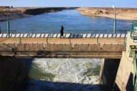
Further transfer Berg isthmus through which in 2005 the dam the Kok-Aral dam which partitioned off the Small and Big Aral Sea and received the name was laid. To the west from our road to the natural boundary Sagyzsay there is a hill Duat (or on another the mountain Kok Aral Sea) 161 meter high above sea level. Here in the 1980th years there was a sea beacon nearby Karotas who helped sea vessels to overcome Berg's isthmus. Walk on the Kok-Aral dam, survey of locks of a dam.
Further transfer: The Kok-Aral dam - settlement of Karateren - Aklaksky water-engineering system - settlement of Bogen - settlement of Amanotkel - lake Kombash (76 km). On the way visit of the settlement of Bogen, walk in the neighborhood of local school which was constructed in 1954 partially brought by sands, photography of the local mosque. Arrival on the lake Kombash, walk in the environs of the lake.
Further transfer: lake Kombash - town of Aralsk (86 km). Walk in the environs of the lake Kombash. Arrival in Aralsk, end of a tour.
Distances on route «Tour to Small Aral Sea»:
Town Aralsk - settlement Zhalanash - 63 km.
Settlement Tastubek - place of fishermen Tastubek - 4 km.
Place fishermen Tastubek - settlement Akespe - 61 km
Settlement Tastubek - settlement Akespe - 55 km.
Settlement Akespe - settlement Akbasty - 100 km.
Settlement Akbasty - settlement Karateren - 98 km.
Settlement Karatern - lake Kombash - 98 km.
Lake Kombash - the city of Aralsk - 86 km.
Train schedule from station Aralsk - Almaty:
The train 24 «Aktobe - Almaty », daily, from Aralsk, at 06.24.
The train 377 « Mangyshlak - Almaty», daily, from Aralsk, at 02.35.
The train 34 «Aktobe - Almaty», daily, from Aralsk, at 08.02.
The train 41 «Atyrau - Almaty», daily, from Aralsk, at 12.35
The train 7 «Moscow - Almaty», daily, from Aralsk, at 02.22.
All trains from Aralsk to Almaty and on other directions passing.


The note:
Author program is Alexander Petrov. Copying and use - from the sanction of the author petrovsra@mail.ru
Alexander Petrov
photos by.