You are here
Türkmenabad town.


Tourist sights of Türkmenabad.
"Turkmenabad is a country with the glorious past. It is rich in historical monuments and different places of interest, there are many historical interesting places in Turkmenabat. It is Dayahattin Kervansaray, Amul' Settlement, Allamberdar Mausoleum, these are famous historical places and the tourist attractions in Central Asia"
Excursion in Turkmenabad.
Türkmenabad is located at an altitude of 187 m (614 ft) on the banks of the Amu-Darya River, near the border with Uzbekistan. Türkmenabat is at the center of Lebap province, which has borders with three provinces in Turkmenistan: Mary, Ahal and Daşoguz.
The province also borders with Uzbekistan and Afghanistan. Some 70 kilometres (43 miles) south of Türkmenabat in the East Karakum Desert is the Repetek Nature Reserve, famed for its zemzen, or desert crocodiles.
Although now a modern industrial city, Türkmenabat has a history of over 2,000 years. In ancient times, it was known as Āmul (to be distinguished from the Iranian city of Amol). The river Amu Darya is said to mean River of Āmul, named after this ancient city.
Türkmenabat was the hub in an intersection between 3 paths of the Great Silk Way leading to Bukhara, Khiva and Merv.[citation needed]. For centuries, Āmul was an important town of the relatively backward Uzbek feudal khanate (later emirate) of Bukhara.
When the Russian Empire started annexing Central Asian Turkestan, Āmul was surrendered to Russians by the Bukhara emirate, who later herself would entirely become a vassal of Russia and pledge allegiance to the Russian emperor.
The modern city was founded in 1886, when Cossack Russians settled in Uralka in what is now the eastern part of Türkmenabat, naming their settlement New-Chardjuy. The settlement here was necessary to complete the construction of the Trans-Caspian railway.
After the revolution of 1917, when the Bolsheviks came into power in Russia, communists merged former khanates into republics on the basis of nationality. Thus, Türkmenabat (known as Chardjuy at those times) was passed to the newly created Turkmen Soviet Socialist Republic in order to reduce the territory and strength of a highly nationalistic Uzbekistan.
Its role as a railway junction, and the high fertility of the Amu-Darya region, made it the major trade center for agricultural products in the northeast region of the country. The city has food processing, textile (cotton processing and silk) factories.
Chardzhou was Turkmenistan's industrial and transport hub during the Soviet period, but most of these related jobs and transport opportunities have been relocated to Ashgabat or closed since Turkmenistan's independence.
Is the of Turkmenabad and It is very dear to me, because I was born here which it is the second largest city in Turkmenistan. The population of Turkmenabat is over 254 thousand people.
The city is located in the province of Lebap in the northeast of the country, which has borders Uzbekistan in the north, Afghanistan in the east with another three provinces Mary, Ahal, Dashoguz.
Turkmenabad is located on the banks wild river of the Amu-Darya River. The climate of the Turkmenabat is extreme summer heat and cool winters with frosts. There is snow in the north and in the mountains. In the south and east the weather is dry especially in summer.
Beauty Turkmenabat can be seen in April and in May, these are the best months for a beautiful blossoming deserts and mountains. And September and October are great for an abundance of fresh fruits and vegetables.
On its streets you’ll hear as much Uzbek as Turkmen and will likely be enjoying Uzbek produce, driven across the border a few kilometres to the north. The town itself feels as if it’s in the geographic centre of nowhere, yet after the mind-numbing drive through the desert from either Dashogus or Mary, it’s something of a surprise to find such a large city appear out of the sand.
It has a long history, based around its geographical position as a suitable crossing point of the broad and treacherous Amu Darya. Initially named Amul, it was first settled more than 2,000 years ago, and gradually became a prosperous crossroads for Silk Road routes heading east to China, south to India and north to Khorezm.
Amul was razed by the Mongols in 1221, but the city re-emerged, now called Charjou ('Four Channels'), a name you’ll still hear used by the remaining Russian-speaking locals. It fell under the control of the Khanate of Khiva and then the Emirate of Bukhara in the XVIIIth and XIXth centuries.
The construction of a railway bridge over the Amu Darya in 1886 marked a new stage in the development of the town. Following the Ashgabat earthquake of 1948, some suggested that the capital of the Turkmen Soviet Socialist Republic be moved to Charjou, as it was less earthquake-prone than Ashgabat, but nothing came of the idea, and the town has slipped into an increasingly provincial existence.
By a decree of President Niyazov issued in July 1999, Charjou was renamed Turkmenabat, the city of Turkmens, in order to reflect the 'great ideas of unity and stability of the country ... as well as taking into consideration the wishes of the population of Lebap region'.
Many local people still refer to the place as Charjou. In 2009 a new gas pipeline opened here taking Turkmen gas to China, thus ensuring the city’s economic prosperity. Despite being the second-largest city in the country, there’s nothing much to see or do here, though it’s an obvious stopover on the long journeys to Kugitang Nature Reserve, Mary, Dashogus or Uzbekistan.
Like Turkmenistan's other regional capitals, Turkmenabat serves as a base from which to explore its region. The shortage of accommodation options towards the top end of the market, however, makes it less than ideal in fulfilling that function.
Its sights, which include a regional museum and the unexcavated ruins of the town of Amul, are by no means unmissable, but Turkmenabat is a friendly place, it not a particularly dynamic one.
Turkmenabad is a country with the glorious past. It is rich in historical monuments and different places of interest, there are many historical interesting places in Turkmenabat. It is Dayahattin Kervansaray, Amul' Settlement, Allamberdar Mausoleum, these are famous historical places and the tourist attractions in Central Asia.
Repetek Reserve and Nature Reserve Museum Amu Darya are also in Turkmenabad and the animal world is very diverse there. Many different animals live in nature reserve: wolves, foxes, hares, squirrels, chipmunks.
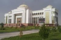
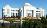
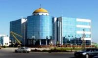
Nowadays Turkmenabat doesn't look the same way it looked before. There are a lot of tall buildings of marble. The present-day city is almost entirely of new construction. It is the city with broad streets and avenues, modern architecture.
Besides, the central street of our town is beautifully decorated with red, white and yellow tulips. It makes our town very beautiful and nice. The world's largest handwoven rug has got a big carpet museum in Turkmenabat which produces to the carpet factory.
In order to Turkmen rugs and jewelry to withdraw from the country must present the official receipt and registration form from the store where it was produced for sale.
Authority:
On materials of information department of the State committee of Turkmenistan on tourism and sport.


