


![]()
You are here
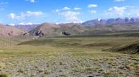
Valley Ak-Sai in Naryn region.

Travels in Naryn region.
"Winter camp, behind which
The blue mountains cannot be counted
Who ever saw the mountains -
He will return to them again."
Yuri Vizbor. "Hut". 1962.
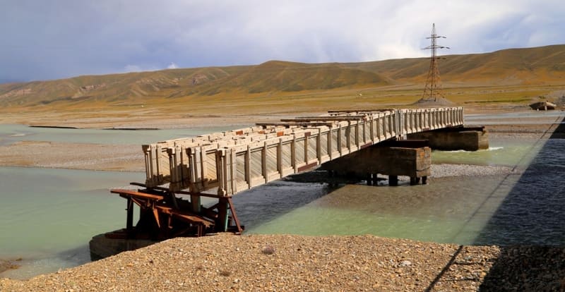
Drive from Naryn to Aksai river valley.
Ak-Sai valley is located between the Atbashi ridge in the north and the Kokshaal-Too ridge in the south, in the southeast of the Naryn region. The length of the Ak-Sai valley from the southwest to the northeast is 163 kilometers, the maximum width is 56 kilometers.
The widest part is in the western part of the valley. The valley stretches from the border ridge Maidantag, which, in turn, is located in the Western Kokshaal-Too and to the southern slopes of the Atbashi ridge in the interfluve of Kensu and Chet-Ichkesu.
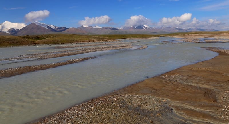
The length of the valley is measured from the sources of the Western Ak-Su to the Kogalya-chap plateau, where the sources of the Eastern Ak-Sai are located. It should be noted that the Ak-Sai valley bears the name of the river of the same name; there are two Ak-Sai rivers throughout the valley: the Western and the Eastern.
Ak-Sai Western river, the sources of which are located in the northern part of the Torugart ridge and 17 kilometers from the eastern shore of the Chatyr-Kol lake. The Ak-Sai East river, its sources are located in the eastern part of the valley on the Kogalyachap plateau.
The western borders of the valley are the eastern end of the Chatyr-Kol lake located at an altitude of 3530.2 meters above sea level, the northeastern slopes of the Torugart-Too ridge and the Western spurs of the Kokshaal-Too ridge.
From the north-west, north and north-east, the borders of the valley are the southern slopes of the Atbashi ridge, which stretches for 137 kilometers from the south-west to the north-east. From the east, the valley is limited by the southwestern spurs of the Borkoldy ridge and the watershed stretching from the Kubyurgenty pass with a height of 3907.2 meters above sea level to the northern slopes of the Kokshaal-Too ridge between the sources of the rivers: from the west - Kyzylunet and Karagermes, from the east - Kotur.
Ak-Sai East and West belong to the Kokshaal river basin. Kokshaal, cuts through the Kokshaal-Too ridge and goes to the Republic of China between the Chon-Chichar pass 3470.6 meters above sea level and the northeastern spurs of the Kekkyya ridge.
The hydrography of the valley is complex. The rivers in the western part of the valley are not permanent and dry in character. The main streams flow along wide and flat river beds. The sources of Western Aksai are located at an altitude of 3700 meters above sea level - the mouth is at an altitude of 2987.1 meters above sea level.
The headwaters of the Eastern Ak-Sai lie at an altitude of 3510 meters above sea level - the mouth is at an altitude of 2987.1 meters above sea level. The eastern part of the valley is more humid, since it is located on an elevated part, the soil is swampy.
The eastern part of the valley is typical syrts with hills, plateaus, heights and numerous lakes. Syrts of the valley, which have been denudated for a long time, i.e. destruction and leveling by glaciers, water and wind.
Flat and shallow river valleys and wide hilly depressions alternate with smooth interfluves and low ridges. Permafrost with remnants of ancient glaciation is observed here, permafrost is widely represented in the western part, at an altitude of more than 3400 meters above sea level.
The climate of the region is sharply continental. The average annual temperature here is minus 5 - 6 degrees, the maximum is +24, and the winter minimum is minus 50 degrees. In summer, at an altitude of more than 3000 meters above sea level, there are frosts every night.
Winter, in most of the territory, lasts from mid-November to March, inclusive (in large intermontane valleys - from mid-November to mid-March); this season is characterized by cold, mostly cloudy weather. The air temperature in the daytime, depending on the altitude of the area, varies from -3 to -15 degrees, at night - from -20 to -30 degrees (the minimum temperature is about -50 degrees).
Precipitation falls everywhere in the form of snow; the thickness of the snow cover on the lower parts of the mountain slopes and in the intermontane valleys is 1 - 2 meters, high in the mountains 5 - 6 meters, in some places up to 10 meters, in these areas there are frequent snow falls and avalanches.
Most of the snow falls here in the spring months. Until January, the valleys are practically snowless.
Geographic coordinates of Ak-Sai valley: N40 ° 55'08.40 "E76 ° 17'31.27"

Authority and photos by
Alexander Petrov.
http://westra.ru/reports/tianshan/m06shamb3.html