


![]()
You are here
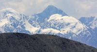
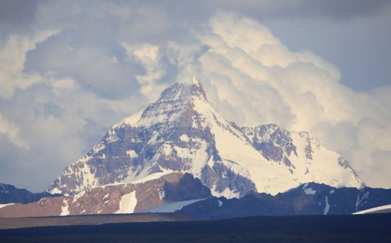
Western part of Kokshaal-Too ridge
Flight by helicopter in mountains West Kokshal-Too.
"Kokshaal-Tau ridge is the most powerful of all the ridges of the Central Tien Shan. The Kyrgyz call it "Great Tien Shan". In the west, it joins the Alay ridge in Fergana, and in the east - even further east of the Khan-Tengri junction - it ends within the borders of China. This eastern part remains almost unexplored to this day. The Kokshaal ridge is the southern border of the Tien Shan mountain system. Directly to the south of it is the basin of Chinese Turkestan and further - one of the most terrible deserts in the world, Taklamakan, in the sands of which the famous Swedish traveler Sven Hedin almost died. The Kokshaal peaks reach their highest point at the sources of the Dzhangart, Uzengegushd and Aksay rivers. There are a number of peaks here that exceed 6,000 meters, and powerful glaciers."
"Central Tien-Shan". Physical Culture and Sport Magazine. No. 7. A. Letavet. 1937.
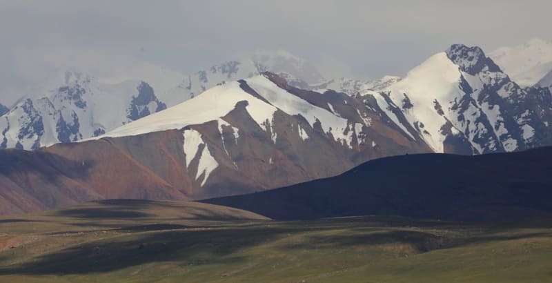
Ascensions in ridge Western Kokshal-Too.
Western part of Kokshaal-Too ridge is located in western part of main Kokshaal-Too ridge, starting from valley of Kekkyya River and extending east for 190 kilometers to canyon of Uzengegush River, in Atbashi district of the region.
The state border between the Republic of China and the Kyrgyz Republic runs along the western part of the Kokshaal-Too ridge. The beginning of the ridge in the west is located at the sources of the Kurumduk and Karabel rivers, which are left tributaries of the Kekkiya River belonging to the Kokshaal River basin.
In the west, the ridge borders on the eastern end of the Keltau and Sarybeles ridges. The eastern border of the western part of the Kokshaal-Too ridge is the valley of the Uzengegusch River, which cuts through the Kokshaal-Too ridge from north to southeast.
In the northwest and north, the border of the ridge is the valley of the rivers: Aksu Zapadny, Kokshaal, Kotyr and Uzengegusch. In the northwest, the ridge includes the Sarybeles and Keltau mountains and a little to the north of them are the mountains of the Kekkiya ridge.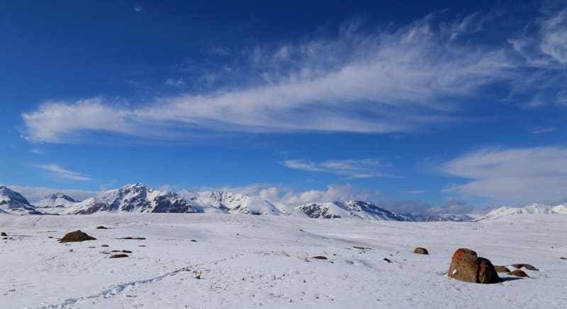
The main glaciation of the ridge is concentrated in the eastern part, in the area of the Kyzyl-Asker (Krasnoarmeyets) mountain range, 5842 meters above sea level. In this area, the following glaciers flow to the north from the main ridge of the ridge: Kentor, Karagermes Western and Eastern, Aitali, Sarychat, Grigorieva, Komarov a total of about 17 glaciers that belong to the Kyzyl-Asker mountain range.
The next ice knot is located in the area of Dankov Peak, these are the glaciers: Uzengegush, Chon-Turasu, Issledovateley, Chon-Tyuskuyruk and others. The length of the ridge from west to northeast and to the east is 190 kilometers. The highest point of the western part of the Kokshaal-Too ridge is Dankov Peak, 5982.3 meters above sea level, located in the eastern part of the ridge.
The river system of the ridge belongs to the Tarim River basin. There are many peaks with an altitude of about 6,000 meters above sea level. The most interesting of them (from west to east): Bely Peak is 5,697 meters above sea level, Kosmos Peak is 5,940 meters above sea level, Molodezhny Peak (Druzhba) is 5,330 meters above sea level, Marona Peak is 4,902 meters above sea level, Professor Gorelik Peak is 4,758 meters above sea level, Krylya Sovetov Peak is 5,800 meters above sea level, Schmidt Peak is 5,954 meters above sea level, Dzholdash Peak (Chon-Turasu) is 5,729 meters above sea level, Alpinist Peak is 5,641 meters above sea level, Sergei Korolev Peak is 5,815 meters above sea level and others.
In 1969, only Sergei Korolev Peak was climbed for the first time. The ridge is characterized by a combination of typical alpine forms (many steep walls with a height difference of 1.5 - 2 kilometers) with a large snow cover and powerful glaciation, which is second in the Tien-Shan only to the glaciation of the Pobeda Peak region.
The snow line is located at altitudes of 4000 - 4500 meters above sea level. The river valleys have a fairly high absolute altitude of 3000 - 3500 meters above sea level. In many places there are swampy areas even at altitudes of 3500 - 4000 meters above sea level.
The climate is severe. In the summer in the valleys, the average monthly temperatures are 5 - 8 degrees C, Average monthly precipitation is 20-30 mm. The weather is unstable. There is no permanent population south of the Naryn River. A small part of this area is used as temporary pastures by settlements located on the shore of Lake Issyk-Kul and near the Naryn River.
Intensive geological exploration is being carried out in the upper reaches of the Naryn River.
The valley of the Uzengegush River is visited only by shepherds and hunters, but there are also expeditions of geologists and tourists. The approaches here along the trails are quite long and difficult. The easiest, but the longest route is from the city of Naryn, the shortest, but difficult from the village of Karasay on the Naryn River. The best route to the climbing area is from the village of Karakol through the Sapozhnikov Pass.
Geographic coordinates of western part of Kokshaal-Too ridge: N41°01'13 E77°26'04
Authority:
Alexander Petrov.
Defeated peaks. 1968 - 1969. Publishing house "Mysl", Moscow, 1972. "In Western Kokshad-Tau". Korsun A., Povarnin P.
Photos by:
Alexander Petrov.