


![]()
You are here
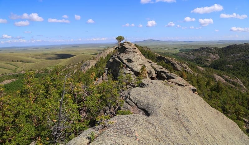
Zhirensakal peak in Karkaraly.


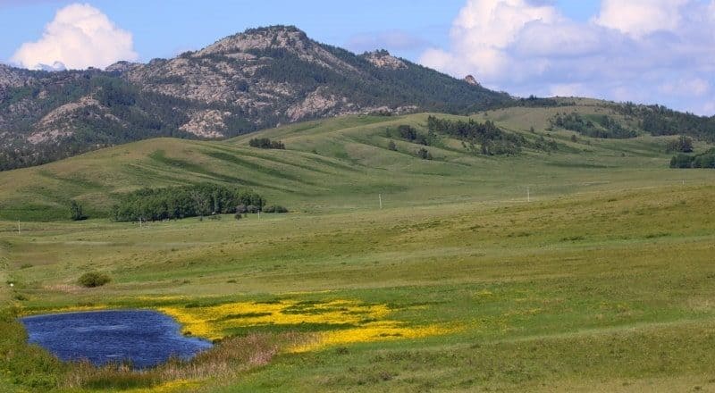
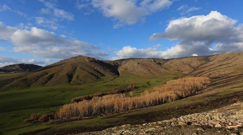
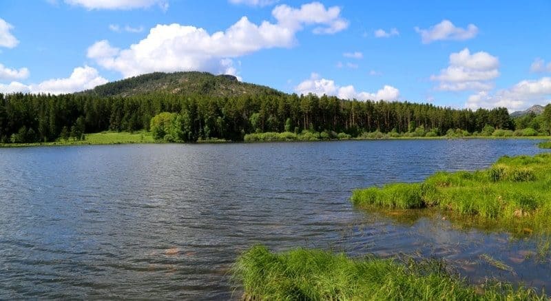
Sights of Karkaraly mountains.
"Oh, Karkaraly, desired mountain land,
I am shrouded in sorrow, like you in mist.
In Sary-Arka, like a saiga in the desert,
I live alone, a stranger and unwanted."
Madi "Ushkara."
Walking in Karkarlinsky mountains.
Zhirensakal Peak, or Komsomol Peak, stands 1403.4 meters above sea level and is located in southern part of Karkaraly Mountains, 14 kilometers south and slightly west of village of Karkaraly, 5.8 kilometers west and slightly south of Lake Kimassarovskoye. It is located in Karkaraly Nature Park, in district of same name in eastern Karaganda region.
Geographical and natural description of Zhirensakal (Komsomol) Peak.
Zhirensakal (Komsomol) Peak is the pinnacle of Karkaraly legends and winds. Zhirensakal Peak, also known as Komsomol Peak, is one of the most prominent peaks in the southern Karkaraly Mountains. Its granite walls, like vast waves of solidified stone, rise above the forests and valleys, creating a majestic backdrop for the surrounding area.
From its 1,403-meter elevation, sweeping panoramas open up: to the north are the forests of the Karkaraly Nature Park, to the east are the Kimassar and Shaitankol lakes, and to the south, the steppes of Central Kazakhstan stretch into the distance.
The slopes of the peak are covered with pine forests, alternating with sparse woodlands of birch, rowan, and juniper. Mosses, lichens, and rare mountain herbs grow on the higher reaches of the mountain, including the endemic smooth wormwood, a plant known for its medicinal properties.
In spring, carpets of purple irises and white pasqueflowers bloom here, and in autumn, the granite cliffs are painted with the gold of larches and the reddish flame of shrubs. Southwest of the peak lies Mount Shanai, 978.5 meters above sea level.
The summit of Zhirensakal is crowned by three enormous stone "towers." During the time of the Cossack village, this rock massif was called "Boar Shish" (Boar Shish), because wild boars roamed the area, and they are still found here today.
Historical information and research on Zhirensakal (Komsomol) Peak.
The first mention of the peak appears in geological and geographical reports from the late XIXth century, when the Karkaraly Mountains were actively studied by Russian explorers and topographers. During Soviet times, the mountain received a second name – Komsomol Peak – in honor of the youth hiking and climbing teams that held ascents and camps here in the 1950s – 1970s.
In 1936, 100 young men and women climbed the dominant peak of the Karkaraly Mountains and named it Komsomol Peak. A trail leading to the summit has survived since then; it begins at the foot of the southern slopes of the Karkaraly Range, gradually winding its way through a pine forest and emerging at a rocky ridge.
Legend of Zhirensakal - "Red-Haired Old Man."
Local legend tells that a hermit named Zhiren Sakal, which means "red-bearded old man" in Kazakh, once lived in these parts. He was a sage, wanderer, and healer who knew every path and every spring in the Karkaraly Mountains. It was said that he could speak with the wind and birds, and animals were not afraid of him.
When Zhiren Sakal died, his soul, according to legend, migrated to the mountaintop where he loved to greet the sunrise. Since then, when the early morning sun paints the rocks a copper-gold color, locals say:
- "Zhiren Sakal welcomes the new day again."
And on windy days, if you listen at the summit, you can hear a drawn-out hum - as if an old man is telling stories of the past in these parts.
Tips for hikers on Zhiren Sakal (Komsomol) Peak.
Route to the summit: Starts at the southern edge of Karkaraly Park (landmark: old tourist camp).
The climb is approximately 5 kilometers long, the elevation gain is approximately 470 meters, and the journey takes 2 – 2.5 hours.
Difficulty: Moderate, accessible to experienced hikers.
At summit: There are several natural rock platforms convenient for resting and taking photos. It's worth climbing here at dawn - the sun's rays paint the granite cliffs a reddish-golden hue, creating the illusion of a living flame.
Season: Late May to early October. The trails are damp in spring, and especially picturesque in autumn.
Safety: It's not recommended to climb during a thunderstorm - the summit is exposed to winds and lightning.
Atmosphere at the summit of Zhirensakal (Komsomol) Peak.
A special silence reigns at Zhirensakal Peak - the sounds of the forest remain below, and only the wind, like an ancient spirit, swirls around the granite slabs. From the summit, a stunning view opens up: it seems as if the mountains and steppes breathe in unison, and the horizon stretches into infinity.
Here, it's easy to believe that time slows down, and the boundary between earthly and celestial becomes almost invisible.
Geographic coordinates of Zhirensakal Peak (Komsomol Peak): N49°17'21 E75°25'52
Authority and photos by:
Alexander Petrov.