You are here
Lake Chunkur-Kol.

Lakes in Uchemchek and Barskoon valley.
“The lake is blue, like a section of mirror glass. No wind. The sun burns painfully, burns the face, hands and - through the shirt - the body. It is stupefyingly hot, and at night all the small streams froze; the water dried up by morning, as usual here, and a thin layer of ice formed airy hollow ceilings over the empty channels."
Pavel Luknitsky. 1955.
Trip to Lake Chunkur-Kol from Tossor Pass.
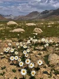
High-mountain, flowing, fresh lake Chunkur-Kol is located at an altitude of 3673 meters above sea level, is located on a pass saddle between sources of rivers: from west - Uchemchek, from east Barskoon, between southern slopes of Sary-Tor ridge in Terskey Ala-Too system and northern slopes of Uchemchek ridge, in Jety-Oguz district of Issyk-Kul region.
The lake is located on a swampy intermountain saddle on the Kerege-Tash pass at an altitude of 3650 meters above sea level and feeds the streams flowing out of it, which belong to the Naryn River basin on the western side and to Lake Issyk-Kul on the eastern side.
The length of the lake from east to west is 2.5 kilometers, the greatest width in the western part is 520 meters, in the western part 490 meters. The length of the coastline reaches 4.84 kilometers, the area of the lake is 0.67 square kilometers.
Due to the relatively flat underlying surface and the shape of the relief, bottom sediments accumulate in the lake and waterlogged, swampy areas are formed around the lake. According to the water balance, the lake belongs to the wastewater lakes, according to the chemical composition, the lake belongs to the carbonate (soda) lakes.
In terms of configuration, the lake repeats the pass saddle, the depth of the lake is insignificant - up to 2 meters in the central part. According to the regime, it belongs to the flowing lakes. From the western part of the lake flows the small river Dzhel-Tor, 9 kilometers long, which is the right tributary of the Uchemchek River.
The mouth of the river is at an altitude of 3439 meters above sea level. From the eastern part of the lake flows a southern tributary of 2 kilometers in length, which flows into a northern tributary of 3.4 kilometers in length, and from here the Kerege-Tash River forms the main channel of 18 kilometers in length, which is the left tributary of the Barskoon River.
The mouth of the Kerege-Tash is located at an altitude of 2776 meters above sea level, below the Sary-Moynok pass at an altitude of 3442 meters above sea level. From the Tossor pass to the lake leads a road in the form of a track, laid among stones and marshy terrain.
When going on a trip to Lake Chunkur-Kol by car, it is necessary to take into account the deserted area, where it is difficult to find help, marshy terrain, the absence of a distinct road. The lake receives its main nutrition from melt water, underground, filtered springs.
Geographic coordinates of Lake Chunkur-Kol: N41°56'23 E77°27'49
Authority and photos by:
Alexander Petrov.


