You are here
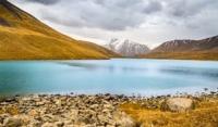
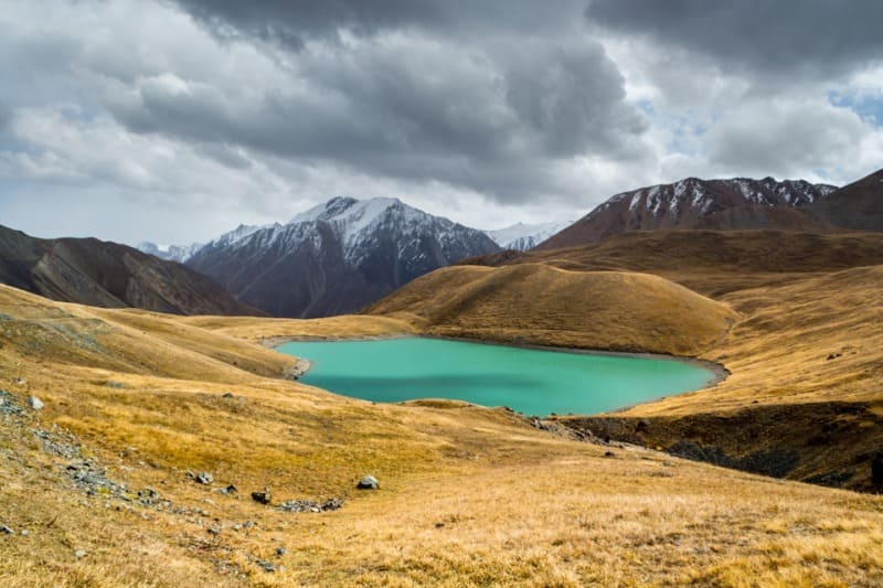
Lake Teshik-Kol.

Trip to Lake Teshik-Kol from Tossor Pass.
“The lake is blue, like a section of mirror glass. No wind. The sun burns painfully, burns the face, hands and - through the shirt - the body. It is hot to the point of stupefaction, and at night all the small streams froze; the water dried up by morning, as is usual here, and a thin layer of ice formed airy hollow ceilings over the empty channels.
Pavel Luknitsky. 1955.
Lakes in Uchemchek Valley.
High-mountain, flowing, fresh, moraine lake Teshik-Kol is located at an altitude of 3516 meters above sea level, is located in a hilly, intermountain basin formed by southern slopes of Terskey Ala-Too ridge and southeastern spurs of Keryu-Karagoman ridge, in Ton district of Issyk-Kul region.
The lake is located in a swampy intermountain hilly area. The length of the lake from northwest to southeast is 1.4 kilometers, the greatest width in the central part reaches 544 meters. The length of the coastline reaches 3.56 kilometers, the area of the lake is 0.59 square kilometers.
From the southern part of the lake flows the Kashka-Suu River, 5 kilometers long, and after 650 meters flows into a small, flowing, moraine lake, located at an altitude of 3504 meters above sea level and soon flows from the right into the Dzhilu-Suu River.
Lake Teshik-Su Nizhneye is 380 meters long, the greatest width in the central part is 240 meters. The length of the coastline reaches 1.13 kilometers, the area of the lake is 0.07 square kilometers. The lake receives its main nutrition from meltwater glaciers.
According to the water balance, the lake is classified as a runoff lake, according to the chemical composition, the lake is classified as a carbonate (soda) lake, and its regime is classified as a flowing lake. A road in the form of a track, among stones and marshy terrain, leads to the lake from the main road from the Tossor Pass to the Jilu-Suu springs.
After about one kilometer, the road ends, running into a landslide that is impossible to overcome. Further, beyond the landslide, which can be overcome along the path leading to the lake, the road continues and there are even wooden bridges across the Kashka-Suu River.
There are no yurts or shepherds' tents in the vicinity of the lake, a lot of cattle graze on "free grazing" of horses and yaks. The length of the pedestrian walk to the lake is 4 kilometers.
Geographic coordinates of Lake Teshik-Kol Lower: N41°52'26 E77°00'02
Three rivers flow into Lake Teshik-Kol:
Kashka-Suu West, 5.5 kilometers long, flows into the northwestern part. The river originates from the Kashka-Suu South glacier, 750 meters long. After 1.3 kilometers from the beginning of the sources, the river flows into a flowing, moraine lake, located at an altitude of 3780 meters above sea level, 330 meters long and then after 4.2 kilometers it flows into Lake Teshik-Kol.
In the upper reaches of the Kashka-Suu West River, in the main ridge of the Terskey Ala-Too ridge, there is the Kel-Tor West pass, 4200 meters above sea level. The river originates from two small glaciers of the same name located on the southern slope of the Terskey Ala-Too ridge.
Kashka-Suu East, 3.6 kilometers long, flows into the northern part of the lake. The river originates from the Kashka-Suu South glacier, 1.3 kilometers long. In the upper reaches of the Kashka-Suu East River, in the main ridge of the Terskey Ala-Too ridge, there is the Geographers peak, 4470 meters above sea level.
Kashka-Suu East receives its sources from the glacier of the same name, 1.9 kilometers long, located on the southern slope of the Terskey Ala-Too ridge. The glacier has two branches - Eastern and Western. The area of the glacier is 5.53 square kilometers, the perimeter of the glaciers reaches 10.6 kilometers.
The length of the moraine is 1.1 kilometers. At the bottom of the western branch of the glacier, on the moraine, there is a small flowing lake. The upper boundary of the glacier is located at an altitude of 4470 and 4271 meters above sea level.
Geographical coordinates of Kashka-Suu East glacier: N41 ° 55'13 E76 ° 59'16
Ichke-Tor and Keryu-Karagoman rivers flow down the north-eastern slope of the Keryu-Karagoman ridge with a total length of 10 kilometers and flow into the Teshik-Kol from the western side. The Ichke-Tor River has a right tributary, the Ichke-Tor East, with a length of 4.6 kilometers.
The Keryu-Karagoman River originates from small glaciers located on the north-eastern slope of the ridge of the same name.
Geographic coordinates of Lake Teshik-Kol: N41°52'43 E76°59'06


Authority:
Alexander Petrov.
Photos by:
Andrey Enkin.
https://www.drive2.ru/users/andreyenkin/
https://www.drive2.ru/b/615110786116748303/


