You are here
History of town of Naryn.

Historical sights of Naryn.
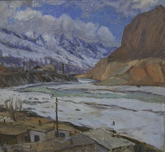
“Having descended the soft clay slope into the valley and crossed the fast Naryn on a wooden bridge, we turned west to the fortress; to the left of the road, at the very foot of the wooded mountain, there was a local hospital in the middle of a large garden, and a little further on a row of white customs buildings was visible. On the western side of the fortress adjoined a small village or trading place, almost entirely populated by Sarts and Tatars, who traded here with the Kirghiz. The information about the population is interesting: according to information for 1903, there were 391 Russians in Naryn (including soldiers, Cossacks and border guards) and 484 foreigners, a total of 875 people.”
A.D. Sokolov. "Along the new road from Semirechye to Fergana". 1908.
Historical events in Naryn
In the mid-1850s, an anti-Kokand uprising also took place in Naryn, the rebels attacked the Kurtka fortification. They killed the Kokand governor. In 1859, the Cherik tribe came out against the Kokandis. The population of Kyrgyzstan began to participate in the political organization of Russian society, joined the process of developing the economy and culture of Russia, and joined the revolutionary struggle of the Russian working class.
By the end of the 1860s, a new administrative structure was introduced in Northern Kyrgyzstan and a military-colonial regime was established. The position of senior manap was eliminated. The Issyk-Kul region with its population was first included in the Alatav district, then, with the formation of the Turkestan Governorate General in 1867, in the Issyk-Kul (later Przhevalsky) district as part of the Semirechye region.
The Kirghiz who inhabited the At-Bashy and Naryn regions were included in the Przhevalsky district. The Kochkor Valley was included in the Tokmak section of the Pishpek district, and the Dzhumgal Valley was included in the Pishpek section of the same district. In 1910, the Atbashinsky section of Przhevalsky district consisted of 12 volosts: Adzhinskaya (6 villages, 604 yurts), Borukchinskaya (10 villages and 1212 yurts), Dzhuvan-Arykskaya (9 villages and 1131 yurts), Narynskaya (8 villages and 851 yurts), Onarchinskaya (9 villages and 1618 yurts), Ryskulbekovskaya (7 villages and 788 yurts), Sayakovskaya (7 villages and 1179 yurts), Chesh-Tubinskaya (8 villages and 1104 yurts), Chorinskaya (9 villages and 1623 yurts), Cherikovskaya (7 villages and 994 yurts), Sharkyratma (9 villages and 1738 yurts), Shatenovskoy (7 ayils and 824 yurts).
The volost administrator was elected at the volost congress, and the ayil elder - at the ayil meeting. At the head of the districts and regions were the tsarist generals and officers, who were granted all local power both in the line of civil administration and in the military and police part.
They were also the commanders of the troops. At the lower levels of military-colonial power were the district bailiffs, who supervised the local population. The district chiefs were appointed by the governor-general of Turkestan, and the governors of the regions and territories - by the minister of war with the consent of the tsar.
The military-popular (and in fact colonial, military-police) administration introduced in Kyrgyzstan served as a convenient screen for the subordination and exploitation of the entire working population - indigenous and migrants - by the tsarist colonizers.
Tsarism, having declared itself by law the supreme owner of the land with its provision for use by the indigenous population, and subsequently by migrants, imposed taxes and zemstvo fees on this basis on the entire taxable population, and introduced a number of natural duties.
Town of Naryn, located in the foothills of the Naryn Too ridge, has a long and multi-layered history associated with the development of trade, military fortifications and cultural traditions of Kyrgyzstan. The founding of Naryn is closely connected with the expansion of the Russian Empire in Central Asia.
Town began to develop as a fortification on the caravan route connecting the Fergana Valley and Chinese Kashgar. In 1868, a garrison of the Russian army was founded here to protect trade routes, which is considered the official date of the city's foundation.
Later, the Naryn settlement appeared, and from that moment on, the construction of the city began. The postal service of the Russian consulate in Kashgar constantly operated through the Naryn fortification with Semirechye. This fortification became an important strategic point and gradually transformed into an urban settlement.
Naryn, located on the river of the same name, was historically an important transit point for caravans and a place of interaction between various peoples and cultures. After the Beijing Treaty of 1860, the Naryn River valley became part of the Russian Empire.
"The Beijing Treaty, concluded by General N. P. Ignatiev, in terms of the importance of the results achieved and the brilliant manner of action of our envoy, who in a very short time managed to raise the significance of Russia in China to a high level of power, represents, one might say, an unprecedented example in the history of our diplomatic relations with the government of the Bogdykhan.
According to this treaty, a strong state border was established for the first time on the western borders of China, which until then had remained undefined for a century by any previous treaties with the Beijing government. It is clear that the uncertainty of the borders over such a vast area, from Shabin-Dabagh at the southwestern end of Eastern Siberia to the former Kokand possessions, repeatedly gave rise to unrest and disturbances on the border, as well as robberies and violence among the border nomadic foreigners.
All this gave rise to hostile relations both between the border authorities of both states and between their central government institutions. With the establishment of a state border on these outskirts of Russia and China, the aforementioned disorders ceased by themselves, and, moreover, by virtue of a state act, all the lands to the southeast of the Semirechye and Zailiysky regions occupied by the Kirghiz of the Great and Wild Stone Horde, the power over which the Chinese had repeatedly disputed with us, as well as the rich Kurchum region with Lake Zaisan and the lower reaches of the Black Irtysh River, passed into the possession of Russia in perpetuity.
"The Occupation of the Zailiysky Region and the Zachuysky Expedition." "Memories of My Service in Western Siberia. 1859-1875. Demarcation with Western China in 1869." St. Petersburg, 1912. I. F. Babkov.
This was confirmed by the actions of the expedition of Captain A. Protsenko in 1863, during which the Kokand fortress of Kurtka was occupied. The expedition of Captain A. Protsenko in 1863 was part of the Russian military-geographical studies of Central Asia, aimed at studying strategically important territories and strengthening the Russian presence in the region.
At that time, the Russian Empire was actively developing areas adjacent to its southern borders, including Semirechye and Tien-Shan. Protsenko led a research team that studied hard-to-reach areas of the Tien Shan, laid out routes and conducted mapping.
His work played a key role in the preparation of further military and administrative actions in these regions. In particular, Protsenko was one of the first Russian officers to thoroughly explore the valleys and ridges in the southern part of Semirechye, which later contributed to the integration of these lands into the empire.
The main result of the expedition was detailed topographic maps, which were subsequently used in the construction of fortifications and administrative development of the territory. These studies also contributed to the strengthening of Russian control over the trade routes linking Central Asia and China.
Protsenko was known as a skilled cartographer and explorer who received high awards for his work. His expedition is an important episode in the history of the development of Central Asia by the Russian state. In response to threats from the ruler of Kashgar Yakub Bek, the Turkestan governor ordered the construction of a fortification and a bridge on the Naryn River.
Colonel V. Poltoratsky in 1867, exploring the route to Lake Chatyr-Kul, determined the location for the future fortress. It was located near the Chinese bridge over the Naryn, on the caravan route that linked the Chui Valley with Kashgar. At first, the soldiers built dugouts, then wooden barracks, and in two years the fortification was completed.
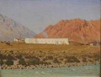
The fortress, depicted by V. Vereshchagin in 1869, was a long building with loophole windows, built of adobe bricks. Gradually, a settlement formed around the fortification, which in 1888 became a trading center on the way to Kashgar. Naryn was founded as a garrison town in 1868, and its military heritage has survived to this day.
In the second half of the XIXth century, the main occupation of the population of the Central Tien-Shan was cattle breeding and barter trade with the neighboring Kyrgyz. At the beginning of the 20th century, some of the Naryn people were engaged in agriculture and very few in beekeeping.
From the end of the 1880s of the XIXth century, stationary trade in Naryn also expanded. There were about 70 shops with textiles and other goods, as well as a shop selling tea, coffee and other colonial goods, which belonged to the large merchant and industrialist N. Pugasov.
On December 6, 1877, a crowd of Dungan refugees - rebels from China - arrived in Naryn in the evening. The Kirghiz supplied them with cattle, bread, and housing. The first medical institutions in the district were military hospitals in the Naryn (1868) and Karakol (1869) military fortifications.
Later, an outpatient clinic was opened in Naryn. In many ways, the development of healthcare in the Naryn zone is associated with the names of the senior physician of the Naryn hospital Pavlyuts, epidemiologist Laurenti, in the Issyk-Kul region - with the activities of the district physician A. I. Levin (died in 1916) and his assistants, and the service for the protection of motherhood and childhood - with the names of the first midwives (Bulatova and others) who enjoyed great trust among women of indigenous nationalities. In 1913, the total number of retail outlets in Naryn was already 139.
Their annual turnover increased from 9,000 rubles in the 80s of the 19th century to 300,000 rubles. In 1920, an orphanage ("mektep-commune") was opened in Naryn for 40 street children; 99 students were studying in 1 primary school. After the October Revolution of 1917, Naryn came under the control of the Bolsheviks, but in 1920, fierce fighting broke out in the region between the Red Army and White Guard forces.
After intense battles, accompanied by significant losses, the Bolsheviks consolidated their power in the city. During the bloody battles, many lives were lost. In memory of the fallen, a memorial was erected in the center of town. In 1927, Naryn was declared the administrative center of the region of the same name, and its first chairman of the city executive committee was Dzhanuzakov Kary, who made a significant contribution to the development of the region.
During the Soviet period, the city became an administrative and cultural center, retaining its strategic importance. In 1939, the Naryn region was formed, which contributed to the further growth of town. Naryn is also known for its natural surroundings.
Town served as a base for expeditions to mountainous areas such as Lake Son-Kul and the At-Bashi Valley. This made it an attractive destination for explorers and tourists. Modern Naryn retains its cultural and economic importance, remaining the heart of the cattle-breeding region.
In addition, it is one of the centers of handicraft production of felt and woolen products such as shyrdaks (traditional Kyrgyz carpets). Town is also home to the Muratbek Ryskulov Musical and Drama Theater, the only academic theater in the region.
Geographical coordinates of town of Naryn: N41°25'44 E75°59'52


Authority:
Encyclopedia "Issyk-Kol. Naryn". Academy of Sciences of the Kyrgyz SSR. Frunze. 1991.
Photos by:
https://foto.kg/galereya/472-selenie-naryn-foto-1906-g.html


