







You are here
A.V. Kaulbars. Glaciers of Tien-Shan. 1869.
Explorations of Dzhuku and Barskoon gorges.
"Only on July 29th did we manage to find a Kyrgyz village beyond the Ak-Bel Pass, rent a yurt, and on July 30th, we finally settled down 2 kilometers from the Petrov Glacier. After we had arranged our shelter and set up the yurt, we began work. A campsite was established at an altitude of 3,700 meters above sea level. A meteorological station was set up, where the following instruments were installed: an aneroid barometer, an Assmann psychrometer, an Arago-Devy actinoscope, a Kempel heliograph, a thermograph, maximum, minimum, and soil thermometers on the soil surface, an anemometer, a wind pennant, and a rain gauge. Readings from all instruments were taken at the usual times of 7:00 a.m., 1:00 p.m., and 9:00 p.m. In addition, hourly observations of wind direction and speed, cloud cover, and radiation were made daily from 7:00 a.m. to 9:00 p.m. A water gauge was installed, but readings were not taken systematically. Then they began surveying the Petrov Glacier, installing markers on two adjacent glaciers, instrumentally leveling the end of the Petrov Glacier, and organizing experiments to study evaporation and condensation on the glacier surface.
L.K. Davydov, "Petrov Glacier," 1925.
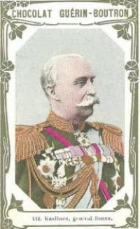
Travels of Alexander Vasilyevich Kaulbars in 1880s.
General overview.
A traveler ascending one of the passes through the Terskey-tau (Kyrgyz Ala-tau) ridge from the southern shore of Issyk-Kul initially passes through dense forests in picturesque gorges. This atmosphere persists for 25-30 miles, then the air becomes colder, the forest thins, becomes shallow, and gives way to bushes, which in turn disappear, leaving only grass and scattered clumps of small heather.
At these altitudes, during hot summer days, the traveler is greeted by snowstorms, and at night the water sometimes freezes. At this time, the water temperature of the frequent mountain lakes here is usually around 4 degrees Celsius. Then, even higher up, the last heather bushes disappear; Instead of the former dense forests, bare cliffs and scree slopes of large debris, and sometimes even enormous boulders, rolled from the heights, are visible on both sides of the trail.
Pack snow lies on the peaks and slopes, forming white ridges overhanging the chasms. Where its masses have accumulated, small glaciers form, descending to the bed of a mountain stream and feeding it. Then the mountains seem to end; the traveler has reached the heights of the mountain range and stands on a vast mountain plateau.
It is entirely covered with countless lakes, whose waters feed the four river systems of this country; the soil, composed of loose sediment from the surrounding ridges, is so saturated with water that with every step a horse sinks knee-deep into a swamp of mud and rock debris.
Streams flow here, fed by countless springs. Clouds cling to the surrounding mountains and frequently sweep through the valley, cooling the air. According to Kyrgyz accounts, snow sometimes persists year-round. The mountains abutting the surface of the Akshirak syrt were covered in enormous masses of snow from their base to their peaks in the first half of July 1869, and since they have no steep slopes at all, their white cover is almost unbroken.
Large glaciers lie in almost all the gorges; they can be recognized by their lower ends, which abut the valley like an icy cliff; their surfaces are covered in snow; sometimes black rows of boulders (moraines) on the main and lateral glaciers break the complete uniformity of their smooth surfaces.
The altitude of the area and the influence of the masses of snow and ice accumulated there significantly cool the temperature. On July 10, 1869, around 5 p.m., the temperature dropped to -2 degrees Celsius, and snowstorms recurred daily on average during that month.
Vegetation is almost nonexistent; small, sparse grass (mostly cypress) and moss are the only representatives. Animals include geese and ducks (especially red atays) on the lakes, argali (mountain sheep), foxes, including silver foxes, and a large number of rats. mice, and among the lower animals there are many earthen spiders and some other small species.
A person comes here only occasionally, mostly accompanying a trade caravan heading to Altyn-shar or back. Sometimes, but this happens rarely, the nomadic population, the Kyrgyz, bring herds of horses here for a short time, when all the food in the low valleys has already been hunted down 2.
There was a time when it was believed that there were no glaciers in these alps. This happened because we were more familiar with their western parts, where there are really very few glaciers, moreover, they are small and hidden in high, inaccessible gorges; however, research by Mr. Semenov in 1856 discovered the existence of huge glaciers in the eastern part and in the same direction outside the described area.
It should be noted, however, that most of the ridges of this country really do not provide the conditions necessary for the development of glaciers. Many of them are narrow, rocky and do not have wide basins or ledges in the upper parts that serve as reservoirs for glaciers.
Recently, repeated studies of the eastern part have supplemented the information of 1856 and proved the existence of a mass of ice in the gorges of the local mountains. Here, apparently, the Akshiyrak Mountains more than others satisfy the conditions for the formation and development of glaciers (see geographical description); they appear in the form of a wide system of low, relative to the surrounding valley, ridges that do not have a strictly defined direction and steep slopes.
Due to the height of the entire area above sea level, these mountains, starting from the very base, are covered with eternal snow, the masses of which clutter all their upper basins. As a direct consequence of this, almost all the valleys and gorges of Akshiyrak are cluttered with glaciers.
The Terskey-Tau ridge, bordering the Issyk-Kul valley on the southern side, has a rocky structure, which is especially noticeable on the northern slope, and therefore the glaciers here could not develop much 3. On the southern slope there are quite a lot of them, and they reach significant sizes.
I now turn to a more detailed description of the glaciers in the east 4. I have already said that small glaciers are found on the northern slopes of Terskey-tau. I had the opportunity to see those of them that lie in the Dzhuuki and Barskoon gorges.
The respective passes fall short of the permanent snow line by 100 and 200 feet. On the Barskoon River, the first glaciers lie about three miles above the confluence with the Eastern Keregetash. The western slope of the gorge consists of screes on which ice lies in wide stripes.
These glaciers apparently do not move, but simply rest on the rather steep slopes of the gorges. The Barskoon River flows at their base. In one place, where the gorge narrows, in July, when we passed there, the ice that had descended into the ravine cluttered up the entire space between the side slopes, and the river washed out a tunnel for itself, soot-long. 15, with a width of 4-5 fathoms, and a height from the base to the vault of 2 fathoms, and the thickness of the vault in the castle did not exceed 1 ½, f.
The surface of both this and other glaciers was completely covered with mud and fine scree (in the form of sand). The tunnel consisted entirely of crystalline ice, the dirt inside was washed away by rapid melting and the ice appeared completely transparent.
I was about to enter the tunnel when a significant collapse inside it forced me to abandon this intention. In the Syrt Valley, the glaciers are of a completely different nature. Here huge masses of ice fill almost all the gorges, moving out from large reservoirs of eternal snow that clutter the upper basins and ledges.
Glaciers of Akshiirak.
I have already said above that the Akshiirak mountain system is very capable of developing large glaciers. In almost all of its gorges, glaciers move, unloading it from the enormous amount of snow accumulating on its upper basins and slopes.
Petrov Glacier range of Akshiirak.
The largest of these glaciers, Petrov Glacier 5, divides the entire system into two halves. The western one, by its structure, is most conducive to the accumulation of snow and therefore, in addition to many small glaciers, supplies three of the greatest glaciers of the country described.
Their valleys on three sides cut deeply between the ridges of Akshiyrak, the peaks almost converge on the southern side of the main snow reservoir. The largest of these glaciers is the Petrov glacier, from which the main composite arm of the Naryn Yaaktash flows; the second largest is the glacier of the Karasai River on the western side (also one of the peaks of Naryn); and finally the smallest of them, on the southern side, is the glacier of the river. Kuyan-su, belonging to the Uch-Turpan river system.
Besides those mentioned, there are less significant glaciers in almost all the gorges of the western part, and they are all fed from the same reservoir. I will say a few words about the Petrov glacier. As I already mentioned, he sort of divides the Akshirak system into two.
The valley it fills faces southeast; in its upper part, it turns sharply west toward the aforementioned snow reservoir, which is why the beginning of the glacier was not visible from the Syrt Valley. From the lower end of this turn, the glacier is slightly less than 20 miles long, its width at the lower end is about 1.5 miles, and the ice thickness in the lower cliff is enormous (7).
Several small glaciers (tributaries) join it, the most significant of which lies in a western side gorge. The number of rows of debris (moraines) reaches 5 or 6; they were difficult to trace, since the entire surface of the glacier was covered with snow.
In front of the ice cliff at the end of the glacier is a long terminal moraine, which in July alternately separated from and then joined the glacier. In front of the western half of the glacier's end is a pond in which streams of melting ice collect, and from it flows the river.
Yaaktash (upper reaches of the Naryn River). In July, this lake was covered with ice. 8. The Akshiyrak system deserves detailed scientific study, both because it is the central watershed of the entire country and because of the enormous mass of snow and ice with which it is laden.
Its influence on lowering the temperature of the surrounding area, and consequently on lowering the pack snow line, is likely quite significant. East of the Dzhuuk Pass, the Teskei Ridge begins to gradually rise, the gorges become deeper and steeper, and they contain quite significant glaciers.
This ridge is distinguished by its rocky structure, with the cliffs consisting of loose rock. This contributes to the growth of moraines.
Notes.
1. However, according to my leader, the herds have not appeared at the Akshiyrak syrt for the third year in a row. 2. However, in the Dzhuukuchuk gorge adjacent to Dzhuuk, there is a very significant glacier, but this is an exception, as there are no glaciers in the gorges of the Kara-Kola River and, it seems, the Ak-Su River.
3. In 1870, during a visit to Musart, I had the opportunity to personally verify the significant development of glaciers in the eastern parts of the Tien Shan.
4. Recognizing the intensive work of Second Lieutenant Fyodor Petrovich Petrov, who conducted surveys during a difficult expedition in these cold regions, and his services in the Naryn region in general, I asked the district's highest authorities for permission to name the glacier in the upper reaches of the Naryn River the Petrov Glacier, in commemoration of Petrov's first survey of this main source of the Syr Darya (Naryn). This request was granted.
7. All this is very approximate, by eye.
8. The proposed plan of the glacier is drawn from a distance. Unfortunately, I didn't have the opportunity to examine this glacier in detail.
Authority:
A.V. Kaulbars. "Materials on the Geography of the Tien-Shan, Collected During a Journey in 1869."