You are here
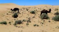
Sands Sholshagylkum on Mangyshlak.


Travel packages Mangyshlak to Nukus.
“A desert, completely without any vegetation, sand and stone; if only a tree - there is nothing ... "
Ukrainian poet T. G. Shevchenko.
Shopping tour in Aktau.
The sands of Sholshagylkum are located in the Mangistau region in the north of the Mangystau region. The sands are located in the western part of the Buzachi Peninsula in the latitudinal direction. In the northern part of the Sholshagylkum sands are the necropolis of Kenepan and Sary.
In the eastern part of the sands is the Yermeken necropolis. The length of the Scholsagylkum sands from west to east is 19 kilometers, the maximum width in the central part is 6 kilometers. In the south and east, sands border the Kyzyl-Kum sand massif.
In the east, 12 kilometers from the sands, there is the village of Sheber, in the southeast, 14 kilometers, the village of Tushchykuduk. In the central part of the sand there is the tract Karsybir. In the northern part of the sands there is the Keregemol tract and to the north of it there is a large saline march Bolshoi Saline march.
In the northern and eastern parts of the sands there are swampy salt marsh depressions from –5 to –19 meters below sea level, to which wells with salt water are confined. Sands Scholsagylkum are located in the depression, represented by hilly and cellular fixed sands.
The height of the sand mounds is not more than 3 meters, the depth of the sand cells is up to 3 meters. In the sands of Sholshagylkum grow a feather grass, comb wheat grass, zhuzgun, weeds, biyurgun from shrub in the sands are represented by Saxaul.
Geographical coordinates of the central part of the sands of Scholshagylkum N44 ° 51'13.36 "E51 ° 51'28.48"

Authority and photos
Alexander Petrov.


