Вы здесь
Tour from Turkmenistan to Mangyshlak and to Uzbekistan.




Tours from Kazakhstan to Uzbekistan.
“If you walked on a level road, walked of your own free will and still retreated back, then the matter would be lost; but since you are climbing a steep slope, so steep that from below you yourself seem to be hanging on it, then steps backward can only be caused by the peculiarities of the soil, and you should not despair"
Franz Kafka. "Reflections on the True Path."
Tours from Mangystau to Karakalpakstan.
A short description of tour route from Turkmenistan to Kazakhstan and to Uzbekistan:
Ashgabat - Darvaza gas crater - Mary town - historical and archaeological complex Merv - Serdar town - Yangikala canyon – Golzi ata mausoleum - Turkmenbashi town - Avaza resort – “Garabogaz”/”Temirbaba” check point - Mangyshlak peninsula – Shakpak ata mosque – Boszhyra valley – Sherkala mount – saline land Tuzbair - Beineu town – “Tazhen”/”Karakalpakia” check point - Muynak village - Nukus town - Khiva - Bukhara - Samarkand - Tashkent.
Distance of route: 6060 km.
Season: April - September.
Best time for tour: April, May, June, September.
Duration of tour: 25 days and 24 nights.
Detailed description of program of tour day by day from Ashgabad to Mangistau to Karakapalkstan and to Khiva:
Day 1. Ashgabad – Darvaza crater (192 km).
Arrival in Ashgabad. A meeting at the airport. Transfer to hotel, accommodation. Early check-in. Short night rest. Breakfast. Half day city tour including to National Museum, Neutrality Arch and Independence park. After lunch,
Departure from Ashgabad. Transfer: Ashgabad - settlement Bakhordok - kishlak Erbent (165 km). On road for Ashgabad the great and boundless desert of Turkmenistan – Kara-Kum begins, infinite barchans and mountains of sand will accompany on travel on desert of Turkmenistan. Arrival in kishlak Erbent. In a kishlak there live local residents who grow up sheeps and camels. Here it is possible to get acquainted with a life of Turkmen nomads. For the summer they leave for desert and there among sand their sheeps and camels are grazed. Visiting of houses of local residents. Walk on settlement Erbent.
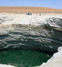
Transfer: kishlak Erbent - Turquoise lake in a crater (85 km). Following local sights in desert Karakum, it is a crater filled by water which has a shade of turquoise. The crater is near to road. Walk to a crater, photographing of vicinities.
Further transfer: Turquoise lake - Mud crater (15 km). A stop at a crater, walk in vicinities, survey and photographing of the Mud crater.
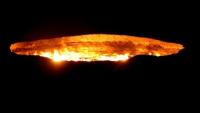
Further transfer: the Mud crater - gas crater Darvaza (12 km). We pass yurts Turkmen nomads at road and soon we leave asphalt road and we turn off to the right on road which leaves in sand. Arrival on gas crater Darvaza, this unique technogenic show in sand of Kara-Kum which we shall observe, in a crater burns gas since 1971. Walking and photographing of vicinities. Dinner and overnight in tents near the crater.
Day 2. Darvaza – Ashgabad – Mary (544 km).
Breakfast. After breakfast transfer: crater Darvaza - Ashgabat (192 km). Arrival in Ashgabad. Traditional national lunch. Visit to the Carpet Museum. The national museum of Turkmen carpet was created in Ashkhabad by presidential decree in 1993.The museum was opened in order to recreate and preserve the national traditions of Turkmen carpet-weaving and also for carpet popularization of Turkmenistan.
It was designed for the collection of the best samples of carpet art, study, restoration and farther development of a manual carpet-weaving. Now the museum has up to 8000 different exhibits,the smallest carpet is 0,01 sq. metre and that which is considered as the biggest one in the world is 301 sq. metre, entered the Guiness Book of Records in 2003.
Transfer to airport. Depart to Mary at 17.20 h with flight T5-131. Arrival in Mary, at 18.00 h. A meeting at the airport. Transfer to hotel, accommodation. Dinner and overnight at hotel.
Day 3. Mary - Ashgabad (387 km).
Breakfast. On the way following the Karakum Canal and the foothills of the Kopetdag Mountains. Transfer: Mary – Baitamaly settlement - historical park Merw (36 km). Visit of the historical park, including Erk Kala, Gyaur Kala, Sultan Kala, Abdulla Khan Kala and Bairamali Khan Kala and the most relevant remaining monuments such as the Sultan Sanjar Mausoleum, the Shahriar Ark, the Kyz Kala Emsemle, Graves of the Ashkhabis, and the mausoleum of Ibn Zaid. Lunch in Mary. After excursion transfer to Mary. Lunch.
After lunch transfer: Mary – town Tedzhen - settlement Dushak - tomb Malik Adzhar Palvan and ancient settlement Ulug-tepe (185 km). The ancient settlement Ulug-depe - the basic in Central Asia with chronology from the end of the Neolithic till the akhemenidy period. It logs in large settlements of ancient farmers of a foothill strip of Kopet Dagh - Cara-depe, to Namazga-depa, Altyn-depe and Yylgynly-depa. However in the XX century this monument was practically not investigated.
The exception is made by local works of V. I. Sarianidi in the late sixties on opening of ceramic furnaces for roasting of pottery which were carried out for the purpose of studying of features of ancient potter's production of an era of an eneolit and bronze.
Transfer: Tomb Malik Adzhar Palvan and ancient settlement Ulug-tepe - ancient settlement Abiverd (47 km). Visit to monument. The archaeological site was created in 1993 and comprises some 200 objects in Kaka and Tejen districts of Akhal Region. The core of the reserve is a medieval town Abiverd or Peshtak (west Kaka) - in the past, one of the largest cities in Northern Khorasan, often cited in written sources along with Nisa, especially since the Arab conquest.
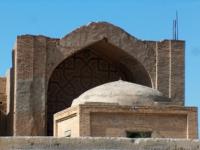
Transfer: Ancient settlement Abiverd - Mosque Seyit Dzhemal Etdin (101 km). In the ancient settlement of Anau, in 18 kilometers from Ashgabat mosque ruins Seyit Jahmal-Etdin - "The house of beauty" are visible. This history is more than five centuries old. To this beauty and now will delight anyone.
On the mausoleum, an entrance arch two impressive dragons - "azhdarkh" stylistically reminding traditions of imperial China were represented earlier. Scientists notice that these "living beings", and their images, as is well-known - taboos for architects of Islam, were a totem at one of the Turkmen tribes.
After visit to mosque Seyit Dzhemal Etdin transfer to Ashgabad (18 km). Arrival in Ashgabad, transfer to hotel, accommodation. Dinner followed by city-by-night tour. Overnight.
Day 4. Ashgabad – settlement Serdar (256 km).
Breakfast. Visit Akhalteke horse stables. After visit to Akhalteke horse stables transfer to Turkmenbashi Mosque-Mausoleum in settlement Kipchak (17 km). Visit to to Turkmenbashi Mosque-Mausoleum. The mosque was built in 2002 - 2004 on the initiative of Turkmenbashi and named after him. Its word-for-word translation means “the mosque of Turkmenbashi spirituality” or “the mosque of spirit of Turkmenbashi”. By the way the mosque is located in Kipchak – the Turkmenbashi native village.
The construction of the mosque cost to Turkmenistan $100,000,000. The whole complex is built in white marble by French company Bouygues. The total area occupied by the complex is 18,000,000 m2. The mosque itself is a one-domed building, surrounded by 4 minarets.
The height of the mosque is 55 m, and that of the minarets is 91 m to symbolize the year 1991 – when Turkmenistan gained independence. The building is accessible through 9 entries with arches. Around the mosque there are numerous fountains as though the mosque stands on the water and it makes the mosque look very good.
After visit to mausoleum Turkmenbashi transfer to Geok Depe settlement (30 km). Visit to Mosque Saparmurat khadzhi. Saparmurat Khadzhi mosque (turkmen. Saparmyrat Hajy metjidi) - the mosque in the city of Gyokdepe (earlier of Geok-Tepa) in Turkmenistan.
It is constructed in memory of soldiers defenders of Geoktepe fortress. The mosque has four minarets. The project was developed by the Ashgabat architect Kakadzhan Durdyev. The mosque was open in 1995, and is called in honor of the President of Turkmenistan. The mosque was built by the French company Bouygues in one year.
Further transfer: Mosque Saparmurat khadzhi – Kow-ata Underground Lake (45 km). Visit to Kow ata underground lake. A unique cave with the underground lake Kov-ata. The cave is 250 m long, 65 m deep and 50 m wide. The water of this lake is constantly warm, clean and transparent with an admirable amethyst color and contains 27 elements of the periodic table. The underground lake Kow-ata south- west of Ashgabat to see the Bakharden underground lake with swimming facilities all a year round. The lake is located in the biggest cave of the Kopet Dag mountains, called Kow ata.
After visit to lake Kov-ata transfer to Nohur village (52 km). Arrival in Nohur village. Explore Nohur village (visit silk weaving and tribal cemetery). Deep in the mountains, at height of 1000 - 1100 meters there lies Nokhur. The way to this “compact world” is long and difficult: grades, slopes, mountainous hairpin curves. But you will forget all travelling difficulties when you see this place, rare in its beauty and protected from four sides with high mountains.
According to the legends, its name originates from the Bible prophet Noah, whose Ark after a forty-day’s sailing landed to Manoman Mountain, that is why the words “nokh” or “nukh” are translated as “hit”.
After visiting the village Nohur transfer to settlement Serdar (112 km). Arrival in settlement Serdar, transfer to Guesthouse, accommodation. Dinner and overnight.
Day 5. Settlement Serdar - Yangikala canyon (399 km).
Breakfast. Transfer: Serdar - settlement Bereket - settlement Kumdag - town Balkanabad - settlement Oglandy - Yangikala canyon. On the way visit of an exotic and picturesque market in the town Balkanabad. On the way to Yangikala canyon we pass near mountains of the Western Turkmenistan - Small and Big Balkhan. Big and Small Balkhan - ridges in the west of Turkmenistan, near the Caspian Sea, the mountains extended from the West on the East on 60 kilometers, width - 20 kilometers.
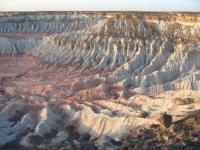
The highest point - the mountain Arlan of 1880 meters above sea level. In a mountain landscape ridges, deserts, and mountain steppes dominate. Near Big Balkhan ridge there is an oil field - Nebit Dag. Lunch on the way. Arrival in canyon. An excursion in Yangikala canyon to volcanic and rocky formations of the valley Kemal-ata. Yangi-Kala canyon ("fiery fortresses"). Yangikala canyon is in Balkan Region, in 160 kilometers to the East from the town of Turkmenbashy.
Locals call this massif Kyzyldag (Red mountains). Steep breaks white, yellow, ochre, purple and red colors, fancifully cut out by winds and rains, are very similar to stone locks. Canyons at sunset when everything is painted in bright-red color around are especially beautiful. Once the bottom of canyons was a bottom of the ancient sea. Then sea water receded, and on a surface hills and breaks, similar to plateaux, seemed.
In the main canyon of Yangikala the small canyon Kemal-ata punched in rocks by the stream which appeared in the middle of the desert which laid itself (himself) a way from a spring is especially interesting. From this spring sheep and camel herds satisfy thirst. Ornament Kemal - Ata is stone educations, many of which are on canyon slopes. A dinner and overnight in tents.
Day 6. Yangikala canyon - town Turkmenbashi (211 km).
Breakfast. Transfer: Yangikala canyon - Gozli-ata mausoleum (50 km). Visit of the mausoleum of Gozli-ata. Gozli-ata the mausoleum is in Balkan Region in the west of Turkmenistan. Gozli-ata mausoleum is located in 157 kilometers from the Turkmenbashi. Gozli-ata the most remote place of a pilgrimage in Turkmenistan. The mausoleum is in the picturesque place, surrounded with pink, greenish, reddish mountains of a surprising form and beauty. On these lands the Turkmen soldiers from troops of the Khivan khan, for the independence courageously defended.
Transfer: Gozli-ata mausoleum - town Turkmenbashi (144 km). Arrival in Turkmenbashi. Transfer on the coast of the Caspian Sea. Sightseeing tour of the Turkmenbashi. Visit of Russian Orthodox Church. Walk on a seaside market, visit of the sea harbor. Lunch at restaurant.
The Turkmenbashi (Krasnovodsk was called earlier) - the town on the west of Turkmenistan, is located on east coast of the Caspian Sea, large international seaport. The town is the center of oil-processing industry of Turkmenistan. The city began the history with 1716 when the prince Bekovich-Cherkasskiy founded strengthening on the coast of the Krasnovodsk gulf ("in the mouth Uzboya"), preparing a campaign to Khiva.
After construction of the Zakaspiyskiy railroad from Krasnovodsk via the ferry in Baku, at the end of XIX - the beginning of the XXth centuries, the town turned into the important transport center. In 1993 Krasnovodsk was renamed by the president Saparmurat Niyazov (Turkmenbashi) into the city - the Turkmenbashi. The developing sea resort of Avaz is located in 17 kilometers to the West from the downtown. In the neighborhood of the town of the Turkmenbashi there took place shootings of the Soviet feature films "Days of an Eclipse" of Alexander Sokurov, "Forty first" Grigory Chukhraya.
In the second half of day moving to the sea resort of Avaza (17 km). Accommodation in hotel. Acquaintance to the sea resort of Avaza. Dinner and overnight in hotel.
Day 7. Town Turkmenbashi - check point of "Garabogaz"\"Temirbaba" - Aktau (482 km).
Departure from Avaza resort center at 5.00. Breakfast (lunch-boxes) on the way. Transfer: Awaza resort center - check point of Garabogaz (244 km). Going through formalities of the customs and border service of Turkmenistan. Transfer: "Garabogaz" check point - check point of "Temirbaba" (3 km). Going trough formalities of the customs and border service of Kazakhstan. A meeting at check point of Temirbaba.
Transfer: checkpoint "Garabogaz\Temirbaba" - Kenderli valley - Zhanaozen town - Aktau (323 km).
In the environs of the Kenderli valley, on the right side of us, we will see the Caspian Sea. Lunch on the way. Arrival in Aktau, transfer to hotel, accommodation, dinner, overnight.
Day 8. Aktau – mosque Shakpak ata – Aktau (275 km).
Breakfast. Transfer: Aktau - Akshukyr village (20 km). Our way from Aktau lies north in the direction of the city of Fort Shevchenko, in the village of Akshukyr visit the necropolis of Kashkar ata. On the Kashkar-Ata necropolis, a characteristic type of monuments are various types of tombs of the Koytas type, tombstones of small sizes without decorative processing. At the ends and sides, carved tamgas and epitaphs in Arabic. Walk to the necropolis.
Transfer: Kashkar ata necropolis - Kasym necropolis - Kapamsay canyon (99 km). At 92 km after Aktau we turn to the north-east. We pass a small necropolis of Kasym consisting of four old burials. Arrival at Kapamsay Canyon. A walk along the western part of the ravine to its southern tip is the beginning of the canyon. To the north, the canyon expands, makes intricate bends, exposes the overhanging white chalk cliffs, which fall into the bottom of the canyon by sheer discharges.
Further transfer: the western part of Kapamsay canyon - the eastern lateral canyon Roshcha (3.5 km). We go down the rocky road, which is laid along the western part to the northern beginning of the canyon. Kapamsay Canyon stretches from south to east for 4 kilometers. In the vicinity of the lateral canyon Grove, the largest width of the canyon is 277 meters.
Transfer: Kapamsay canyon - necropolis and underground mosque Shakpak ata (7.5 km). We pass the shepherd’s house and our road turns east, on the way there is a source of hot water, a mosque and soon we will stop at the metal fence in front of the Shakpak ata complex. Visit to the necropolis and the underground mosque of Shakpak ata.
The mosque is located in the thickness of calcareous rocks on the western slope of a small terrace overlooking the Zhanbyrt valley, not far from Mount Ongazy (Onega), in the area of Shilykudyk. The mosque is a building of four rooms located in the shape of a cross, which are elongated along the line of the central room with a dome vault, with a light opening in the upper part. The entrance aperture at the western part of the mosque is arranged as a small corridor, at the end of which there is a small platform, and the outer side of the aperture is designed as a portal.
Transfer: Shakpak ata mosque - Sarytash pier (9 km). After visiting the necropolis and the underground mosque of Shakpak ata, we will visit the pier Sarytash. The berth is currently not working. In the 30s of the last century, a narrow-gauge railway with a length of 26 kilometers was laid to the pier, along the "narrow-gauge railway" coal was transported from mines in the vicinity of the Taushyk village.
Only 11 kilometers of this road were laid along the plain and the shore of the southern part of Sarytash Bay, the remaining 16 kilometers were laid along the Kumakapa River. It should be noted that the narrow gauge road was laid to the Dospan building in the Taushyk valley, which is located 5 kilometers northwest of the Taushyk village.
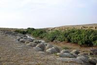
Coal mines were located 2 kilometers west of the village of Taushyk. At this time, an embankment of large stones has been laid to the pier, on both sides of the embankment, among the stones this place was chosen by a large number of bull-calves, this is already water (Natrix tessellata).
Watery spends time in water much more than ordinary watery one. It feeds mainly on fish (60%), less often amphibians. Spends the night on land, in the morning it warms up in the sun and goes hunting for water. Having caught the prey, it crawls back to the shore, where it swallows it and either goes for new fish, or arranges to digest the prey.
Often hunts gobies, for which he received the nickname "bull-calves". It also winters on land, in spring appears in March - April, the mating season in April - May. He leaves for the winter in October-November. The main enemies of snakes are birds of prey and mammals. Watermark is not aggressive, at the sight of a person he usually tries to hide in water or in shelter. Bites are extremely rare. For humans, they practically do not pose any danger. Photographing colonies of water snake. Return to Aktau (136 km).
Day 9. Aktau - Boszhyra valley - Aktau (545 km).
Breakfast. Transfer: Aktau - Sautty valley (panoramic platform near the Karagiye depression). At 30 km from the town, an asphalt road crosses the deepest depression of Kazakhstan Karagiye (- 132 meters below the level of the Baltic Sea). The lowest place where the road passes is 119 meters below sea level. Stop at a panoramic site for photographing the Karagiye depression.
Further transfer to the town of Zhanaozen (102 km). Transfer to the Boszhyra valley (148 km), arrival at the panoramic points of the Boszhyra valley. The first panoramic point is located in the central part of the Karakiyansky district of the Mangistau region and belongs to the Western cliff of the Ustyurt plateau. On the surrounding cliffs, which rise above the Boszhyra valley, there are several panoramic points, from where a stunning view of the surroundings of Boszhyra opens.
The First panoramic platform starts from the 79th kilometer of the Zhanaozen highway - the Beket ata mosque. After the first panoramic point, we will visit the other five panoramic sites, from where an unforgettable view of the unique sights of the Boszhyra valley opens.
After photographing from the panoramic points of the Boszhyra valley, we will go down to the Boszhyra glade, from where amazing views of the outlier mountains Azu tisteri, Borly tau, Ulken keme, Yurt mount open up. lunch. Transfer: Boszhyra - Aktau town (275 km).
Day 10. Aktau - Mount Sherkala - Aktau (362 km).
Breakfast. Transfer: Aktau - Zhetybai village - Shetpe village - Sherkala mount (181 km). From the town of Aktau, our way lies to the southeast, after the Zhetybai village, our way lies to the north in the direction of the Shetpe village. We pass the large village of Shetpe and after it our path lies to the north-west to Mount Sherkala.
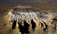
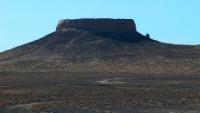
Mount Sherkala is located between the central and western systems of the Karatau ranges, in the northern part of the Akmyshtau mountain. Translated from the Turkic “Sherkala” means “lion's fortress” (“sher” is a lion, “kala” is a fortress). At the foot of the mountain are the remains of the walls of the ancient caravanserai, on the slopes - niches of the sentry, traces of rope ladders, the remains of a secret passage that led to the top of the mountain.
Sherkala is a lonely mountain of unusual shape, if you look at it from one side, the mountain resembles a huge white yurt, but on the other - the mountain resembles a sleeping lion with its huge head resting on its paws. Therefore, the mountain was named Sherkala. Sherkala is surrounded by an aura of curious legends. Walks in the vicinity of Mount Sherkala. On the way back, visit the archaeological site at the Kyzylkala settlement. Return to Aktau (181 km).
Day 11. Aktau – town Beyneu (489 km).
Breakfast. Transfer: Aktau - Manata pass - panoramic platforms near Tuzbair saline land - Manata pass (248 km). Stop in the environs of Tuzbair saline land, photographing the surrounding landscape panoramas and the mausoleum of Manata. lunch.
Transfer: Manata pass - Korkembay mosque (191 km). Visiting the mosque, walking in the vicinity.
Transfer: Korkembay Mosque - Old Beyneu Mosque and Necropolis (29 km). The underground mosque Beket ata (Old Beyneu) is located 22 kilometers southwest of the town of Beyneu. The mosque is located in the southwestern part of the necropolis of the same name. It contains more than 1,500 burials of different times and types.
The dating of the monuments begins in the XVth - XVIth centuries. to the present day. Early Muslim burials are represented by monuments of the beltas-pyramid type, primitive stone fences, monuments of the latest period are mausoleums, saganatams, sandyktases, ushtases, composite koitases with kulpytases. Walking tour of the necropolis, visiting the underground mosque.
Transfer: Old Beyneu Mosque - Beyneu town (21 km). Arrival in Beyneu, transfer to the hotel, accommodation. Evening walk through the central part of Beyneu. Dinner and overnight.
Day 12. Beineu - ruins of fishing village Urga (369 km).
Breakfast. Early departure from Beyneu. Transfer: Beyneu - checkpoint "Tazhen" (82 km). Passing the formalities of the customs and border service of Kazakhstan. Transfer to the checkpoint "Tazhen" - checkpoint "Karakalpakia" (21 km), passing the formalities of the customs and border service of Uzbekistan.
Transfer: check point "Karakalpakia" - Zhaslyk village - Sekseulsay valley - Sudochye lake - ruins of the fishing village of Urga (Karatereng lake) (287 km). Our way from the Kakarkalpakia checkpoint goes along the Central Asia - Center gas pipeline system controlled by the Russian company Gazprom.
This gas pipeline transports gas from Turkmenistan through Uzbekistan and Kazakhstan to Russia. The gas pipeline system was built between 1960 and 1988. Construction began following the discovery of the Turkmen Dzharkak field in the Amu Darya basin, and the first section of the pipeline was completed in 1960.
In the Sakseulsay valley, we will see the Eastern cliff of the Ustyurt plateau, which with steep, eastern slopes drops off towards the Aral Sea of Uzbekistan, from here our path turns north and further north-east to the abandoned fishing village of Urga. Arrival to the eastern shore of Lake Karatereng, accommodation in tents, dinner, overnight.
Day 13. Ruins of the Urga village - Muynak village (98 km).
Breakfast. The village of Urga was founded at the beginning of the XXth century. In Soviet times, Old Believers were exiled here; in the early 50s, a fishing state farm with a population of several hundred inhabitants was founded here.
The village had its own club, post office. The last resident left his usual dwelling in Urga in 1971. Now a small handful of fishermen live here, who fish according to a long tradition. In winter, they collect ice and put it in basements dug in the ground, and in summer they put fish there, so the fish is stored like in a refrigerator. Visit to the Russian cemetery with wooden crosses on the outskirts of the old fishermen's village.
Transfer: ruins of the fishing village of Urga - Kyzylkayyr tract - Uchsay village (76 km). Our path lies to the north along the Eastern cliff of the Ustyurt plateau. We pass the Alzhibay valley and our path turns to the east, in the 80s of the last century the Aral Sea was still splashing in this place.
The road is laid through the Alzhibay Bay and heads to the Muynak Peninsula, only our imagination can draw this, all this has been gone for a long time and there is only the bottom of the Aral Sea covered with shell sand and salt. Arrival in the village of Uchsay, a walk around the village.
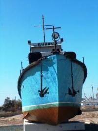
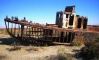
Transfer: Uchsay village - Muynak village (16 km). Arrival in the village of Muynak, transfer to the guest house, accommodation, lunch. Visit to the local museum dedicated to the Aral Sea and the monument - the ship "Buiny" of the Aral flotilla, erected on a pedestal near the rural khakimyat.
The local history museum was founded in 1984 in the house of culture of the Uchsay village of the Muynak region and in 1998 was moved to the house of culture in the center of the region. The museum has over 200 exhibits of fine and applied art telling about the history of the Muynak region, the Aral Sea, the local population, flora and fauna, as well as the famous Muynak cannery. Visit to the stele "Fallen Star" dedicated to a mother who is waiting for her son from the front, an old pier on the shores of the Aral Sea. Walking tour of the village.
A trip to the Cemetery of ships of the Uzbek Aral flotilla near the memorial obelisk "The Tragedy of the Aral Sea", on the former coast of the Aral Sea (3 + 3 km), a walk in the vicinity. Return to the village, dinner, overnight.
Day 14. Muynak - Nukus town (207 km).
Breakfast. Transfer: Muynak village - Karakoltyk village - Shagyrlak village - Kungrad town - Kanlykul village - Khojeyli village - Mizdakhan necropolis (187 km). From the village of Muynak, our path lies south to the most densely populated region of Karakalpakstan.
In the western part of the large village of Zhodjeyli, there is the most ancient and revered among believers architectural and archaeological complex Mizdkhkan. The complex covers an area of 200 hectares, located on three hills. On its territory there are two fortresses built in the XIth - XIIth centuries Gyaur kala (Khojeli) and the ruins of the town of the Golden Horde period.
The last burial at the Mizdahkan necropolis dates back to the XIV century. According to some reports, the complex was destroyed in 1338 during Tamerlane's campaign to Kunya-Urgench. The complex includes the Kyryk Shopan mausoleum, the mausoleum of the princess Mazlumkhan-Sulu, Shamun Nabi and Khalfa Erezhep.
There is a legend that it is here that the grave of Adam is located. Scientists identify this hypothesis with the tomb of Gayomard - the first person on Earth according to Zoroastrian mythology. Also throughout the complex there are columns of seven bricks, according to local legend, these columns fulfill the wishes made during their construction.
On the eastern hill of Mizdakhan there is the legendary hill Jumrat Kasab, by all indications looks like a burial tower, around which archaeologists have discovered many ossuaries, remains of fabrics with gold threads, jewelry, coins, ritual lamps. Visiting the sights of Mizdahkana.
Further transfer: Mizdahkan complex - Nukus town (20 km). Arrival in Nukus, lunch. Visit to the Museum of Art. I.V. Savitsky. The museum contains wonderful masterpieces of painting by artists Rafael Matevosyan and Faim Madgazin, dedicated to the Aral Sea and the South Aral Sea region.
The museum today contains about 20,000 paintings, as well as 70,000 carpets, coins, jewelry and other exhibits from ancient times to modern times. Here are the objects of the material and artistic culture of ancient Khorezm, the folk applied art of the Karakalpaks. City tour. Return to the hotel, dinner, overnight.
Day 15. Nukus - Ayaz Kala fortress (190 km).
Breakfast. Transfer: Nukus - Chilpyk Tower (Tower of Silence) (III - VIII centuries and X - XIV centuries) (50 km). Arrival to the Chilpyk tower, walks in the vicinity of the monument, climbing to the tower. Dakhma Chilpyk - the burial tower ("tower of silence") refers to the Zoroastrian culture.
Monument of the ancient Khorezm era, erected at the end of the Ist century BC. - the beginning of the Ist century A.D. Dakhma Chilpyk is a typical structure for the specific Zoroastrian practice of burying the dead, but it strikes with its monumental size and belongs to the heyday of the Zoroastrian culture in Ancient Khorezm at the crossroads of historical eras. The approximate date of construction is the end of the Ist century BC. - the beginning of the Ist century A.D.
Transfer: Chilpyk tower - ruins of settlement of Dzhanpyk kada (I - II centuries and IX - XIV centuries) (53 km). Arrival at settlement of Dzhanpyk kala. The settlement dates back to the X - XI centuries, XIII - XIV centuries. AD, is one of the picturesque monuments of the right bank of the Amu Darya, closely adjacent to the northern part of the Lower Amu Darya biosphere reserve.
The site of the settlement has a complex configuration. In the eastern part, the citadel has been preserved in the form of a rectangle of pakhsy walls. The walls are decorated with closed semi-columns and the tops end in pairs of stepped arches.
Archaeological excavations made it possible to clarify the chronology of the settlement. The oldest pottery dates back to the 4th century BC. - 1st century A.D. The date of the last settlement on the site is determined by coins of 1319 - 1320 and 1345 - 1346. A walk in the vicinity of the settlement, photographing the fortress walls.
Transfer: Dzhanpyk Kala settlement - Sultan Uvais necropolis (XIII - XIV centuries) (35 km).
Sultan Uvais complex includes:
1. Chinor Bobo mausoleum at the highest point of the cemetery. Traditionally, pilgrims first visit this mazar, and then go to the tomb of Sultan Vais.
2. Mausoleum of Sultan Vais Bobo on the southern slope of the hill.
3. The sacred spring in front of the entrance to the Sultan Bobo sanctuary, according to legend, flows out from under the feet of the buried saint.
4. Mount with Obo, two or three kilometers from the mausoleum, on which, according to local legend, Sultan Uvais Bobo stood on his knees for 40 days, begging the Almighty for forgiveness to all Muslims and on which he knocked out all his teeth as a sign of solidarity with the Prophet Muhammad, who lost a tooth in the battle of Uhud (Okhud).
5. In the southern half there is a mosque with an aivan, a row of hujras and a living room.
Arrival at the Sultan Uvais necropolis, a walk in the surroundings. Visit to the local bazaar in front of the necropolis. Lunch on the way.
Transfer: Sultan Uvais necropolis - Toprak kala palace (III - IV centuries BC) (20 km). The ancient settlement Toprak Kala, where in the III - IV century AD. the palace of the Khorezmshahs was located.
Toprak kala palace consisted of:
The “Hall of the Kings” on Toprak kala is a dynastic sanctuary in which a fire burned on the altar in front of large images of the 23 kings of Khorezm.
"Hall of Victories" on Toprak kala - carried on its walls the bas-reliefs of the seated kings and the goddesses soaring beside them.
“Hall of dark-skinned warriors” on Toprak kala - here the bas-relief images of the kings, standing in niches, were located under clay moldings in the form of huge stylized ram horns
The “Hall of deer” on Toprak kala was decorated with the figures of these animals, over which there was a belt with the image of griffins. Other bas-relief fragments include pomegranate fruits, vines, etc. The decoration may have conveyed the cycle of life in the kingdom of plants and animals.
"Hall of Dancing Masks" on Toprak kala - partially preserved images of men and women dancing in pairs on the walls. Walking in the vicinity of the ancient town.
Transfer: Toprak Kala palace - Ayaz Kala yurt camp (35 km). Arrival at the Ayaz Kala yurt camp, accommodation, dinner, rest, overnight.
Day 16. Fortress Ayaz Kala - Khiva (204 km).
Breakfast. After breakfast, excursion to the fortress Ayaz Kala (Bolshaya) (1 km). The complex of fortresses Ayaz Kala - the remains of fortifications of the period of the Kushan culture (III - I centuries BC. Are located on the right bank of the Amu Darya.
They were first explored in 1939 - 1940 by the Khorezm archaeological expedition led by S.P. Tolstov, among a large three groups of settlements stand out in particular:
The first of them is the fortification Ayaz Kala No. 3, with minarets and labyrinths, fenced off by a powerful wall. Inside the fortification, there are the remains of a spacious palace, the ruins of an ancient fortress from the times of the Kushan kingdom. The fortification was built in the III-II centuries BC during the heyday of the Kushan culture. The fortress served as a military fortification, guarding the borders of the kingdom.
Fortification Ayaz kala (Small), built in the Kushan era, completed in the 5th - 7th centuries. n. e. The entire area of the castle was built up with narrow corridors, ceilings were vaulted, the walls were up to 0.7 meters thick.
Fortification Ayaz kala (Bolshaya) is located on the Ayaz kala hill, not far from Lake Ayazkol, it is well preserved. It was established that Ayaz Kala was a military fortification that guarded part of the borders of the Kushan kingdom. During the excavations, iron daggers, knives, spearheads and arrowheads, bronze and gold items were found.
Arrival at the Ayaz Kala fortress, a walk around the vicinity of ancient fortresses, photographing the fortress walls. From the fortress wall Ayaz Kala (Big) a panorama of the Ayaz Kala (Small) fortress opens. Also, a good photo is obtained on Ayaz kala (Small) and above it Ayaz kala (Big).
Transfer to the fortress Ayaz kala No. 3 (3 km). Arrival at the Ayaz kala fortress No. 3I, a walk around the environs of the ancient fortress, photographing the fortress walls.
Transfer: Fortress Ayaz kala – II - ancient settlement Kyr kyz kala (16 km). The fortress Kyrk kyz kala No. 3, dates back to the Ist - VIth centuries AD, is located outside the city and was approximately the suburban residence of the rulers. This fortress was already known in the IIIrd - IVth centuries.
According to S.P. The Tolstov fortress was fortified in the Vth - VIth centuries and the old walls are surrounded on all sides by a new wall of baked bricks. Arrival at the Kyrkyz kala settlement, a walk around the outskirts of the ancient fortress, photographing the walls.
Transfer: ancient settlement Kyrkyz kala - ancient settlement Kurgashin kala (14 km). The Kurgashin kala fortress is well preserved, and some towers still stand up to the height of the second floor. It covers an area of 1.4 hectares. Kurgashin kala was built in the IVth - IIIrd centuries BC. and existed as a populated town until the IVth century AD.
The walls were built of pakhsa in the lower part, followed by a masonry of square bricks with tamga. The fortress is surrounded by a barrier wall from all sides, except for the south-western one. The fortress probably covered the inner regions of the ancient Khorezm state from the invasion of the steppe tribes.
Arrival at the Kurgashin kala settlement, a walk around the outskirts of the ancient fortress, photographing the fortress walls.
Transfer: settlement Kurgashin kala - village of Kyrkyz - fortress Guldursun (Big) (90 km). Big Guldursun is one of the largest border fortresses of Khorezm, built on the basis of a desolate ancient fortress. In plan, it is an irregular rectangle measuring 350 x 230 meters, oriented with its corners to the cardinal points.
Inside, during archaeological excavations, a large number of antique and medieval ceramics, bronze crafts and decorations, Antique and medieval coins were found. Judging by the finds of coins, it can be determined that the last period of the monument's existence dates back to 1220.
Transfer: fortress Guldursun (Big) – town of Turtkul - village of Bulish - town of Urgench - town of Khiva (90 km). Arrival in Khiva, transfer to hotel, accommodation, dinner, overnight.
Day 17. Khiva.
Breakfast. Excursion around Khiva - "Open Air Museum". Visiting: Ichan-Kala fortress (VIII - XIX centuries), Pakhlavon Mahmud mausoleum (XVIII - XIX centuries) - the main cult center of Ichan-Kala, built in honor of the patron saint of Khiva, poet, philosopher, doctor and invincible fighter Pakhlavan Mahmud, minaret and mosque of Khoja Islam (early XX century) - the highest minaret (57 meters with a foundation) and the smallest madrasah in Khiva.
Lunch at a local restaurant. Continuation of the excursion in Khiva, visiting the Allakulikhan complex, madrasah, Tim (covered market) and caravanserai (XVIII century), Khurjum madrasah (XVII century), Abdullah Khan madrasah (XIX century), Tash-Khauli palace (XIX century). ) - the khan's palace with throne and court rooms and a harem, Zhuma mosque and minaret (XII - XX centuries) - the roof of the mosque is supported by 212 carved columns, thanks to the unique construction this is the coolest place in Khiva, with excellent acoustics, the height of the minaret - 32.5 meters.
Visiting the mausoleum of Said Alauddin (XIV century), Madrasah of Muhammad Amin Khan (XIX century) - the largest medieval madrasah of Khiva, Kalta Minor minaret (XIX century) was conceived as the tallest minaret in the Muslim world, the height of which was supposed to reach 70 meters, but it remained incomplete at a height of 26 meters, the Kunya-Ark citadel (XIX century) - an internal fortress with administrative buildings, a powder workshop, a courthouse and its own mosque, Shirgazi Khan madrasah (XVIII century). Return to the hotel, dinner, overnight.
Day 18. Khiva - Bukhara (454 km).
Breakfast. Transfer: Khiva - Urgench town - Beruni town - Tortkul town - Uch-Uchak village (185 km). Stop at the village, lunch. Further transfer: Uch-Uchak village - Kuzylkum desert - Gazli town - Bukhara (269 km). Transfer to Bukhara through the Kyzyl Kum desert. Arrival in Bukhara, transfer to the hotel, accommodation, dinner. Evening walk around the town, overnight.
Day 19. Bukhara (41 km).
Breakfast. Drive out of town visiting the majestic necropolis of Bahauddin Naqshbandi (12 km). This is the burial place of the Sufi mystic of the Naqshbandiya order, Saint Bahauddin Naqshbandi, revered throughout the Muslim world.
Visit to Sitora-i-Mokhi Khosa (16 km) - the summer palace of the last emir of Bukhara (XIX century). Transfer and visit to the Chor-Bakr necropolis (X - XVI centuries), located in the village of Sumitan in the west in the suburbs of Bukhara - the "town of shadows", which once served as a family residence for the spiritual leaders of the Naqshbandia order. Lunch at the Chor-Bakr teahouse.
Return to Bukhara. Visit to the Chashma Ayub mausoleum (XII - XVI centuries), inside the mausoleum there is a source of holy water and a small museum. Visit to the most ancient monument in Uzbekistan - the Samanid mausoleum (X century), the family tomb of the Samanid dynasty. The monument is recognized as the pearl of the architecture of Central Asia.
Visit to the house of a wealthy Bukhara merchant who once belonged to the first President of the Bukhara People's Republic - Fayzullo Khodjaev. Demonstration of old Bukhara clothing. Dinner at a local restaurant, overnight.
Day 20 Bukhara - Samarkand (267 km).
Breakfast. Excursion around Bukhara. Visiting the architectural monuments of Bukhara: the Lyabi Hauz architectural ensemble, the mausoleum and madrasah of Nodir Divan Begi (XVIth century), the Kukeldash madrasah (XVIth century), a monument to Khoja Nasreddin, Tim Abdullakhan (XVIth century), a covered bazaar, which was used to trade expensive silk fabrics.
Visit to the Magokki Attori mosque (XII century), this mosque was built on the site of a temple of fire worshipers, this is one of 3 monuments in Bukhara, which survived after the invasion of Genghis Khan. Visit to the Ulugbek madrasah (XV century), this madrasah was built by Tamerlane's grandson, at the entrance to the madrasah there is an inscription in Arabic script belonging to the Prophet Muhammad: "The pursuit of knowledge is the duty of every Muslim and Muslim woman."
Visiting Abdullazizkhan Madrasah (XVII century), Bukhara caravanserais, Kalon mosque (XVI century). Visiting the operating Mir-i-Arab madrasah (XVI century), the head of Russian Muslims Ravil Gaynuddin and the former President of Chechnya Akhmad Kadyrov studied in the madrasah. A visit to the Kalyan minaret - a symbol of Bukhara (the tower of death), according to one of the legends, unfaithful wives and freethinking Bukharians were thrown from the minaret.
Visit to trade domes in Bukhara (XVI century): Toki Saraffon, Toki Telpak Furushon, Toki Zargaron, where local artisans (jewelers, ceramists, potters, artisans) sell their products. After lunch, continue the excursion, visit the architectural ensemble Registan - Ark fortress - a grand citadel, the dwelling place of the rulers of Bukhara, a stronghold of power and power (Ist century BC - XIXth century), Bolo-Khauz mosque (XVIIIth century), Shukhov's towers, Registan square. Visit to the Chor Minor mosque. On request, bathing in the XVIth century Central Asian bathhouse "Homi Bozori Kord". Lunch at a local cafe.
After lunch, transfer: Bukhara - Galaasia village - Vabkent village - Gijduvan town - Rabat-i Malik caravanserai (83 km). Visit to the Rabat-i Malik caravanserai. The erection of the "Tsar's Fortress" in the steppe, as established by a set of data, refers to the end of the XIth century, reconstruction to the XIIth century, functioning continued until the beginning of the XVIIIth century.
The political history of the region of the XI - XII centuries was associated with the three Turkic Empires and dynasties of the Karakhanids, Ghaznavids and Seljukids, who ruled here with varying success and changing state borders throughout the designated time.
Rabat-i Malik, in full accordance with the name "The Tsar's Fortress", was a unique, complex in architectural design and luxurious in decorative design, a palace-type structure with all the attributes of a comfortable fortress-residence, the government headquarters of the Karakhanids, but by no means a caravanserai, as is customary was to count.
Sardoba Malik, visiting sardoba, is located 300 meters southwest of the caravanserai. Sardoba Malik, was built in the 11th century to supply water to the Rabat-i Malik caravanserai. Technically, the sardoba is a 13 meter deep reservoir covered with a 12 meter diameter dome. The dome has three skylights. Currently, the entrance is a portal (recently added).
Transfer: Rabat-i Malik caravanserai - Karmana village - Kattakurgan town - Samarkand (184 km). Arrival in Samarkand, transfer to the hotel, accommodation, dinner, overnight.
Day 21. Samarkand.
Breakfast. Excursion across Samarkand. Visiting: the Ulugbek observatory, the mausoleum of Doniyor Paygambar (the prophet Daniel) (XIV, early XX century), the museum of the history of the town near the ancient settlement Afrosiab (VIII century BC), the Khazrati Khyzr mosque (XIX century), mausoleum complex Shakhi-Zinda (XI - XV centuries). Lunch and dinner at local cafes and restaurants. Overnight.
Day 22. Samarkand - Tashkent.
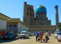
Breakfast. Visiting: the Gur-Emir mausoleum (XV century), the ensemble of monuments on Registan square with Ulugbek madrasah (XV century), Sher-Dor and Tillya-Kari madrasah (XVII century), Rukhabad mausoleum ("Abode of the Spirit") (XIV-XV centuries c.) - the tomb of Sheikh Burkhan ad-Din Sagardzhi (the head of the Muslims in Beijing), buried according to his will in Samarkand. Visit to the Bibi-Khanym mosque (XVth century, Siab bazaar. Lunch at a local cafe.
After the end of the excursion, transfer to the railway station, transfer by train "Afrosiab" to Tashkent. Departure from Samarkand at 17.28, arrival at 19.44 in Tashkent. Meeting at the railway station, transfer to the hotel, accommodation, dinner, overnight.
Day 23. Tashkent.
Breakfast. Visiting the Old City, here is the religious center of Tashkent - the Khast-Imam complex. Among the unique exhibits of old Tashkent, the famous Koran of Caliph Osman (VII century) is kept here, the original source of the holy book of Islam. Visiting the architectural and cultural complex Khast-Imam, Barak-khan madrasah, Tilla-Sheikh mosque, Abu Bakr Kaffal Shashi mausoleum, Islamic Institute named after Imam al-Bukhari.
Transfer to the oldest bazaar of the city - "Chorsu", walk through the bazaar. Dinner. After visiting and sightseeing of the Old City, a trip by the Tashkent metro to the central part of Tashkent. In 1973, the construction of the Tashkent Metro began. Since 1977, the metro has been operating in the capital - the only one, at that time, in Central Asia.Today, the metro has three lines - Chilanzar, Uzbekistan and Yunusabad, 29 stations.
The total length of the lines is 35 km. Visit to the squares of Amir Timur and Independence, the Museum of Applied Arts. Walking through the squares, visiting the Museum of Applied Arts - the museum presents unique exhibits that tell about the history of decorative arts in Uzbekistan. Among them are the works of woodcarving and chasing masters, jewelers and gold embroiderers. After the excursion, transfer to dinner. Return to the hotel, overnight.
Day 24. Tashkent.
Breakfast. Visiting Alisher Navoi Park and Abdul Kasim Madrasah where the center of artisans is located, here you can buy souvenirs in the form of works, wood carvings, miniature paintings on caskets and on silk paper. Visit to the Kukeldash madrasah, one of the oldest madrasahs in Tashkent, visit the Zhuma mosque, the third largest Friday mosque in Uzbekistan.
Visiting the monument "Courage", Friendship of Peoples Square, Broadway - Alley of Artists. Visit to the monument to Amir Timur in the city park of Amir Timur, the memorial "In memory of the victims of repression".
Visit to the Pilaf Center, there are five pilaf masters in the Pilaf Center, as well as several assistants who prepare pilaf. Pilaf is cooked at 11 o'clock, in Uzbekistan it is customary to eat pilaf during lunch. They begin to cook pilaf in the morning in the courtyard of the Pilaf Center in five huge cast-iron cauldrons-cauldrons (containing 50 kilograms of rice each) on wood. Sightseeing tour of Tashkent. Return to the hotel, dinner, overnight.
Day 25. Tashkent.
Breakfast. Transfer to the airport, flight to Tashkent.
Note:
Author program is Alexander Petrov. Copying and use - from the sanction of the author.
Photos by:
Alexander Petrov.


