


![]()
Вы здесь
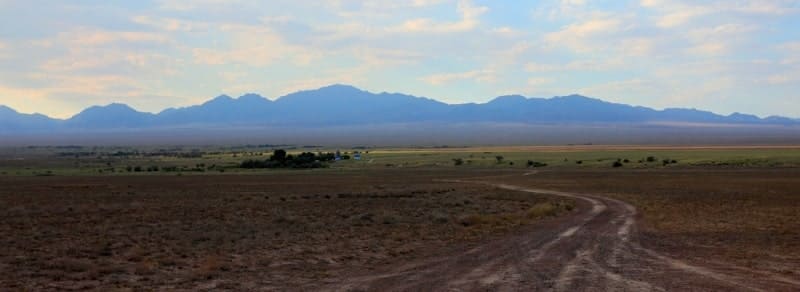
Altyn-Emel ridge.


Tours to mountains of Altyn-Emel.
"Having completed our interesting expedition to Mai-Tyube, we arrived at Altyn-Emel at 19°C by 7:30 PM. A hypsometric measurement gave us an absolute altitude of 1,120 meters. We spent the night here. On September 5th, we set out early in the morning, heading for the Altyn-Emel mountain pass."
P. P. Semenov-Tyan-Shansky. "Journey to Tien-Shan." 1856 - 1857.
Botanical excursions in mountains of Altyn-Emel.
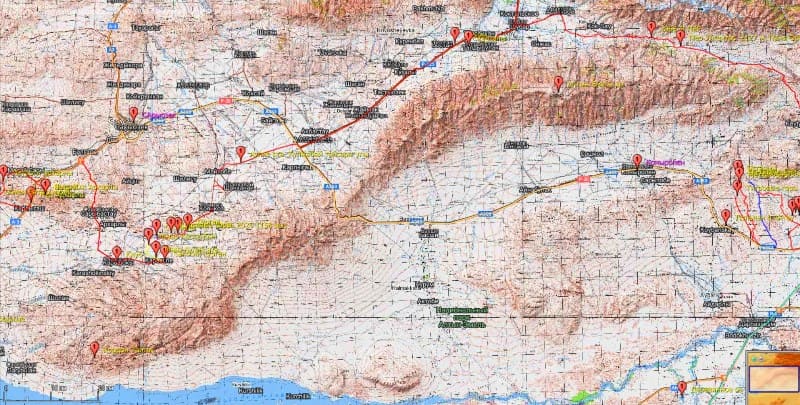
Geographical location of Altyn-Emel Mountain Range.
Altyn-Emel Range is located in northeastern part of Zhetysu region, in Kerbulak and Panfilov districts. Its westernmost spurs are located within Konayev city administration in Almaty region.
Altyn-Emel Range is the western spurs of the Zhungar Alatau. The border of the Altyn-Emel National Nature Park extends from the central part of the Altyn-Emel Range southward. Altyn-Emel Mountains are an intermediate link in a mountain range that extends from southwest to northeast, consisting of several mountain ranges, from west to east: Sholak, Degeres, Matai, Orikty, Ulkili, Buguly, Koyandy-Tau, Suat-Tau, and Yrgayly.
This mountain range, which encircles the Altyn-Emel Nature Park from the north, extends for 182 kilometers, with its greatest width in the eastern part being 23 kilometers. To the west, the Altyn-Emel Range borders the Matai Mountains, a natural boundary formed by the Saryozek-Zharkent highway with the Altyn-Emel Pass, 1,711 meters above sea level.
To the northeast, the Altyn-Emel Range borders branches of the main Dzungarian Range - Kyzylkiya and Koyandy Mountains. The southeastern part of the Altyn-Emel Range consists of the Kontag Mountains, which reach an elevation of 1,709 meters above sea level, and the Yrgayly Mountains, with their unnamed peak at 2,847 meters above sea level.
The southwestern part of the Altyn-Emel Range consists of the Orikaty Mountains, which gradually transition from west to east into the Dolanaly and Ulkili Mountains. The Orikaty Mountains are dominated by an unnamed peak at 2,115 meters above sea level.
Dolanaly Mountains are dominated by the dominant peak, Koyindy, at 2,210 meters above sea level. The Ulkili Mountains are dominated by an unnamed peak at 2,914 meters above sea level. The central part of the Altyn-Emel Range is home to two mountain groups: the western-facing Bugul Mountains, dominated by Karagayly Peak, at 3,297 meters above sea level.
Near Karagayly Peak are two passes – Karagayly and Terekty, both at 3,197 meters above sea level. Karakol Peak, at 3,459 meters above sea level, dominates the eastern part of the Altyn-Emel Range. Hydrography of the Altyn-Emel Ridge. Altyn-Emel Ridge has a complex hydrography, represented by a large number of large and small rivers.
This is characterized by the ridge's high moisture content, its geographic location, and its proximity to the higher, perennially glaciated Dzungarian Alatau Mountains. The northern part of the ridge is represented by a network of rivers belonging to the Barokhuzdir River basin: the Belbulak and Suateai.
The northeastern part of the ridge has a branched network of rivers belonging to the Bizhe River basin: the Kugali, Baitarak, Razvilenka, Mamyrkan, Dolanaly, Tasbastau, and Zhama. The northwestern and western parts of the ridge contain a network of rivers belonging to the Kaskantirek River basin: the Karagayly, Esengul, Zholbastai, Ulken-Koyandy, Krutoy Log, Shoshkaly, Zhangyzagash, Kyzylkersai, Kasymbay, Taldybulak, Borshabulak, and Karabulak.
Southwestern part of the ridge has a very small network of rivers belonging to the Barokhuzdir River basin: the Ulken-Karagayly. The southern part of the ridge contains rivers belonging to the Kapshagay Reservoir basin, most of which do not reach the reservoir due to irrigation.
These are the rivers: Kaishi, Sulubokey, Karakol, Tamshy, Kartasty, Koktasty, Karagaily, Bugul, Kisyksai, Terekty, Koktasty, Ulken-Alaman, Taldy, Nazaytapkaya, Kyzylauz, Uzunbulak, Kaiyndy, Dolanaly, Altyn-Emel and Zhamansai.
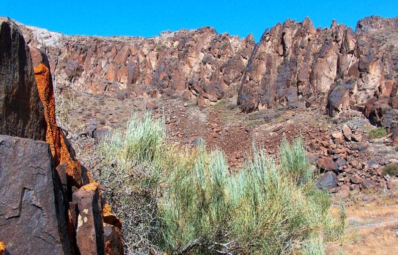
Altyn-Emel Range's orography.
Altyn-Emel Range's orography consists of two main parts: the plain adjacent to the right bank of the Ili River, and the mountainous region comprising the spurs of the Zhungar Alatau and the macroslope of the Altyn-Emel Range. Small, insular mountain ranges are located on the plains.
Altyn-Emel Range is more than just a geographical feature. It is a place where ancient geology, rugged steppe beauty, and rich history intertwine. This area continues to be a source of discovery for scientists, an inspiration for travelers, and a treasure trove for those who appreciate the true pristine nature of Zhetysu.
Geology of the Altyn-Emel Range.
Altyn-Emel Range is a true open-air museum. Its geological structure includes:
- ancient metamorphic rocks, some hundreds of millions of years old;
- sandstones and conglomerates, indicating ancient water flows;
- volcanic rocks, indicating active tectonic processes of the past.
The ridge was formed as a result of uplifts and faults associated with the general activation of the Tien Shan orogeny. It is part of a large tectonic zone where weak seismic activity is still recorded. The ridge's geology is represented by Carboniferous deposits (300 million years old), consisting primarily of volcanic rocks, Permian and Carboniferous deposits, and the most ancient deposits, Silurian deposits.
The mountains of the ridge are primarily composed of Paleozoic rocks, dating back 200 to 400 million years.
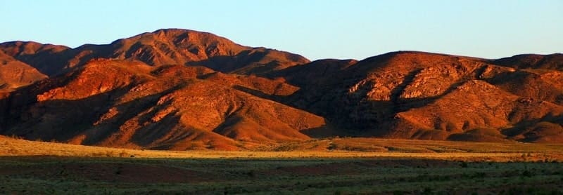
Relief of Altyn-Emel Ridge.
Altyn-Emel Ridge is one of the most distinctive and enigmatic mountain ranges in Zhetysu. It is part of a complex orographic junction connecting the Zhetysu Alatau ranges and the Ili Valley, and has long attracted the attention of researchers, travelers, and nature lovers.
Altyn-Emel Ridge's topography is highly rugged:
- steep southern slopes drop off toward the Ili River,
- northern slopes are gentler and transition to foothill plains,
- peaks are smooth, but sharp ridges and scree slopes are common.
The cliffs at sunset often shimmer with golden-red hues - it is this phenomenon that earned the ridge its poetic name.
Climate of Altyn-Emel Ridge.
Region's climate is sharply continental:
- hot, dry summers, with temperatures reaching 40°C;
- cold, snowless winters;
- precipitation falls primarily in spring and autumn.
Winds are common, especially northeasterly and easterly. The location between the mountain range and the Ili Valley creates contrasting temperature conditions and localized wind corridors.
Sights of Altyn-Emel Ridge.
While ridge itself is a unique natural landmark, other famous sites are located nearby:
Singing Dunes, a natural phenomenon that creates an infrasonic "singing" sound when sand moves, are located in the southern spurs of the Altyn-Emel Range – Kysty-Kalkan and Ulken-Kalkan;
Katu-Tau Mountains – red mountains reminiscent of Martian landscapes, are located in the southern spurs of the Altyn-Emel Range – Katu-Tau;
Aktau Mountains – multicolored clay mountains of great interest to geologists, located in the southern spurs of the Altyn-Emel Mountains and south of the Katu-Tau Mountains;
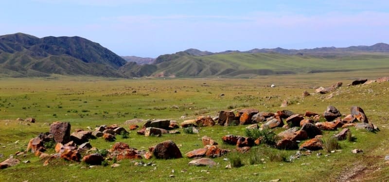
Ancient Saka burial mounds of Besshatyr are located on the southern foothill plain of the Altyn-Emel Range at an altitude of 686.8 meters above sea level, at the foot of the range.
In the southwestern part of the range, at the exit of the Taygak Gorge, is the "Post No. 1" cordon, and 132 meters to the northeast is the Altyn-Emel Nature Park visitor center. The visitor center has a café and restrooms. Five summer houses are located a little further north, and six yurts are set up in the summer.
In the northwestern part of the Altyn-Emel Mountains are Saka burial mounds, 10 kilometers east of the village of Karashoky. The Aulie Mausoleum is 8.3 kilometers east and slightly north of the village of Karashoky. The ancient Kaskenbay Mazar is 7.7 kilometers northeast of the village of Karashoky.
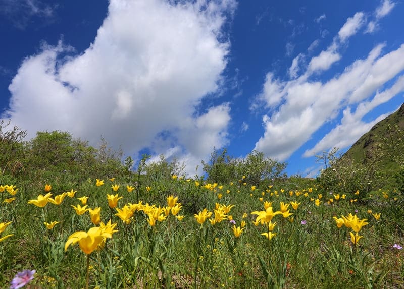
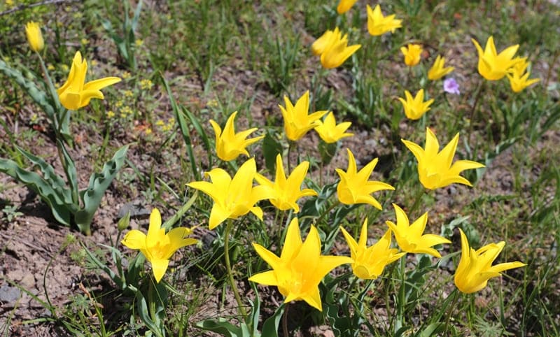
On the southern side of the Altyn-Emel Pass, the short-stamen tulip (Tulipa brachystemon) grows.
On the northern slope of the Altyn-Emel Ridge are several Saka burial mounds, 2.4 kilometers west of the village of Taldybulak and 2.7 kilometers east of the village of Bolstan. A large Saka burial mound is also located. In the southeastern part of the Altyn-Emel ridge lies the Kaishi valley, home to rock carvings dating from the late Bronze Age and early Iron Age. The valley is located between the southern slopes of the Yrgaity Mountains and the northern slopes of the Orta-Tau ridge.
These are historical caravan routes that connected the Ili Valley with the eastern lands.
Altyn-Emel and this entire complex form a single natural and historical space.s.
Geographic coordinates of Altyn-Emel mountain range: N44 ° 25'39 E79 ° 00'03


Authority and photos by:
Alexander Petrov.