







You are here
High mountain valley of Arabel.
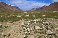
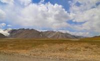
Tours to Tien-Shan mountains.
“A vast plateau spread before the travelers - a syrt, along which small half-frozen lakes were scattered, located between relatively already low mountains, however, covered with eternal snow on the peaks, and on the slopes - with luxurious greenery of alpine meadows. From the top of one of these mountains, travelers could very clearly see the upper reaches of the tributaries of the Naryn, flowing from the syrt lakes spread at their feet, the main source of which was to the east of Yu.E. from here. Thus, for the first time, the origins of the vast river system of the Jaxartes were reached by a European traveler.”
P. P. Semenov. "History of half a century of activity of the Russian Geographical Society".
Geographical sights of Tien-Shan.
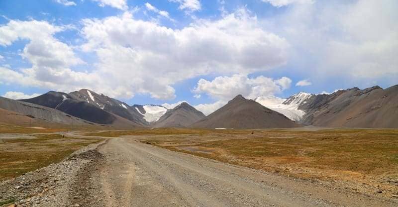
Latitudinal, high mountain valley of Arabel is located at an altitude: in western part from 3822 to 3858.6 m. a. s. l., in central part at an altitude of 3752 to 3779.1 meters above sea level, in eastern part up to 3689.9 m. a. s. l., is located between southern slopes of Terskey Ala-Too ridge and between northern slopes of Jetym-Bel and Sook ridges in Jety-Oguz district of Issyk-Kul region.
The length of the valley from the southwest to the northeast is 22 kilometers, the width in the western part reaches 4 kilometers, in the central 8 kilometers, in the east 3.5 kilometers. The area of the Arabel highland valley is 105.52 sq. km., the perimeter is 67.54 kilometers.
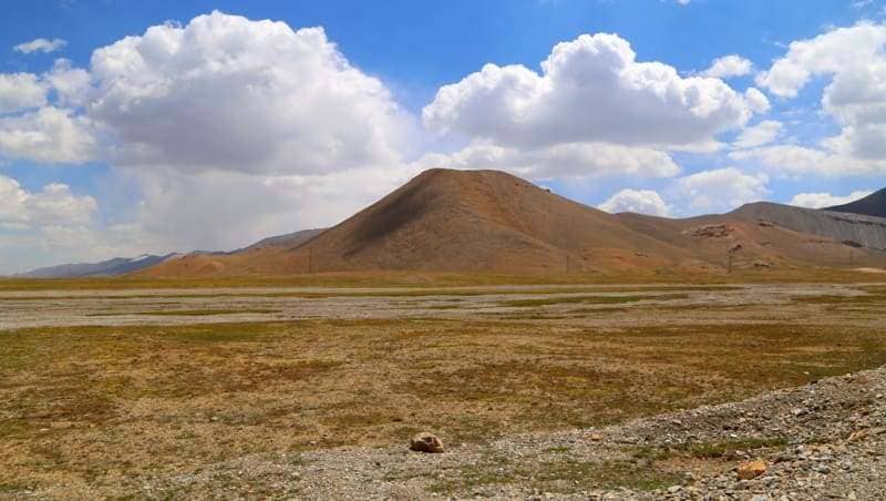
There are more than 15 large lakes in the valley, among them a group of lakes Dzhashyl-Kel: Western Dzhashyl-Kel, Southern Dzhashyl-Kel, Northern Dzhashyl-Kel, Central Dzhashyl-Kel. More than 15 small lakes. The relief of the Arabel valley is represented by syrts, wide sloping valleys, bordered by mountains, sometimes steep.
In some Turkic languages "syrt" means "back". The Arabel valley is a residual, relict form, preserved from an ancient flat country from a leveled country, which in the Tertiary period was subjected to mountain-building processes, and individual massifs were strongly uplifted.
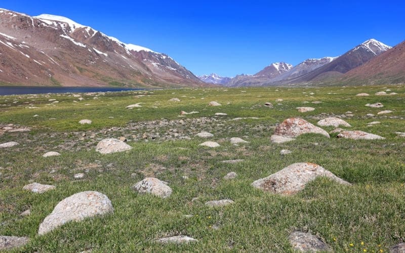
In the Arabel Valley it is always cold, even in the short summers, the winters are long and severe, the landscape is dull and inhospitable, the vegetation is mostly stunted and stiff, and only in places green and dense. Cattle are driven here, as a rule, only in summer, but often on the southern slopes, in those places where there is little snow, winter grazing is also practiced. Numerous glacial boulders and moraines cover part of the valley surface.
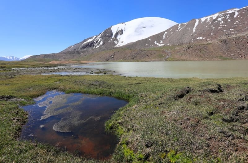
There are many small saucer-shaped lakes, wetlands are common - according to the local "sazy". Frozen soils do not allow water to pass into the underlying horizons, therefore, water, collecting in the gentle basins of the syrt, where evaporation is very weak, swamps the surface.
In the Arabel Valley, snow also occurs in the summer, this phenomenon is not uncommon. Sometimes heavy snowfalls and frosts hit pastures at the very beginning of autumn. The surface of the valley is slightly (by 7 - 10 °) inclined to the south, to the sources of the Big Naryn - the Arabel-Suu, Sarychat, Taragay rivers.
Flat and shallow river valleys and wide hilly depressions alternate with smooth interfluves and low ridges.
Relief of high mountain valley Arabel.
The relief and the whole appearance of the Arabel valley was formed as a result of ancient powerful glaciation, traces of it are visible everywhere: moraines ingrown into the ground, large boulders, sheep's foreheads, many swamps, small (less than 1 km square) shallow lakes with swampy low banks and swamps.
Permafrost here is also a remnant of ancient glaciation, it is widespread at an altitude of more than 3400 m. a. s. l., its upper limit lies in the soil at a depth of 1-1.3 meters. By preventing seepage and runoff of groundwater, permafrost contributes to the formation of waterlogged areas.
The prevailing westerly winds, passing through the Terskey-Alatau, leave the moisture of the air masses on the northern slope of the ridge and fall on the syrts largely dehydrated. This circumstance, combined with the high altitude of the syrts, determines the severity and dryness of the climate: moderately warm summers and moderately severe, almost snowless winters.
Falls 150-350 mm of precipitation per year. There are frosts every night in summer. A strong wind blows during the day, calm happens only in the morning and in the evening. On the syrts, the unfavorable conditions for the existence of glaciers on the slopes of southern exposure are balanced by the severity of the climate at high altitudes.
The Arabel valley is a region of distribution of peculiar glaciers of flat peaks; they have neither a developed bed nor a rocky frame, and therefore are devoid of stone material and do not form large moraines. Such glaciers cover small, rounded peaks not affected by erosion, are fed by atmospheric precipitation and have a thickness of 100-150 meters. Snow line on the Terskey Ala-Too ridges.
Here's how V.I. Lipsky describes high-mountain Arabel Valley after descending from Dzhukuchak Pass in 1903.
"On the other side of the Dzhukuchak Pass, the scene was unexpected. Descending from the pass, you immediately find yourself in a rocky landscape: the entire area south of the pass consists of rock fragments from the left (eastern) side, which seems to be completely transformed into ruins.
And this entire rocky landscape is full of water: streams, lakes, and melting snow. Such is the valley below, which, despite its altitude, is almost snow-free due to its southern exposure. Only to the right (i.e., to the west), at a certain altitude, is a significant snow slope with firnak visible.
In general, the heights on both sides of the valley have little snow. If you drive a little further back and descend, then to the left, behind you, i.e., closer to the pass, you see a snowfield falling in two ridges, and perhaps there is also ice there. Such was the scene, not a particularly cheerful one, at the beginning of the syrta.
In the distance, directly to the south, a whole snowy ridge was visible, which the Kirghiz called Aravyol to me, and a considerable foggy expanse. This Aravyol ridge was heavily snow-covered, but the glaciers were obviously quite insignificant; all its gorges, facing north or almost northwest, were covered in snow.
This ridge, despite its snow, seemed quite low and produced a very gloomy impression, whether because of its dark rocks or for other reasons. I note that it was already evening (we descended from the pass at 6 a.m.), and the general illumination of the entire area had a strange quality.
As I already mentioned, this entire valley, lying between inhospitable heights on both sides, was abundant in water. The riverbed immediately, that is, almost from the pass, became wide. The river, still quite insignificant, immediately after the pass divides into a series of channels, but small and quiet.
Scattered along the riverbank and throughout the valley (or rather, in the gorge) are numerous small lakes, some connected to the river, others lying separately. They are easily fordable. These puddles and marshes had to be crossed many times, or rather, driven through all the time.
There is almost no vegetation here. Only here and there are small Fleurogyne carinthiaca Grieb., Smelowskia calycina sam., Erigeron aurantiacus Rgl. with orange flowers, and Sibbaldia tetrandra Bge. Below, in places, there are hummocks, such as are found in swamps in central Russia; a certain sedge (Satvkh) grows here in abundance, but only greenery and grass are visible.
The mountain slopes on the right (we were driving along the right side of the river the entire time) weren't particularly rocky, and, curiously, large, rounded boulders could often be seen on their crests. Overall, this weathered country, still brimming with winter's shackles, gave the impression of being the result of considerable glacial activity.
However, it gradually grew darker, the temperature became very cool, and there was no end to this hummocky and often impassable marshy terrain. We descended gradually lower, turning more westward. The high-mountain valley widened. There was nothing left to observe in the darkness.
Only the snow-capped Aravel Ridge, with its dark rocks, offering a strong contrast to the snow, had acquired a surprising, fantastically reddish hue, illuminated by the last rays of the sun. As we entered a wider valley, the snow was visible from all sides; It was as if we were surrounded by a ring of snow from above.
Despite the darkness, it was impossible not to notice that the terrain we were traveling on was quite unique. We gradually descended somewhere down a gently sloping, gently sloping surface, sometimes grassy, sometimes rocky, sometimes apparently completely bare, and in places boggy and swampy.
Quite noisy streams flowed from somewhere above along the very gentle slope.
V.I. Lipsky. "Flora of Central Asia, i.e., Russian Turkestan and the Khanates of Bukhara and Khiva." 1902-1903.
Geographic coordinates high mountain valley of Arabel: N41°50'54 E77°46'00
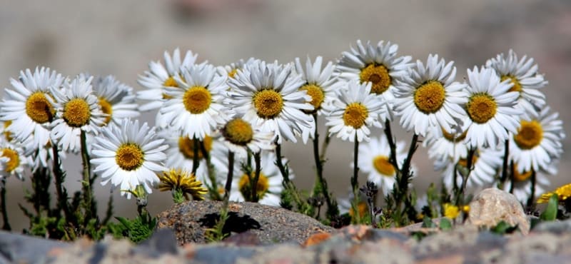
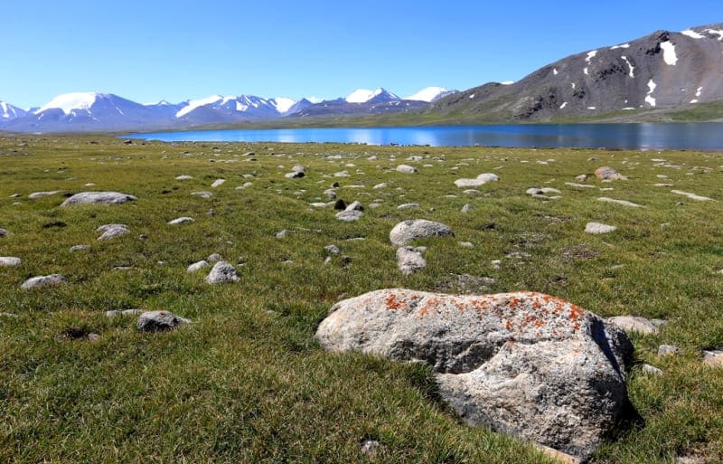
Authority
Alexander Petrov.
B.I. Rukavishnikov. "Lake Issyk-Kul and Terskey Alatau Ridge". Moscow, "Physical culture and sport", 1970.
"Years of searching in Asia". Murzaev Eduard Makarovich.
Photos by:
Alexander Petrov.