You are here
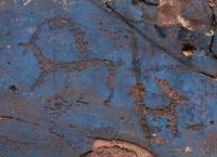
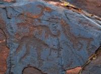
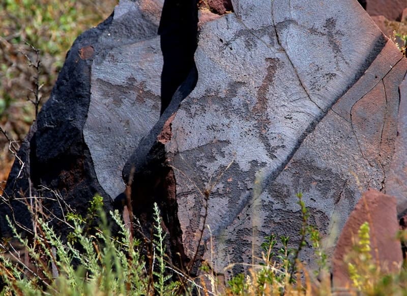
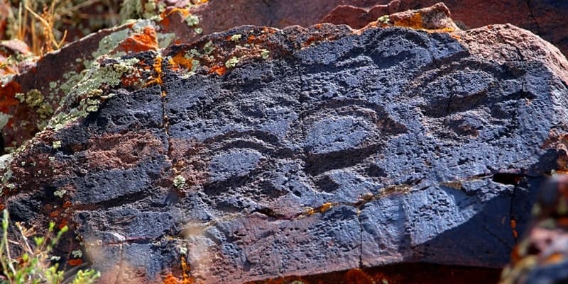
Petroglyphs of Karakyr.


Photos petroglyphs of Almaty region.
"A jumble of basalt boulders
bent over a turbulent river.
On the rocks - from ochre, a picture
is drawn by an ancient hand"
Pyotr Korytko.
Petroglyphs in Anrakhai mountains.
Karakyr petroglyphs are located at an altitude of 980 to 998 meters above sea level, are located in mountains of same name, in southeastern end of Anyrakai Mountains, south of Zunbulak Mountains, 4 kilometers northwest of Kopa - Kanshengel highway, in Zhambyl district of Almaty region.
The Karakyr Mountains have a highest elevation of 1050 meters above sea level. The length of the mountains is 8 kilometers, they stretch from southeast to northwest, the greatest width is 2.5 kilometers, 8.5 kilometers to the southeast are the Tamgaly petroglyphs.
The rock paintings are scattered here on several hills, mostly on the western slope of the mountains. Most of the drawings were found on the rocky ridges of the northern hill of the tract, they are located in 2 - 3 tiers. Along the main ridge, there is a gorge formed by a dried-up stream bed, and further to the west there are separate rocky hills, forming several tracts of Kugaly, Kagaly-Bastau, Shoshkaly.
The difficult terrain, the lack of water and roads make it difficult to explore this area. Archaeological exploration of the territory in 2007-2008 revealed several new interesting clusters of petroglyphs, settlements and burial grounds from various historical periods.
The largest clusters of drawings were found in the Kagal-Bastau and Shoshkaly tracts, to the west and south of the main Karakyr sanctuary. The application of all discovered petroglyphs to a single plan and their division into historical periods allows us to take a new look at ancient rock paintings.
In the very location of small clusters of petroglyphs, it was possible to identify a certain system, the observance of certain patterns that shed light on the functional purpose of the ancient drawings. Starting from the main Karakyr ridge, further to the west, petroglyphs were found along the entire length up to the Kagal-Bastau tract and the exit to the Karaoi valley.
At the same time, small clusters of drawings are not found on all convenient rock outcrops covered with black patina. The application of clusters of drawings to a topographic plan made it possible to determine that all the drawings were knocked out on every second rock ridge, every other one.
Several patterns were also revealed in the arrangement of petroglyphs in each group. n each hill with drawings, one rock plane with a dominant scene was discovered, from which individual images of animals and less significant scenes were knocked out in both directions.
Such small clusters of petroglyphs are located along all the western and southern spurs of Karakir, right up to the sanctuaries located in large tracts. In the tracts, the system of applying drawings changes. Here, as in the large sanctuaries of Tamgaly, Karakir, separate semantic groups of petroglyphs are distinguished.
In the Kagaly-Bastau tract, drawings were knocked out on four hills facing the plain and in a gorge going from south to north. Petroglyphs were knocked out on both sides of a stream that has now dried up, in the upper part of the hills. The main part of the Kagal-Bastau petroglyphs are images of the early Iron Age, but there are also individual drawings from the Bronze Age.
Among the most interesting subjects, it is necessary to highlight the images of musical bowed instruments. One image corresponds to a kobyz. It is interesting that next to the instrument and the bow there is a camel and a lying (dead) man. All three images were found on the same rock outcrop and belong to the period of the early Iron Age.
Unusually for the petroglyphs of the early Iron Age of Semirechye is the fact that in Kagal-Bastau various signs were often depicted. Usually signs are found among the petroglyphs of the Bronze Age. In general, it is precisely on the example of the Kagal-Bastau tract that it is possible to trace certain patterns in the arrangement of the drawings of the early Iron Age.
On each hill there is one large scene depicting some animals - argali, deer, horses and camels. There are no other images around this scene, and further down the slopes of the hill there are numerous, less expressive, smaller animal figures.
It seems that each hill was dedicated to a specific sacred animal. It should be noted that this the pattern is typical for hills stretching along the plain, in the gorge itself, such an order of drawing is no longer recorded. In 2009, it is planned to complete the work on creating a complete inventory of all the images of Kagal-Bastau.
Compiling such an inventory will allow us to better understand both the system of arrangement of petroglyphs and their functional purpose. In the Shoshkaly valley, the drawings were knocked out on the steep slope of the hills along the right bank of the dried-up riverbed.
There are not many planes with petroglyphs here, but interesting scenes from various historical periods are found. Unlike other clusters of drawings known in the Karakyr Mountains, in the Shoshkaly tract there are many scenes that were renovated in the Middle Ages.
Moreover, as a rule, the petroglyphs of the Bronze Age were renovated. In the main sanctuary of Karakyr, the medieval images are all concentrated on a separate hill, and in the cult centers of the Bronze Age, the petroglyphs were not updated, but simply one new image was knocked out nearby.
In the Shoshkaly tract, most of the Bronze Age images were updated in the Middle Ages. What is unusual in the Shoshkaly tract is the presence of different traditions in the carving of animals of the Bronze Age. Here, there are images of bulls and horses that are not typical for the petroglyphs of the Anrakhay Mountains.
Images of bulls are more reminiscent of the style known in the Kulzhabasy Mountains, and images of horses are found in different styles known in the Eshkiolmes, Kulzhabasy, Tamgaly and Karakyr Mountains. Drawings of such mixed styles are not typical for the sanctuaries of Semirechye.
Probably, in their status and functional purpose, the Shoshkaly petroglyphs differed significantly from other rock art monuments of the Karakyr Mountains and the entire system of sanctuaries of the Anrakhay Mountains.
History of study of Karakyr rock paintings:
The location of the Karakyr petroglyphs was discovered in 1983 by geologist V. Volobuev, was first surveyed by A. E. Rogozhinsky in 1984 and subsequently studied by A. N. Maryashev and S. A. Potapov. The main archaeological expeditions to Karakyr took place from 1985 to 1987.
The expeditions were carried out by the Kazakh Pedagogical Institute named after Abay under the leadership of Alexey Nikolaevich Maryashev. Beginning in 1992, a small group of enthusiasts from the Institute of Archaeology compiled a description of more than 900 drawings from various eras.
Over the next 10 years, it was possible to identify the central part of the sanctuary, explore 12 hills, on 7 of which petroglyphs were discovered, and conduct a topographic survey of 10 hills over 4 square kilometers.
Geographical coordinates of Karakyr petroglyphs: N43°51'19 E75°27'18


References:
Maryashev A.N., Goryachev A.A. "Rock Art of Semirechye". Almaty. 2002. Pp. 147. 154. 156.
Baipakov K. M., Maryashev A.N. "Petroglyphs in the Kulzhabasy Mountains", Almaty. 2004. Baipakov K.M., Maryashev A.N., Potapov S.A. "Petroglyphs of Tamgaly". Almaty. 2006. Pp. 93.
Authority:
Potapov S.A. "Ancient Sanctuary Karakyr". Almaty. 2007. pp. 32, 58, 95, 107.
https://web.archive.org/web/20190826145229/http://nblib.library.kz/elib/library.kz/jurnal/o_2009_1/Potapov0901.pdf
Photos by:
Alexander Petrov.


