You are here
Features of Zailiysky Alatau.

Northern Tien-Shan Mountains in Kazakhstan.
“The mountains seemed to hang in the sky, illuminated by light, sharp peaks, heavy pyramids, grandiose domes, broken and rounded passes seemed like a solid wall erected on the edge of the earth”
Traveler and geographer of Central Asia and Kazakhstan P. P. Semenov-Tyan-Shansky.
Natural zones of Zailiysky Alatau Mountains.
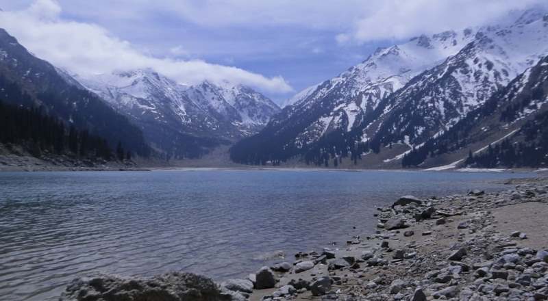
Zailiysky Alatau (Ile Alatau) ridge is located in northernmost part of Northern Tien-Shan mountain system, on border between Republics of Kazakhstan and Kyrgyzstan, stretching from west by Zhetyzhol (Zhetizhol) ridge, up to 3273 m. a. s. l. and Kendyktas Mountains, up to 1520 m. a. s. l., to east by Syugaty (Sogety) ridge, up to 1801 m. a. s. l. The highest peak of the ridge is Talgar Peak, 4978 m. a. s. l. Zailiysky Alatau.
This ridge of the Northern Tien Shan was called the "Heavenly Mountains" until the second half of the last century. "The mountains seemed to hang in the sky, illuminated by light," wrote the famous traveler and geographer of Central Asia and Kazakhstan P. P. Semenov-Tyan-Shansky.
"Sharp peaks, heavy pyramids, grandiose domes, broken and rounded passes seemed like a solid wall erected on the edge of the earth." Indeed, this is the impression you get when you first see the Zailiysky Alatau, approaching Almaty.
It rises like a mighty ridge with snow-white peaks above the city, which is spread out at its foot.
And if you look at the diagram of the Tien Shan mountains, the modern name of the range will immediately become clear. The Ili River is marked with a slightly winding ribbon, and behind it, a little lower, the arc of the range facing the south is outlined in black.
These two lines are connected by thin threads - tributaries of the Ili, which irrigate the fields and originate on the peaks of the Zailiyskiy Alatau. It stretches for 380 kilometers from east to west. The broken outline of the central part of the ridge is majestic, 5017 m. a. s. l. - this is the height of the highest point, Talgar Peak.
Twenty-two of its peaks are higher than 4500 m. a. s. l. The endless steppes, heated by the sultry summer sun, come right up to the mountains. The characteristic feature of the Zailiysky Alatau is even more striking - the accumulation of a huge mass of ice on the peaks.
According to glaciologists, the Zailiysky Alatau is the center of modern glaciation of the Northern Tien Shan. The border of permanent snow on the northern slope of the ridge passes at an altitude of 3700 - 3900 m. a. s. l., on the southern - 4000 - 4200 meters above sea level.
The contrasts of the climatic conditions of the Zailiysky Alatau are truly amazing: if in Almaty there is rain, then snow in the mountains, the city can be unbearably hot, and on the mountain tops - frost. The following analogy is interesting: in terms of average July temperature, Almaty roughly corresponds to the island of Kalimantan, which is located on the equator, while the glacial zone of the ridge corresponds to the island of Spitsbergen, located near the North Pole.
The nature of the mountains is also amazing. In one day of travel, for example, along the Maloalmatinsky gorge from the city to the Tuyuksu glaciers, you can see almost all natural zones from wormwood steppes to alpine meadows and tundra.
For the first time, as experts call it, the natural-landscape-altitude zonality of the Zailiysky Alatau was identified by P. P. Semenov-Tyan-Shansky. According to scientists, it is classical and is not found anywhere else in our country. In this regard, part of the territory of the Zailiysky Alatau (about one hundred thousand hectares) was declared a nature reserve.
Alma-Ata Nature Reserve is located in the central part of the ridge between the basins of the Talgar and Issyk rivers. Here, in the Alma-Ata Nature Reserve, the steppe rises to an altitude of 800 meters above sea level. At the border of 1100 meters above sea level, it gradually begins to give way to forest.
Birch and aspen groves with fairly dense thickets of rose hips, hawthorn, dogwood, and sea buckthorn bushes appear. Gardens of the famous Alma-Ata aport and dried apricots are spread along the river valleys. Higher up, the forest and meadow belt begins.
On its northern slopes, real taiga darkens. These are majestic Tien-Shan firs. Tien Shan spruce is one of the most beautiful and strong coniferous trees. It grows even on bare rocks. Amazingly slender, reaching forty to fifty meters in height and about a meter in diameter, Tien-Shan spruce is the main attraction of our mountains.
Tien-Shan spruce grows very slowly, but its wood is surprisingly strong. Before the revolution, this spruce was used as a building material. Residential buildings were built from it and public buildings of old Verny, including the famous Cathedral. It is interesting to note that during the restoration of this monument in the mid-seventies, logs from residential buildings of the last century were used - they are so well preserved.
Tien-Shan spruce wood is a valuable material for making musical instruments: dombra, guitar. At present, much attention is paid to its reproduction and protection. From the forest and meadow belt to an altitude of 3100 meters above sea level, the subalpine and alpine belts rise.
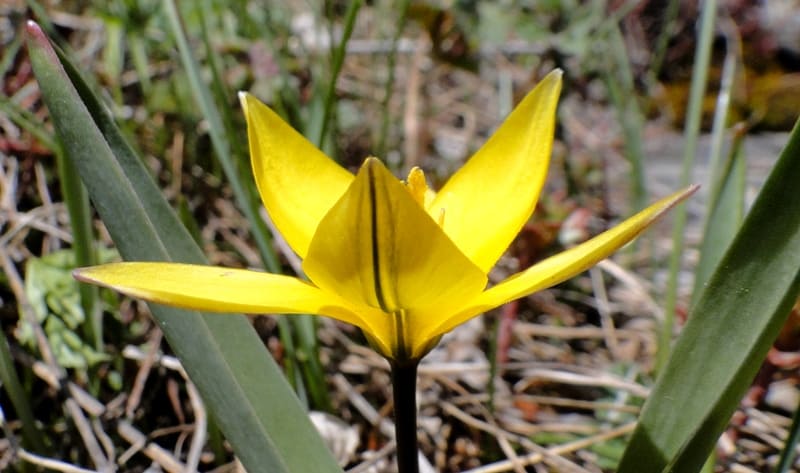
There are many thickets of caragana, meadow flowers and cereals here. Alpine meadows are wonderful pastures - jailau. In summer, numerous herds of sheep, cattle, and horses graze there. The highest mountain belt begins above 3200 meters above sea level.
Here is the kingdom of rocks and glaciers. Sharp ridges, rocky slopes, bizarre piles of boulders, snow and ice, gloomy gorges give the landscape a lifeless look. In summer, the lower edge of glaciers and snowfields melts, exposing only the upper soil layer, and permafrost remains underneath.
These are areas of high-mountain tundra. Here, in the rock-glacial belt, powerful mudflows form, landslides and avalanches are not uncommon. In 1966, to protect Alma-Ata from mudflows, the Small Almaty Gorge was blocked by an explosion.
Now a complex hydraulic structure has risen here to a height of 115 meters - an anti-mudflow dam. On the southern side there is a huge mudflow reservoir, and the river in this area flows through a tunnel. This dam protected the city in 1973, taking on a mudflow of several million cubic meters.
The world-famous Medeo skating rink is located in the Maloalmatinskoye Gorge. From the dam you can clearly see its round bowl, bordered by rows of stands, a little higher - a water intake basin with glacial water, which fills the rink, and on the right - a hotel building.
The unique high-speed ice of the Medeo skating rink has set the largest number of world records in speed skating. Since 1951, about a hundred have been registered here. And the famous, also high-altitude, skating rink in the Swiss city of Davos has only eighty world records to its credit since 1898.
In the same gorge, above the dam, beyond the Gorelnik River, is the Chimbulak ski resort. Thousands of Almaty residents and guests of the capital relax here all year round: they skate and ski, breathe the clean mountain air, admire the picturesque landscapes, and the bravest and most courageous conquer the peaks of the Zailiysky Alatau.
This mighty beauty is created by nature itself. And a feeling of admiration for its pristine nature comes to us when we look at the "Heavenly Mountains".
Geographical coordinates of Zailiysky Alatau ridge: N43°00'48 E77°09'23


Authority:
Penkova S. «Zailiyskiy Alatau» 1981.
Photos by:
Alexander Petrov and Rinat Bektenyarov.


