You are here
Charyn river.
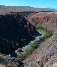
Trip to canyons on river Charyn.
“Nature does nothing in vain”
Aristotle.
Ornithological tours to Charyn Canyon.
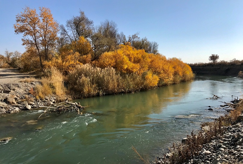
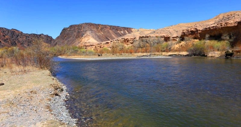
Charyn River is the left tributary of the Ili River, is located at an altitude of 1411.6 and up to 493 meters above sea level, starts from the confluence of the Shet-Merke River with Kegen, is partly located on the territory of the Charyn Natural Park, flows through the territories of Raiymbek, Enbekshikazakh and Uyghur regions , in the south-east of the Almaty region.
The length of the Charyn River is 155 kilometers. The birth of the Charyn River is given by the flow into the Kegen River of its left tributary Shet-Merke.
Shet-Merke river.
The Shet-Merke River, 33 kilometers long, originates on the northern slope of the Kungei Alatau ridge. The main channel of the river is formed from two sources at an altitude of 2756 meters above sea level. The sources originate from two moraine lakes: Shet-Merke located in the upper reaches of the gorge at an altitude of 3254 meters above sea level and the nameless lake of the eastern tributary of the river, located at an altitude of 3346 meters above sea level.
The state border between the Kyrgyz Republic and the Republic of Kazakhstan runs along the main ridge of the Kungei Alatau ridge. The lake is located 500 meters from the crest of the ridge. After the tributaries of the river have formed a single channel, Shet-Merke on the right receives 7 small nameless tributaries.
On the left, the river receives two minor tributaries along its entire length. The mouth of the river is located at an altitude of 1411.6 meters above sea level
Geographical coordinates of Shet-Merke River: N43°02'00.67" E78°45'12.85"
Kegen River.
The length of the Kegen River is 122 kilometers. The river begins its journey in a wide valley between the southern slopes of the Ketmen ridge and the northern slopes of the Elshyn-Buiryk mountains, flows southwest, passing the northern slopes of the Sholadyr mountains.
Then it turns to the north-west and, bypassing the southern slopes of the Temirlik mountains, approaches the village of Kegen along a wide valley. In front of the southern slopes of the Kuluk-Tau mountains, in the vicinity of the village of Zhalauly, the river heads west along a wide valley opposite the southern slopes of the Bestobe mountains.
In the vicinity of the Koltykbastau ravine, Kegen enters the canyon and gradually, the waters of the river reach the Bestyubinsk reservoir with a length of 4.5 kilometers. Bypassing the reservoir, the Kegen River passes a 9-kilometer underground diversion channel and in the southern part of the Kalasai valley, at the mouth of the Shet-Merke River at an altitude of 1411.6 meters above sea level, and loses its name.
Geographic coordinates of Kegen River: N43°00'27.47" E79°15'16.19"
Temirlik river.
60 kilometers after the beginning of the Charyn River, the Temirlik River flows in from the right. The sources of the river are located in the Ketmen ridge and the Temirlik mountains in the Uigur and Raiymbek districts of the Almaty region.
The Temirlik River is formed from the confluence of the eastern tributary of the Zhanakarasai and the western Komirshi Severny. The sources of the Temirlik River are located at an altitude of 2819.8 meters above sea level in the western part of the main Ketmen ridge.
The length of the Temirlik River is 58 kilometers, the area is 523 square kilometers. The river belongs to the Ili basin. There are no glaciers in the Ketmen ridge, Temirlik belongs to the rivers of mixed type of supply - it receives water from snowfields and springs.
Floods and floods on the river continue from April to June. Water levels and discharges are uneven throughout the seasons. Water consumption, for example, in May, June exceeds the autumn and winter norms by four to five times.
The water of the river is used for irrigation. Vegetation in the river valley is represented by poplars, ash, barberry, relict saxaul, ephedra. There is a naked osman in the river. Among wild animals you can meet hares, foxes, among birds - partridges and pheasants.
Geographical coordinates of Temirlik River: N43°10'48.48" E79°17'03.14"
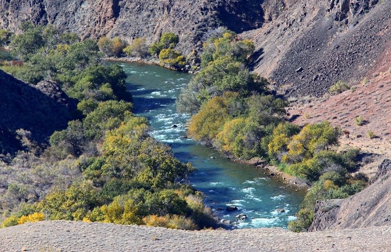
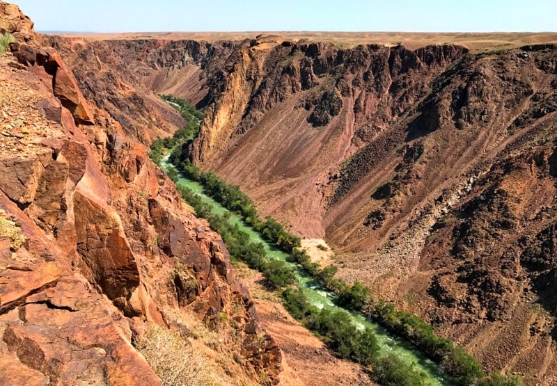
The Charyn River cuts through the carboniferous intrusive rocks that make up the Kuluk-Tau mountains, thus forming a canyon. Charyn, becoming a full-flowing river, cuts through the eastern parts Zhalanash valley and mountains Toraigyr grandiose canyon.
Then it receives the only large tributary Temerlik (Zhelezny) and, deviating somewhat to the northeast, flows into the Ili River. This is a full-flowing turbulent river with an average annual flow of 33.2 cubic meters per second.
Charyn feeds on precipitation, so its water regime is somewhat different from glacial rivers. The main costs fall on the period of maximum precipitation, that is, May - June, while almost all glacial rivers - in July and August.
Charyn canyon and valley in the region of the Kuluktau mountains is a canyon up to 150 meters deep. In the area of loose deposits of the Zhalanash valley, in the tract Aktogay (White Forest), which is located in the left-bank, floodplain part, the river takes the form of a trapezoid.
Here the width of the floodplain part of the river reaches 1 kilometer. The height of the surface of the Zhalanash valley, at the edge of the beginning of the slope, is 1430.7 meters above sea level (near the Aidar necropolis).
he elevation of the riverbed is 1180 meters above sea level. Accordingly, according to the height difference, the depth of the river canyon in this place is 250 meters. In the eastern part of the Toraigyr ridge, 9.5 kilometers south of the Glade of Castles, there is a canyon - Kurtogay (Grave Forest).
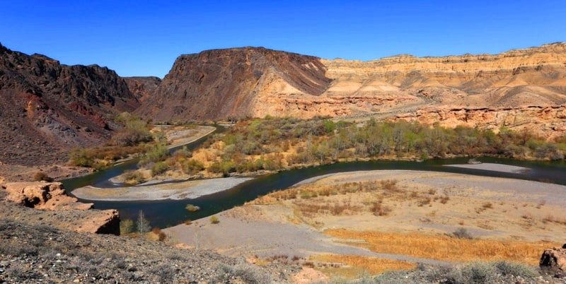
Pliocene deposits with complex forms of weathering in the form of cornices and niches are exposed on the slopes of the canyon. The canyon here is exceptionally attractive. In the lower reaches, the river becomes flat and wide, this place is called Sartogay (Yellow Forest), there is a Relic ash grove 22 kilometers long. In the vicinity of the Sartogay valley, Aktobe, Zhagargyozen, Dungan canals depart from the riverbed, the waters from which are used to irrigate agricultural land in the Uyghur region.
10 kilometers south of the village of Shyryn, a canal is diverted from the riverbed, which passes through the village and bypasses the sands of Karabaskum and flows into the Ili River. The mouth of the Charyn River is located at an altitude of 493 meters above sea level.
Geographic coordinates of Charyn River: N43°31'20.94" E79°15'39.09"

Authority:
Alexander Petrov.
«Nature Zailiyskiy Ala-Tau», M.Z.Zhandaev, printed "Kazakhstan", Alma-Ata, 1978.
Photos by
Alexander Petrov.


