


![]()
You are here
Village Taushyk.
Villages of Tyub-Karagansky district.
“Between Jarmysh and Ausar I observed only three layers of brown coal up to half a meter each in the layers bordering the previous suite. At the base of the Kara-diirmen mountain there is a layer of brown coal more than half a meter thick, and above it there are several less significant ones. The coal-bearing suite was observed near Jarmysh and Ausar, to the south of the Airaikty mountain, near Chair to the north of Karatau, near the Tartaly well and other points of its western end and near the Kert well at the southern foot. In the upper horizons of this suite I found fossils on Kara-diirmen and near Chair that were partly identical to those that Doroshin discovered in the footwall of the brown coal layer to the west of the Bishashchi tract. Almost all of these fossils are in that part of the Eichwald collection that is kept in the Geological Cabinet of the St. Petersburg University. I could therefore compare them with mine.”
Works of Aral-Caspian expedition. "On geological research in Trans-Caspian region, carried out in 1887." N. I. Andrusov.
Trip to village Taushyk from For-Shevchenko.
Village of Taushyk is located at an altitude of 80 meters above sea level, surrounded by Karatau Mountains, in eastern part of Mangyshlak Peninsula, 88 kilometers to east and a little south of city of Fort Shevchenko, 77 kilometers to north and a little east of city of Aktau in Tyub-Karagan district of Mangistau region.
"The road ran through a fairly large village of Taushyk, which looked like a modern, well-equipped town. Who built it? It turned out that the history of the village is closely connected with the activities of the expedition of 1851. Even then, in the Apazhar Valley, not traces, but real deposits of coal were found.
The pits dug in some places showed a significant thickness of coal seams, although of low quality. However, this was compensated by the shallow occurrence, and therefore the simple method of extraction. Shevchenko took direct part in the search for and extraction of coal, so it will be interesting to get acquainted with some of the data on these works, given in A. I. Antipov report.
In "Description of brown coal mines discovered in Karatau Mountains" he noted, which A.I. Antipov prepared and compiled, it says:
"Starting from the western end of the Karatau Mountains, the first coal deposit is discovered at the very foot of the ridge near the Apazir well, at a distance of about 75 miles from the Novopetrovsk fortification and about 30 miles from the Kochak Bay.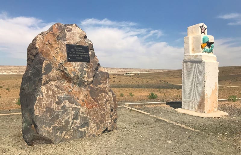
The coal seam is exposed here for about 3 1/2 miles... Prospecting with pits showed that directly under the sandstone seams lies a coal seam, the thickness of which is 18 vershoks (about 75 cm). The coal seam, when it comes out on the earth's surface, in all places where it is exposed, is completely destroyed by the action of atmospheric air and is completely turned into soot of a black-brown color.
With depth from the earth's surface it takes on a harder appearance, and finally, at a depth of 3 fathoms (6 m) from the surface, it shows its true qualities. The coal of this mine is black in color, thin to the touch, earthy when broken, very light, dull and easily soiled, soft when damp, cracks and becomes completely loose when dried in the air. It ignites quite easily, burns without flame, does not bake into coke and leaves a lot of earth impurities...
Based on all these qualities... the coal should be classified as a lignite. Of all the pits dug at this mine, the deepest lignite layer was found at a depth of 7 fathoms from the earth's surface. The qualities of the lignite were the same as in the pits... at a depth of 3 fathoms. Consequently, it can be assumed that the properties do not improve with depth. During exploration, 1,000 poods of lignite (16.5 tons) were mined from this mine."
But decades passed, and the tsarist government never got around to taking advantage of this energy wealth. After the October Revolution, the issue of Mangyshlak coal was raised again. In the mid-30s, additional exploration was conducted and studies were detailed. In 1939, the first shaft was laid in the place where the first pit of the A.I. Antipov expedition was located. In addition to it, in the same year, seven more were laid in different places of Tauchik over a distance of 4 kilometers. All eight shafts were put into operation during 1939 - 1940.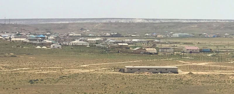
In the center of the territory where the shafts were located, the settlement of Tauchik was built for workers and engineering and technical personnel, the same one that we have just encountered on our way. Tauchik was both the administrative and cultural center of the Mangistau region, occupying almost half of the entire Mangyshlak Peninsula.
Tens of thousands of workers arrived here in a short time. A narrow-gauge railway 25 kilometers long was built to transport coal to the Sarytash (Sartas) pier, and the pier itself was rebuilt. The narrow-gauge railway passed through places depicted in Shevchenko drawings: the Apazhar, Tauchik, Tartaly tracts, and then the Art-kapi gorge to the very shore of the Caspian Sea.
But over time it became clear that the coal extracted from these mines quickly ignited spontaneously on the surface. The question arose of improving the technology of its extraction, methods of transportation and storage. t the same time, one hundred kilometers from Tauchik on the eastern coast of the peninsula, explorers discovered rich deposits of oil and combustible gas.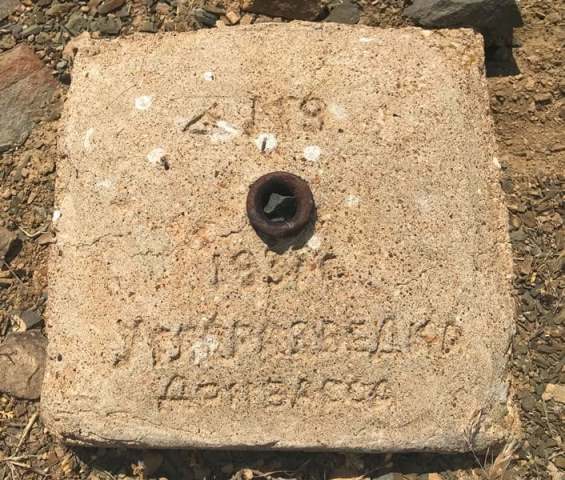
These deposits had incomparable advantages over the unpromising extraction of coal. The government of the Kazakh SSR decided to build a new large industrial city here, giving it the name of the great Ukrainian poet. Thus was born the city of Shevchenko, now the center of the Mangyshlak region, with a first-class industry and, probably, the largest desalination plant in the Soviet Union... ".
20 kilometers to the east and a little to the south of the village of Taushyk is the Torysh valley, also known as the "Valley of Balls", due to the spherical concretions deposited on the surface with a diameter of up to 4 meters. 3 kilometers to the west and a little to the north of the village is the necropolis and mosque of Uytoly. 7 kilometers to the northeast of the village is the necropolis of Doly apa.
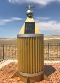
3.7 kilometers north of the village there is a small memorial dedicated to the Great Patriotic War, one of the monuments, which is located to the east, is made in the form of an aerial bomb and this monument has its own history. Kalysh Utetleuov, a resident of the village of Taushyk, who witnessed the event, tells the story:
“On November 7, 1942, an explosion thundered in Taushyk. It turned out that the Germans had detailed information about the location of important industrial facilities in the Caspian territories. One of the facilities designated by the fascists for liquidation was a coal mine in the village of Taushyk, which worked to meet the needs of the front.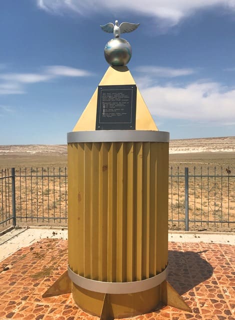
- I remember that day well. A group of Taushyk residents were standing near the village council, when suddenly a roar was heard from the sky. We saw an airplane. No one could have guessed that it was a German bomber. And suddenly, before the eyes of the astonished people, the plane, brazenly circling over the outskirts of the village, dropped something in the area of the brick factory and disappeared over the horizon.
A minute had not passed before the thunder of an exploding explosive device was heard, and for those few moments the horror of war flared up in the deep rear. People ran towards the brick factory, which was located next to the mine. A huge crater formed in the ground. Fortunately, no one was hurt, but the residents of the village remembered this ominous roar for many years, this explosion, which thundered, it seemed, in the very heart of ... "
Geographic coordinates of village of Taushyk: N44°20'26 E51°20'59
Authority:
“The steppes will come to life.” Anatoly Kostenko, Esbol Umirbaev. Alma-Ata. “Oner.” 1984
Toigan Taskinbaeva. Newspaper "Lights of Mangistau". 24.04. 2014.
https://nomad.su/?a=15-201404250008
Photos by:
Alexander Petrov.