


![]()
You are here
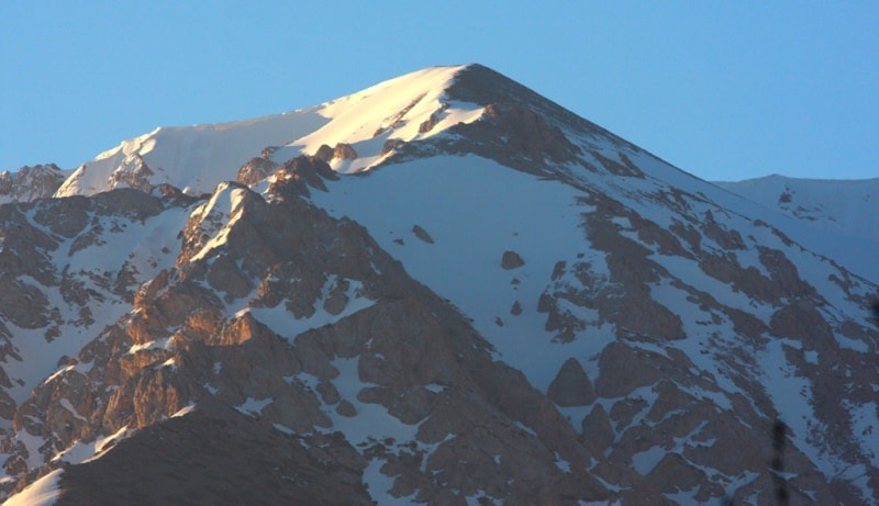
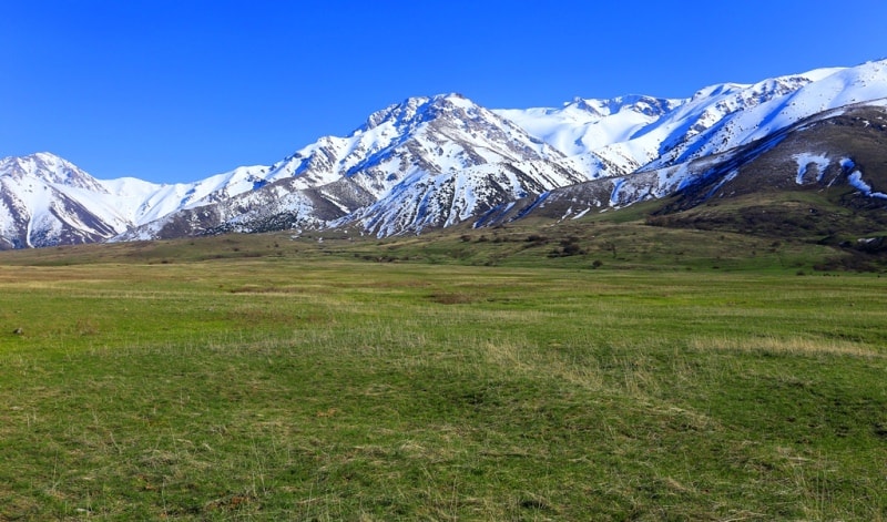
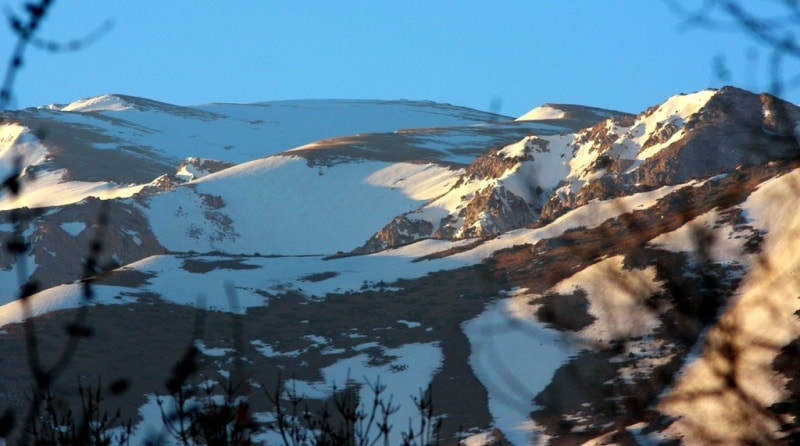
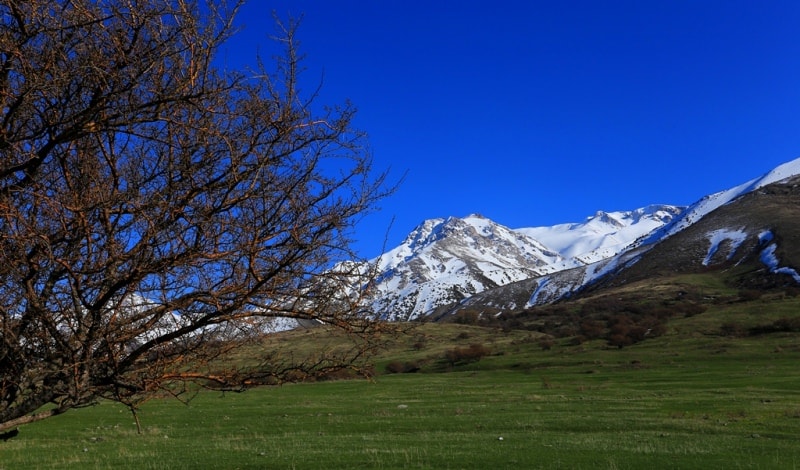
Ridge Talas Alatau.
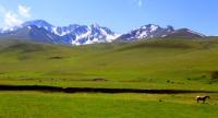
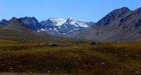
Hiking in mountains Talas Ala-Tau.
“More abounding in water river of Talas Alatay – Aksu flows along narrow, meandering and picturesque gorge. He most beautiful valley of Aksu river – below confluence of Aksu and Kishi-Aksu rivers. Here valley – deep canyon length about 30 km and depth to 500 meters above sea level with stepped steeped walls”
Kazakhstan Tours, Travel & Trips.
Talas Alatau, a ridge in the Western Tien-Shan, located in Kyrgyzstan, Uzbekistan and partly in Kazakhstan. Most of it is located on the territory of Kyrgyzstan, and some in southern Kazakhstan). This ridge separates the Talas Valley from other ridges and valleys of the Western Tien-Shan and the western part of the so-called Vnutrenniy Tien-Shan.
The length of the ridge is about 270 kilometers, in the west it continues with the Boldoytau ridge, heights up to 1813 meters above sea level, in the east in the area of the Otmek pass, 3330 meters above sea level.
The Suusamyr-Too ridge, up to 4048 meters above sea level, adjoins the Talas Alatau ridge. The eastern end of the Talas Alatau is connected to the Kyrgyz ridge. To the southwest, the Ugam, Pskemsky, Chandalash and Chatkal ridges extend in parallel mountain ranges, making up, together with the Talas Alatau, the mountain system of the Western Tien-Shan.
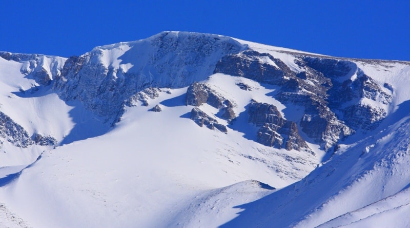
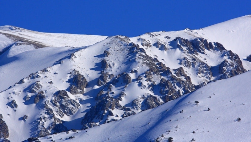
The highest heights in the western part are the Kyumush-Tak peaks, 4251 meters above sea level, Bakayir-Choku, 4457 meters above sea level, in the eastern part - heights up to 4374 meters above sea level. The northern slope is limited by the Talas Valley and is strongly dissected by the tributaries of the Talas River.
In the west of the Manas mountain range, spurs, up to 50 kilometers long, depart - Dzhebaglytau, Alatau, Bugulutor. In the southwest, the Maidantal spur forms a common system with the Ugam ridge. The Chandalash ridge, about 100 kilometers long, forms a common system with the Pskem ridge.
The difference in elevation of the valleys between the northern and western spurs is 2000 - 3500 meters above sea level. The southern slope of the Talas Alatau is poorly expressed due to the abutment of the powerful ridges of the Western Tien-Shan.
The total area of glaciation is about 200 square kilometers. More than 300 glaciers are known. In total, 281 glaciers are registered in the Talas and Assa basins, two-thirds of them are located in the described area, but many are extremely small in size.
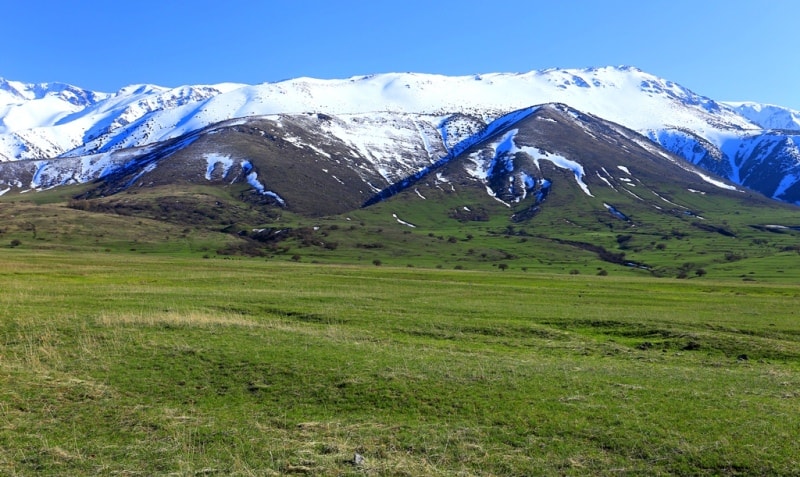
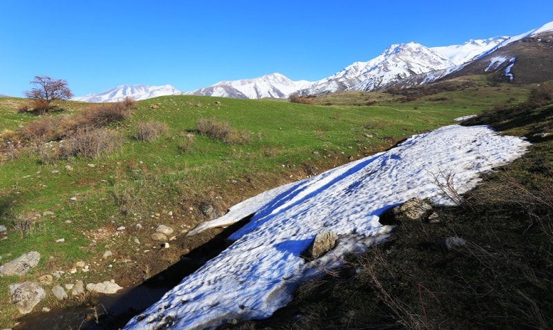
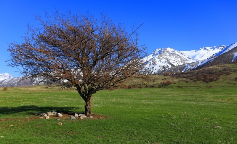
Only 8 glaciers are more than 3 kilometers long, while 164 glaciers do not exceed 1 kilometer. The height of the snow line is 3700 - 3800 meters above sea level. The foothill zone of the Talas Valley is occupied by steppes and forests and steppes, subalpine and alpine meadows are developed higher, spruce, fir and juniper forests are found along the gorges.
More than 30 passes are known in the Talas Alatau and its northern and western spurs, the lowest pass through the Talas Adlatau is Mark at an altitude of 3330 meters above sea level, the highest is about 4100 meters above sea level.
The geological structure of the ridge is represented mainly by metamorphic shales and granites that form a rocky ridge. On part of the ridge, there are glaciers feeding the Talas and Arys rivers. In the spurs of the Talas Alatau rivers originate, which later form the Pskem River.
There are rocky highlands and high-mountain alpine meadows with characteristic vegetation (subalpine and alpine meadows, forests and steppes, where livestock grazing is carried out. In the Zhambyl region of Kazakhstan, on a total area of 128 118 hectares, the Aksu-Zhabagly state nature reserve is located with the Aksu canyon, which has a depth of about 1800 meters.
The Talas Alatau separates the Talas and Assa rivers from the Chirchik basin, and its western end separates the Asa and Arys basins. The high-altitude zone of the Talas Alatau has a typical alpine appearance: rocky relief, narrow, jagged ridge peaks, covered with ice and firn in places, steep (up to 60 - 70 °) slopes.
The northern spurs of the ridge, descending into the Talas valley (usually of a meridional direction), initially have an alpine appearance, but closer to Talas they acquire softer forms with soddy slopes, in some places dissected by a dense network of short, shallow, but rather steep ravines.
The upper part of the Talas ridge is characterized by powerful outcrops of bedrock, which is why extensive talus is widespread here. Above 3,500 meters above sea level, there are tarry depressions with relatively gentle walls, with bottoms filled with coarse material.
Most of the glaciers of the northern slope of the Talas Alatau are concentrated in the depressions.


Authority:
The guidebook across Kazakhstan . Authors Dagmar Schreiber and Jeremy Tredinnick. Publishing house "Odyssey".2010.
Photos by
Alexander Petrov.