







You are here
Saty Pass.
Passes in Kungey Alatau mountain range.
"What was curious was that the ascent to the pass leads over mossy hummocks. These hummocks add a unique touch to the climb (though they were also found on the other side of the pass). Only violets (Viola altaica Pall) with purple flowers and primroses (Primula nivalis Pall) grow on these hummocks. Finally, at the very top of the climb near the pass, there is the lilac-flowered Trollius lilacinus (Bge). We crossed Saty Pass not without obstacles. The small strip of snow was so sloping and uncomfortable for the horses that they had to be unloaded and practically dragged. While this operation, unloading and reloading, was underway, I boiled a hypsothermometer and made other observations. The pass's altitude is quite significant (11,418 feet).
V.I. Lipsky. "Flora of Central Asia, i.e., Russian Turkestan and the Khanates of Bukhara and Khiva." 1903.
A walk to Saty Pass in "Kolsay Kolderi" park.
Saty Pass - An Ancient Route Through the Kungei Alatau Mountains.
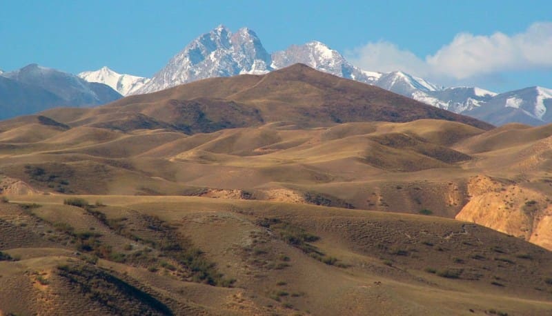
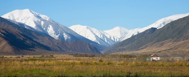
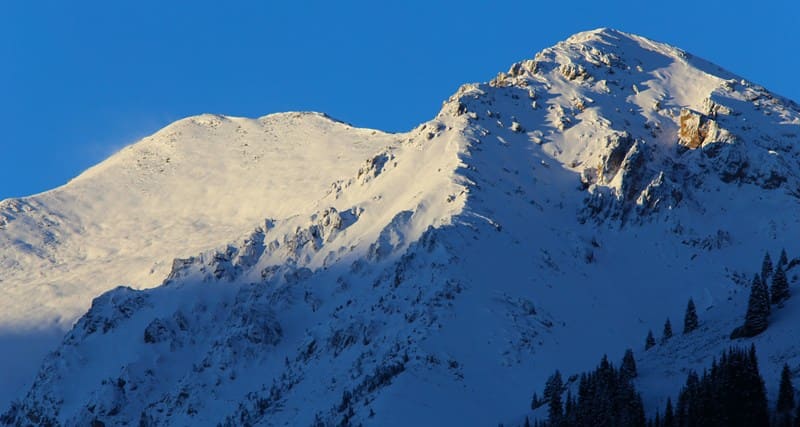
On the main watershed of the Kungei Alatau range, where the high-mountain pastures of Kazakhstan gradually merge into the valleys of the northern Issyk-Kul region, lies Saty Pass - one of the oldest natural passages through the Northern Tien-Shan.
For many centuries, it connected the Chilik River valley with the Issyk-Kul Basin, serving as a route for nomads, shepherds, traders, explorers, and travelers. The Saty Pass is more than just a depression in the mountain range. It is the meeting point of two countries, two river basins, two natural worlds, and many generations of people.
Today, the pass is of interest primarily as a unique natural landmark, allowing visitors to see the diverse high-mountain landscapes of the Kungey Alatau and trace the history of the development of one of the most picturesque parts of the Northern Tien-Shan.
Geographical location of the Saty Pass.
The Saty Pass is located at an altitude of 3,295 m. a. s. l. It is located on the main ridge of the Kungey Alatau mountain range, in the upper reaches of the Saty River, between the Kolsay and Kaindy gorges, southwest of Sasyktau Peak (3,603.3 m. a. s. l.), within the Kolsay Kolderi Nature Park, in the Kegen district of the Almaty region.
The state border between the Republic of Kazakhstan and the Kyrgyz Republic passes through the pass. The northern slopes belong to the Chilik River basin, while the southern slopes face the Shaty River valley, which belongs to the Issyk-Kul basin.
Thus, the pass is located on one of the most important watersheds of the Northern Tien-Shan, separating the Ili River basin and the endorheic Issyk-Kul Basin.
Physical and geographical characteristics of the Saty Pass.
The Saty Pass formed within an ancient tectonic fault, which was subsequently significantly reworked by mountain glaciation. Although there is no modern glacier directly at the pass, the surrounding terrain bears distinct traces of the Ice Age. The upper slopes are characterized by extensive rock scree, talus, and weathered granite outcrops.
Glacier-smoothed rock surfaces, moraine deposits, and small nival areas where snowfields persist until mid-summer, and sometimes even longer, are common throughout the area. The absence of modern glaciation is explained by the slope exposure and the relatively low absolute elevation of the pass saddle.
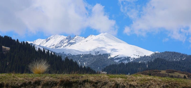
Nevertheless, it was Pleistocene glaciers that shaped the modern profile of the valleys, giving them their characteristic trough shape with steep sides and wide bottoms. The pass serves as a unique boundary between several natural zones. The lower parts of the valleys are dominated by the famous Tien-Shan spruce forests (Schrenk spruce), which, higher up, give way to juniper thickets, subalpine shrubs, and mixed-grass high-mountain meadows.
Even higher up, the vegetation gradually thins, giving way to alpine meadows, stony scree, and cold mountain moors. In summer, the slopes of the pass are covered with a carpet of flowering alpine plants. Here you can find gentians, primroses, columbines, edelweiss, and numerous species of buttercups and Asteraceae, many of which are endemic to the Northern Tien-Shan.
The fauna is represented by typical high-mountain species. Siberian ibex, marmots, and pikas inhabit the rocky slopes, while golden eagles and bearded vultures often soar above the pass. Snow leopards and Tien Shan brown bears survive in the most inaccessible areas of the Kungey Alatau, although encounters with them are extremely rare.
Significance of the Saty Pass.
The Saty Pass has long been one of the most convenient natural passages through the Kungey Alatau. Long before the emergence of modern state borders, it was crossed by seasonal routes of nomads driving cattle between the highland jailau and the Issyk-Kul valleys.
Trade caravans, connecting Semirechye with the northern shore of the great lake, also traveled along these same trails. Thanks to the relatively gentle saddle, the route was considered one of the most accessible crossings of the northern Tien-Shan.
History of Exploration through the Saty Pass.
A special place in the history of the pass belongs to the journey of the outstanding Kazakh scientist Shokan Valikhanov, led by M.M. Khomentovsky. In the summer of 1856, leaving Lake Issyk-Kul, he passed through the Saty Pass, exploring the nature, population, and historical monuments of the Tien-Shan.
This expedition became one of the most important pages in the history of Central Asian exploration and provided the first scientific information about many regions of the Issyk-Kul region. Half a century later, in July 1906, the pass was crossed by the renowned Russian botanist Vladimir Ippolitovich Lipsky, future president of the Ukrainian Academy of Sciences and chief botanist of the Imperial Botanical Garden.
His expedition was dedicated to studying the flora of the Northern and Central Tien-Shan. The collected materials significantly expanded scientists' understanding of the region's high-altitude vegetation. Thus, the Saty Pass went down in history not only as an ancient route through the mountains but also as a route for prominent explorers of Central Asia.
Tourism to the Saty Pass.
Today, the pass remains one of the most interesting mountain tourism destinations within the "Kolsay Kolderi" National Nature Park. The official route begins in the village of Saty and ascends the picturesque valley of the river of the same name.
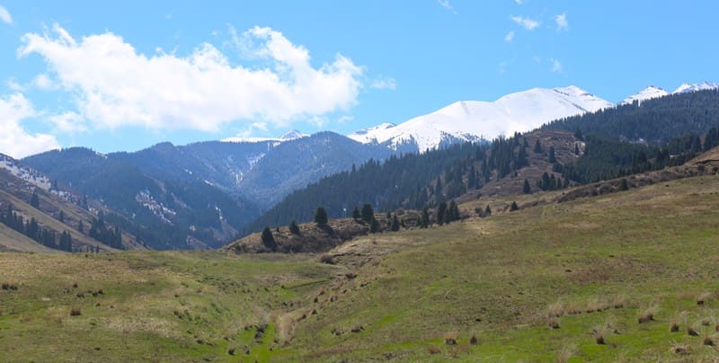
The total distance to the pass saddle is approximately 23 kilometers one way. The route passes through several natural zones. Initially, travelers are accompanied by dense spruce forests, then the trail emerges into subalpine meadows, and higher up, spacious high-mountain pastures open up with sweeping panoramas of the main Kungey Alatau ridge.
The pass offers impressive views of both countries. To the north, the upper reaches of the Saty Gorge and the peaks of the Kolsay region are clearly visible, while to the south, the valleys gradually open up, descending to the Issyk-Kul Basin. Currently, a direct crossing of the pass is impossible, as the state border is not equipped with an international checkpoint.
Therefore, the tourist route is radial: after reaching the pass saddle, travelers return by the same route.
Practical recommendations for hiking to the Saty Pass.
The best time to visit the pass is from early July to mid-September, when the main snowfields have melted and the high-altitude trails are safest. Consider the pass's significant altitude, where sudden weather changes are possible even in summer.
In a matter of hours, clear skies can give way to thick fog, rain, snow, or strong winds. Therefore, the route requires good physical fitness, warm clothing, and sufficient time. Particular attention should be paid to observing the regulations of this specially protected natural area.
The "Kolsay Kolderi" National Park preserves the unique ecosystems of the Northern Tien-Shan, so tourists are advised to travel only on existing trails, not to leave litter, and to respect the surrounding nature.
The Saty Pass: Connecting Eras.
Today, the Saty Pass no longer plays the role it did centuries ago. The state border has disrupted traditional communication routes between the two sides of the Kungey Alatau. However, its significance as a natural and historical monument has not diminished.
Just as it did many centuries ago, it continues to connect two worlds – the northern forest valleys of Kazakhstan and the southern slopes descending to Issyk-Kul. Nomads, scientists, and travelers have passed through this pass, leaving their mark on the history of Central Asia.
And today, ascending its saddle, you can experience the same freedom of the mountainous expanses that those who crossed the Kungey Alatau a century and a half ago experienced.
Vladimir Ippolitovich Lipsky on the route to Saty Pass (Shaty) in July 1903.
From the Shaty campsite, a gradual climb to the Shaty Pass began immediately. This campsite was not located on a plateau, as it had been until then, but among the high, sloping slopes of a gorge, covered with beautiful vegetation. Almost immediately after the campsite, a veritable flower garden began, consisting of common local plants: Trollius altaicus CAM., forget-me-not Myosotis silvatica Hoffm., Geranium coUinum Steph., Polygonum Bistorta L., Phlomis oreophila Kar. Kir.; also abundant here was Acliemilla vulgaris L.
This beautiful flower garden extended upward for quite some time, merging on the sides into thickets of juniper. There are also many beautiful blue-flowered Dracocephalum altaiense Laxm., which I hadn't seen on the road before, and Serraiula lyratifolia Schrenk.
As we moved up toward the pass, the vegetation noticeably thinned out, and flowers became increasingly scarce. The gorge widened at the top, forming a cirque. Interestingly, the rocks composing this cirque were light-colored (granite); furthermore, the very top of the cirque was sharply outlined by a white stripe of snow.
In general, having ascended this cirque, you somehow enter a bright space. The pass is also composed of light-colored rocks. It was curious that the ascent to the pass leads over mossy hummocks. These hummocks add a unique touch to the climb (though they were also found on the other side of the pass).
On these hummocks grow only violets (Viola altaica Pall), with purple flowers, and primroses (Primula nivalis Pall). Finally, at the very top of the climb near the pass, there is the lilac-flowered Trollius lilacinus (Bge). We crossed the Shaty Pass not without obstacles.
The small strip of snow was so sloping and uncomfortable for the horses that they had to be unloaded and practically dragged. While this operation, unloading and reloading, was going on, I boiled a hypsothermometer and made other observations. The pass is quite high. (11,418 ft.).
The pass itself is home to abundant Sibbaldia Utrandra Bge., lilac Oxytropis chionobia Bge., and Callianthemum alatavicum Freyn. A beautiful yellowish-green lichen, Bhixocarpon geographicum DC, also grows on a rock.
V.I. Lipsky. "Flora of Central Asia, i.e., Russian Turkestan and the Khanates of Bukhara and Khiva." 1902-1905.
Geographical coordinates of the Saty Pass: N42°52'45 E78°23'54
Authority and photos by:
Alexander Petrov.