


![]()
You are here
Tour to Kyzyl-Asker Ice Mountain Massif.
Tours in Western Part of Kashaal-Too Ridge.
“One evening I was sitting in a deep gorge on the bank of a fast stream. Nearby, through the dense greenery of pyramidal poplars, the walls of the houses of a small village were visible. The air was filled with the incessant noise of a strong mountain river. And when the sun sank behind the high ridge of the ridge, for a moment, patches of sparkling snow flashed in its farewell rays. The wind died down, the rustling of the leaves ceased, and it became clearly audible how the river carried large stones along the bottom, grinding them against each other.”
E.M. Murzaev.
Tour to Kagalyachap Plateau.
Brief description of trip to Borkoldoy and Kakshaal-Too mountains:
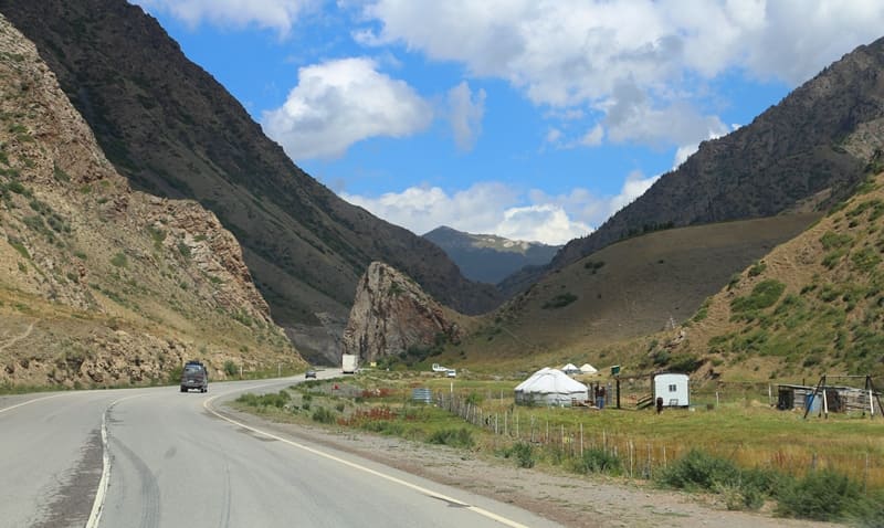
Bishkek - Kant city - Tokmok city - Kemin city - Boom gorge - Kochkor village - Sary-Bulak village - Dolon pass 3038 meters above sea level - Kazan-Kuigan village - Naryn city - Ak-Muz village - Bosogo valley - Kyndy pass - East Aksai river valley - Kyzyl-Asker mountain range - Kyzylunet river - Bivachnoye lake - glacial-dammed Kyzyl-Asker lakes - Kagalyachap plateau - Naryn city - Bishkek city.
Distance of route: 1009 km.
Season: from July 10 to September 1.
Duration of tour: 8 days.
Distance of active part of tour: 22 km.
Best time for tour: July - August.
A detailed program of excursion tour in Naryn-Too mountains:
Day 1. Bishkek - Naryn (320 km).
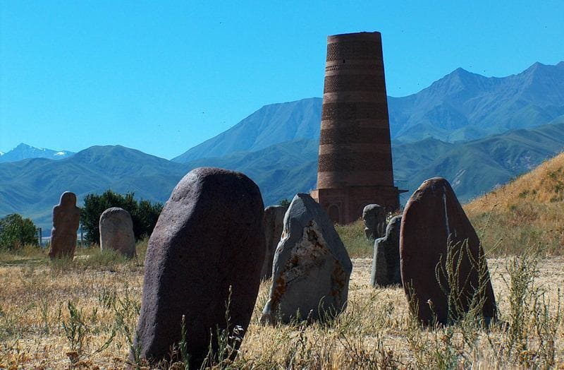
Transfer: Bishkek - Kant city - Tokmok village - architectural complex "Burana Tower" (72 km, 1.5 hours).
Arrival at the architectural and archaeological complex "Burana Tower". In 1976, an open-air archaeological and architectural complex was organized on the basis of the ruins of the Burana settlement. The territory of the complex is 36 hectares of ruins of the ancient city.
Many years of painstaking research by historians and archaeologists give reason to believe that the settlement is the ruins of the ancient city of Balasagyn - capital of the Karakhanid Khaganate. isit to the architectural and archaeological complex Burana Tower: the Burana Museum, stone sculptures, balbals depicting sculptures of the Turks of the VIth - Xth centuries, collections of stone tools found during excavations on the territory of the Burana settlement (Xth - XIIth centuries, millstones from modern mills and threshing stones of the XVIIIth - early XXth centuries, petroglyphs dating back to different eras - from the Bronze Age to the early Middle Ages, kayraks (literally "pebble", a gravestone with an epitaph), the Burana Tower minaret, according to scientists, the tower was built in the XIth century, the tower served as a minaret and a watchtower, the central ruins, where there is a hill measuring 100 x 100 meters and 10 meters high, which hides the remains of a palace complex or temple that existed here until the Xth century, mausoleums, a mausoleum No. 1 is located 24 meters to the southeast of the minaret, among Muslim graves of varying states of preservation, built at different times; mausoleum No. 2 was located on a fairly elevated platform near the floodplain of the Burana River, 70 meters to the northeast of the "tower". End of the excursion.
Transfer: Burana Tower - Tokmok (12 km). Lunch at a local cafe.
Transfer: Tokmok - city of Kemin - Boom Gorge - Kok-Moinok valley - Kubakty pass 2161 meters above sea level - Kochkor village - Sary-Bulak village - Dolon pass 3038 meters above sea level - Kazan-Kuigan village - Naryn city (250 km). Arrival in Naryn, transfer to the hotel, accommodation, dinner, overnight stay.
Day 2. Naryn - gorge Bash-Kashkasu (124 km).
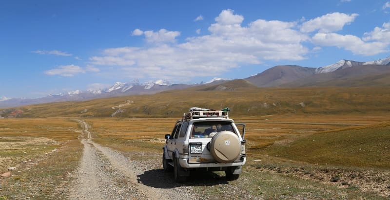
Breakfast. Transfer: Naryn - Ak-Muz settlement - Bosogo valley - Kyndy pass (72 km). Our route from Naryn lies to the south, we pass the eastern end of the Alamshyk mountains, soon we will cross the small Chaar pass at an altitude of 2598.6 meters above sea level.
From the pass, a road branches off to the large village of At-Bashi, the regional center of the district of the same name, the distance to it from here is 29 kilometers. The pass serves as a watershed between the basins of the Naryn and At-Bashi rivers, it should be noted that the At-Bashi river is a left tributary Naryn River.
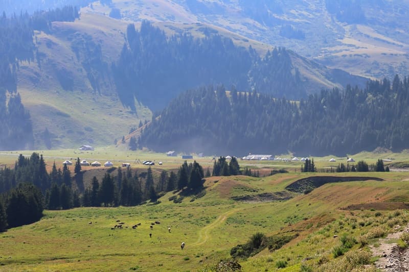
From the Chaar Pass, the road turns southeast, passes the southwestern spurs of the Naryn Too ridge and soon begins a gentle descent into the wide At-Bashi valley, at the beginning of which is the village of Ak-Muz. After the village, our path lies along the right bank of the At-Bashi River and soon we reach the picturesque Bosogo valley, through which the At-Bashi River flows, here are located numerous farms and livestock farms of the surrounding villages, which with the onset of summer drive cattle here to the lush grass of the meadows.
A short stop and a walk in the Bosogo tract. After the valley, the road turns south, passes the eastern slopes of the At-Bashi ridge and the Besh-Bel-Chir mountains. From here, the ascent begins along the Kyndy River, which is located in the western spurs of the Dzhanydzher ridge, to the Kyndy pass of the same name, 3,398.1 meters above sea level. There is a border post at the pass, a stop on the way to the pass, a walk in the surrounding area. Lunch on the way.
Transfer: Kyndy pass - Arasan river, Orto-Kashkasu - Bash-Kashkasu river (52 km).
From the pass, our path lies down, to the south along the Karapa-Tash river, soon the river merges with the right tributary of the Uch-Bulak, after the merger it receives the name Kyndy, which in turn is the right tributary of the Western Aksai River.
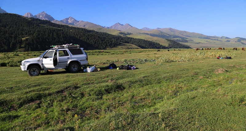
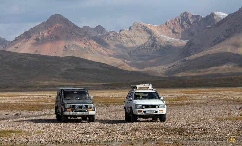
In the Kyzyl-Bulak valley, our road turns to the east. We pass a small mountain range Arasan in the north, in the southern part of Mount Kojete, we ford several rivers and gradually approach the right bank of the Western Aksai River. In the vicinity of the right tributary of the Eastern Aksai Bash-Kashkasu we will set up a camp for another overnight stay. Walks in the vicinity, dinner, overnight in tents.
Day 3. Bash-Kashkasu gorge - Lake Bivachnoye (40 km).
Breakfast. Transfer: Bash-Kashkasu gorge - Kansu, Akbaital, Korumdu-Su rivers - lakes in Karagermes River valley - mouth of Mustyr River - a ford across Kyzylunet River - Lake Bivachnoye (53 km).
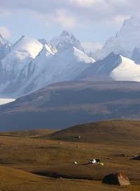
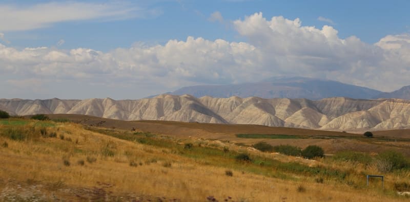
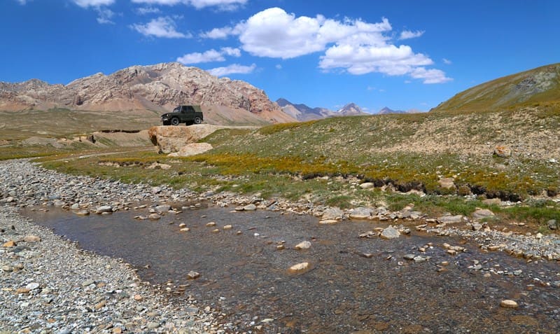
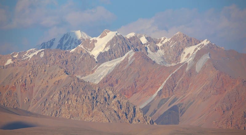
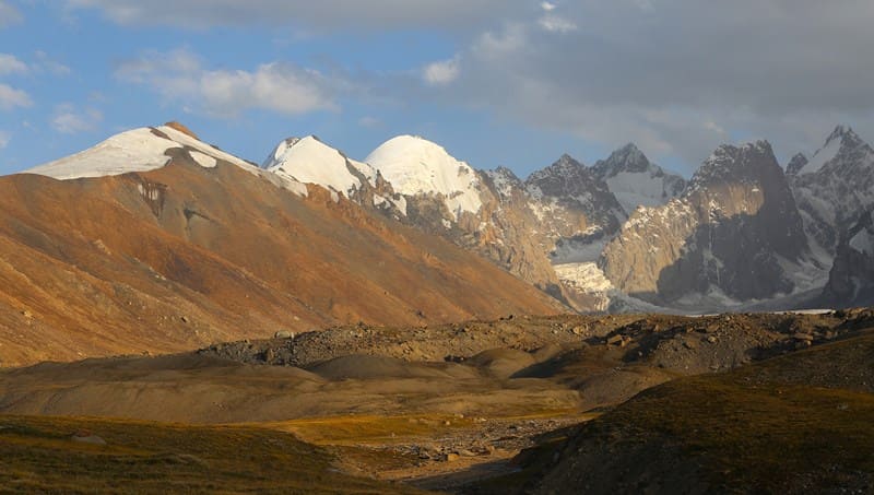
Our further path lies along a vast valley along which the Eastern Aksai River flows with its numerous tributaries. To our left are the southern slopes of the Dzhanydzher ridge, stretching 120 kilometers in the latitudinal direction. To our right, in the south, is the longest ridge in Kyrgyzstan - Kakshaal-Too, its direction is from the southwest to the east. In the eastern part, the Kyrgyz part of the Kakshaal-Too mountains ends with the highest, grandiose and northern peak - Pobeda Peak, 7439 meters above sea level. In the western part of the Kakshaal-Too ridge, Dankov Peak dominates, 5982 meters above sea level.
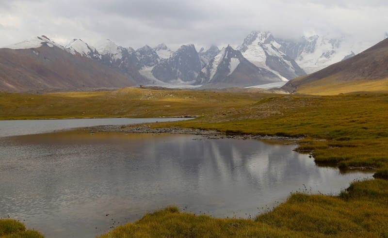
The Kakshaal-Too ridge contains the highest peaks and summits of Kyrgyzstan, some of which remain unconquered. Lunch on the way. On the way, a stop at numerous lakes in the Karagermes River valley. There are 9 large and about 50 small moraine lakes located on the southern, gentle slope of the Dzhanydzher ridge, limited by the high side of the Eastern Aksai River.
The lakes border on the west with the sources of the Akbaytal River, which originates from the eponymous spur located on the southern slopes of the Dzhanydzher ridge, in the east the lakes border with the northern sources of the Karagermes River and the eastern sources of the Kyzylunet River.
Transfer: mouth of Mustyr River - Kyzylunet River - Lake Bivachnoye (11 km).
We reach the small Mustyr River and turn south. We reach the Kyzylunet River, ford it and move along the right side of the Kyzyl-Asker River to the moraine lake Bivachnoye. In the eastern part of the lake, 300 meters from it, on a grassy meadow, we will set up our camp. Sunset walk to Lake Bivachnoye. Accommodation in tents, dinner, overnight.
Day 4. Radial walk to glacial lakes Kyzyl-Asker East and West (3 km).
Breakfast. After breakfast, we will take a walk to the glacial lakes Kyzyl-Asker East and West. These two lakes are visible only from the side ridges of the gorge or from the moraine, which is a dam in front of the lakes. The lakes are formed at the end of the glaciers West and East Kyzyl-Asker.
This is a grandiose spectacle that will not leave the traveler indifferent. The moraine offers a view of a huge mass of water that stretches from east to west. From the south, the waters of the lakes are supported by destroyed glacier masses that rise above the water by more than 20 meters.
Lake Western Kyzyl-Asker has formed a semi-oval on the southern side and wedged itself into the glacier by more than 215 meters. The lakes were formed relatively recently, since there is no vegetation on the moraine, the soil is bare and even the grass is not pleasing to the eye.
The icefall of the Kyzyl-Asker East and West glaciers dumps ice into the glacial-dammed lakes of the same name. The lakes are formed by intensively melting glaciers and a snow-firn layer covering the glacier above the feeding boundary. The tongues of the Kyzyl-Asker glaciers end in flowing, fresh lakes at an altitude of 3885 meters above sea level.
The northern part of the glacier breaks off into a lake. The vertical wall of the glacier tongue is cut by extended cracks with broken-off and overhanging masses of ice, periodically multi-ton masses break off from the glacier, which collapse with noise and rumble into the sun rays contributed to the melting and destruction of the ends of the glaciers.
Thus, the lake began to form and increase in size. Lunch on the way. Return to the camp (3 km). On the way to our tents, we will visit a huge stone that rises on the right side of the gorge on an ancient moraine. The location of this granite giant is associated with the work of a glacier, which in ancient times pushed this stone out of the depths of the gorge.
Now it is split in half and on its upper part there are two more square monoliths, which indicate the power of natural processes. Arrival at the camp, dinner, overnight in tents.
Day 5. Lake Bivachnoye - Kogalyachap plateau (25 km).
Breakfast. Transfer: Lake Bivachnoye - Kyzylunet River - mouth of Mustyr River - Lake Kagalyachap. The journey from Lake Bivachnoye to the ford across the Kyzylunet River requires a lot of attention and experience when moving through marshy terrain and syrts.
We cross the river, move along the pebble bed of the Mustyr River, go out onto the road, turn right and go to the Kagalyachap plateau. It is about 1 kilometer from the main road to the lake of the same name and soon we find a place for a camp. Setting up camp.
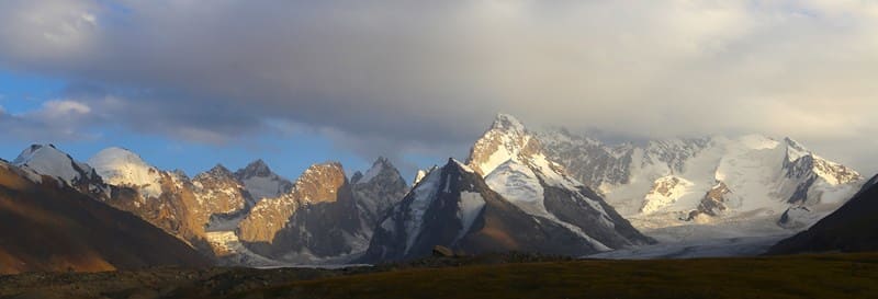
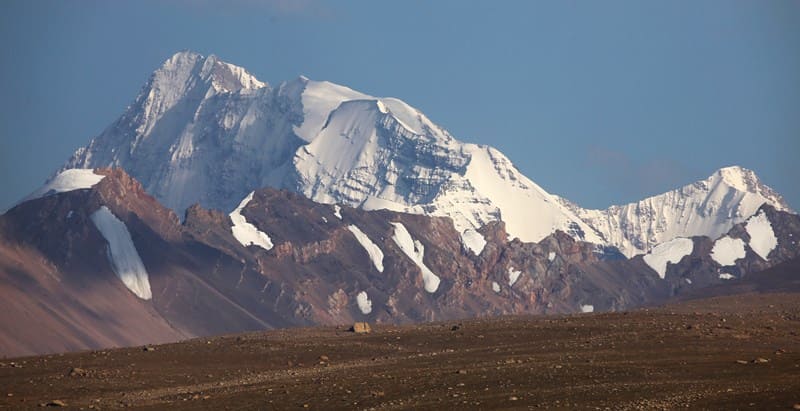
Lunch. In the vicinity of the camp there are three moraine lakes Kagalyachap South, North and Central, among the local population these lakes are called Ush-Kol (translated from Kyrgyz: Three lakes). Against the background of the lakes, amazing panoramas of the mountain-ice massif Kyzyl-Asker open up. In the east, three peaks rise: on the right Dankova 5982 meters above sea level, in the middle Chon-Turasu 5729 meters above sea level and on the left Korolev 5816 meters above sea level.
Against the backdrop of Lake Kagalyachap North, these peaks create beautiful pictures. Dinner and overnight in the tents.
Day 6. Walk to upper reaches of Kagalyachap plateau (8 + 8 = 16 km).
Breakfast. From the camp by the lake, our path lies along the northern slope of the plateau, this is a lifeless space at first glance, but from here we will see landscapes that are unlikely to be seen anywhere else. Rarely in the Tien Shan can you see such unique panoramas of high mountains framed by long, valley glaciers and beautiful glacial-rocky peaks.
In the north, the latitudinal Borkoldoy ridge stretches with its reddish, burgundy, purple slopes not covered with snow and glaciers. The multi-colored mountains of the ridge contrast sharply with its snow-ice peaks. Far to the west, the wide valley of the Eastern Aksai River opens up, which after the upper reaches gets a new name - Modyuryum, which merges with the Western Aksai River, the Kokkiya stream after the confluence of all the rivers gets a new name - Kakshaal, which carries the waters of all the rivers to the Republic of China, where it gets a new name - Taushkandarya, which belongs to the Tarim basin.
Lunch on the way. From the eastern and northern sides of the Kagalyachap plateau, the Kotur River bends around, which is the uppermost and first source of the Uzengegush River. This greatest river flows to the west, receives the left tributary of the Chong-Terek and turns sharply to the south, cuts through the Kakshaal-Too ridge and goes to China, becoming the left tributary of the Taushkandarya River.
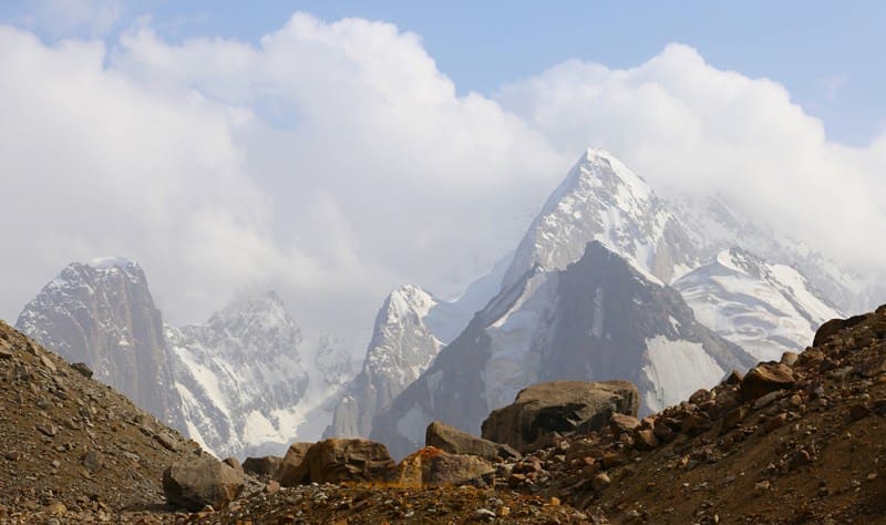
We reach a place from where the best panorama of the high-mountain ice-rock massif of Kyzyl-Asker is visible, even here we feel the breath of ice monsters. Here on the hill are scattered huge, relief and decorative stones, which were brought here by the movement of ancient glaciers.
We look and remember. This is the best we have seen so far. In the south of the massif rise ice giants, which, like giant teeth of an impregnable fortress, block the way to the south. In the southwestern part, against the background of winding glaciers, the grandeur of the Kyzyl-Asker peak, 5842 meters above sea level, located on the main ridge of the western part of the Kakshaal-Too ridge, looms. In the latitudinal direction, it is surrounded by peaks and goes to the west and east, lost in the distant haze and clouds. Return to the camp (8 km), dinner, overnight in tents.
Day 7. Kagaliachap plateau - city of Naryn (180 km).
Breakfast. Transfer: Kagalyachap plateau - Bash-Kashkasu gorge - Kyndy pass - Bosogo valley - Ak-Muz village - Naryn city (180 km). Lunch on the way. Arrival in Naryn, transfer to the hotel, accommodation, dinner, overnight stay.
Day 8. Naryn - Bishkek (320 km).
Breakfast.Transfer: Naryn - Kazan-Kuigan village - Dolon pass 3038 meters above sea level - Sary-Bulak village - Kochkor village - Kubakty pass 2161 meters above sea level - Kok-Moinok tract - Boom gorge - Kemin city - Tokmok city - Kant city - Bishkek. Arrival in Bishkek, end of the tour.
Note:
Author's program of Alexander Petrov. Copying and use of material with permission of author.
Photos by:
Alexander Petrov and Vitaliy Isikov.