



You are here
N. Palgov on Irtysh River.
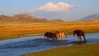
Journey along Bukhtarma and Irtysh Rivers.
"Before the confluence with the Bukhtarma, the Irtysh is called the Quiet Irtysh, although this quiet river is incomparably faster than our Neva. Below, it is called the Bystry Irtysh. The rapids are truly remarkable; a boat loaded with ore travels 130 miles downstream in twelve hours; this spring, we went down on a boat; the banks of the Bystry Irtysh are beautiful, but extremely harsh. Enormous, bare cliffs encircle it on both sides. There is a dangerous spot here, called the Seven Brothers, meaning seven rocks jutting out into the Irtysh; the current pushes and pulls you toward them; and it takes an experienced helmsman and skilled oarsmen to pass them safely. If you get to the first brother, the rowers say, you'll visit all seven. There's no doubt that after visiting the seventh brother, only splinters will remain of the karbaz. On the floodplain meadows of the cape, between Bukhtarma and the Tikhyi Irtysh, the Ukrainian settlers this year planted enormous melon fields, surrounded by sunflowers.
L.K. Poltoratskaya. "Bremen Expedition in Semipalatinsk Region." 1879.
"We traveled almost 200 miles upstream along the right bank of the Irtysh, through a vast steppe covered with dry, yellowish grass. In places where the steppe was watered by small streams flowing into the Irtysh, tall, dense grass and a multitude of flowers grew in narrow transverse valleys; "But for the most part the plain was bare and sun-baked."
George Kennan. "Siberia and Exile." Volume I. 1906.
Sights of Irtysh River in Kazakhstan.
One of the world's largest rivers, the Irtysh, flows through the entire eastern part of the Kazakh SSR. It begins at the 47th parallel, amid the glaciers and snow of the Mongolian Altai, and ends 550 km short of the Arctic Circle. The river's total length is 3,825 km, of which approximately 1,800 km are in Kazakhstan.
In its upper reaches, the Irtysh forms the vast Lake Zaysan, renowned for its rich fish stocks. After leaving the lake, the river receives a number of tributaries along its route, primarily from the right. Here, the Kurchum, Bukhtarma, Ulba, and Uba rivers flow into the Irtysh, collecting their waters from the abundant precipitation of the Kazakh Altai Mountains.
As their outflows join, the Irtysh's power gradually increases. At the same time, the river's banks become 300, 400, and 500 meters apart. Rippling masses of water flow rapidly between them, tearing away unstable clumps of earth. From the boat, one can see sweeping hilly vistas, then rocky cliffs approaching the water's edge.
The most picturesque section of the river is between the village of Ust-Bukhtarma and the city of Ust-Kamenogorsk. Here, for 90 kilometers, the Irtysh has carved a narrow passage between the mountains. To the left, the rocky masses of the Kalbinsky Range plunge down to the river like gigantic cliffs, 200-300 meters high.
To the right, the Bukhtarma Mountains fall like equally majestic walls. During high water, the coastal cliffs, which have compressed the river to a width of a hundred meters, are washed by the water. During low water, a narrow strip of gravel forms between them and the river.
The mountains are covered with forest. Along ledges, crevices, and wherever they can cling, shaggy, tall spruce trees stretch upward, interspersed with fir and shrubs. Their thickets are rich in wild currants and raspberries. Both the right- and left-bank mountains, composed of granite, clay shale, and diorite, are rich in minerals.
The Irtysh carries its waters through the gorge at high speed. This is the most difficult section for shipping and rafting. But these same swift and powerful waters also contain enormous hydroelectric resources. After exiting the gorge, the Irtysh begins to meander slightly and, in places, breaks into branches.
Here, too, sandy spits and green capes cut into it. Cozy backwaters, where you can sometimes spot a fisherman setting his nets, beckon with the smoothness and calm of their waters. Before the city of Semipalatinsk, the banks of the Irtysh become smooth.
Pine forests appear on them, stretching like a continuous ribbon far downstream from Semipalatinsk. The city itself is located on the right bank of the river, but also partially encompasses the left. It is the third largest city in Kazakhstan. Among its numerous industrial organizations, the meat-packing plant has earned a well-deserved reputation.
The city grows year after year, enriching itself with cultural and educational institutions. From the mouth of the Chagan River, the Irtysh River in Kazakhstan receives no more tributaries. But fed by groundwater, it continues to grow wider and more majestic.
Here, the picturesque landscape characteristic of the mountainous part of the river gives way to the beauty of open spaces, bordered by distant horizons. The Irtysh Valley, composed of alluvial deposits, extends up to 8 km in width. It is covered mostly by floodplains, lakes, oxbow lakes, and small marshes.
From Pavlodar to Omsk, along the right bank of the river, stretches a ridge, falling on the eastern side toward Kulunda, and further downstream toward the Baraba steppe. Between the villages of Cheremushki and Grachevskoye, groves of pine forests can be found on this ridge - remnants of the once vast Dolonsky pine forest.
The earliest settlements, which served as outposts for the region's former tsarist colony, are also located on this ridge. The left bank of the river is almost entirely low and meadowy. Rising above the water as a small ledge, it gently slopes away from the river and gradually merges with the plain.
For hundreds of kilometers beyond it stretches a sun-baked semi-desert with salt marshes, salt lakes, and dry riverbeds that only fill in the spring. Surrounded by such nature, the city of Pavlodar stands on the right bank of the river. Beyond Pavlodar, the river enters the West Siberian Lowland.
Its vast waters merge here with wide, lush floodplains... Here is the capital of Western Siberia – Omsk. The city's white stone buildings, standing in a beautiful row along the river, almost touch the edge of the bank. The noise of relentless life and gigantic construction contrasts sharply with the rhythmic splash of the river.
Further downstream, at a speed halved to a third, but with an increased load of water, collected from an area greater than half the size of Kazakhstan, the Irtysh meets the Ob River and flows together into the Arctic Ocean.
Geographic coordinates of Irtysh River are: N50°03'15 E82°22'18


Authority:
"The Nature of Kazakhstan in Essays and Pictures." N.N. Palgov. Publishing House of the Academy of Sciences of the Kazakh SSR. Alma-Ata. 1950.
Photographs and drawings:
George Kennan. "Siberia and Exile." "Southwestern Siberia. The Altai Mountains." Volume 1. 1906.
https://rus-turk.livejournal.com/354668.html
Photographs by George Kennan and drawings by George Frost, 1885, taken from the archive of George Kennan.
https://rus-turk.livejournal.com/354668.html