


![]()
You are here
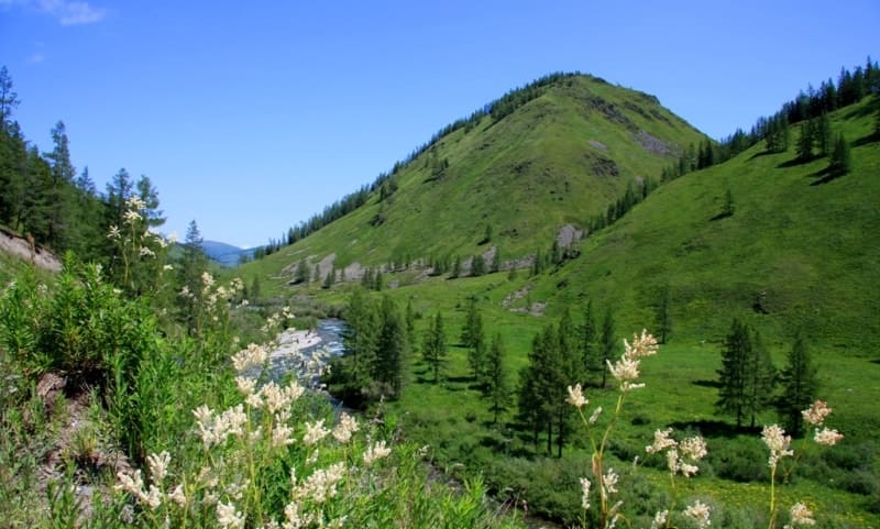
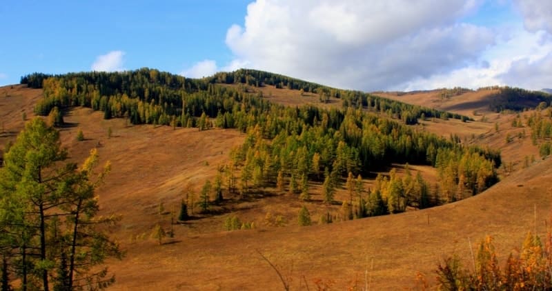
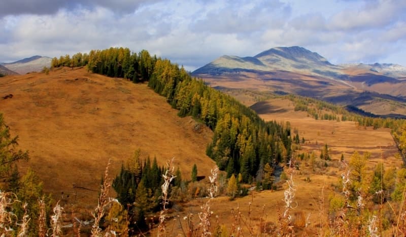
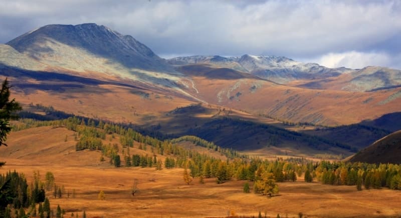
Alatay-Burkhat road
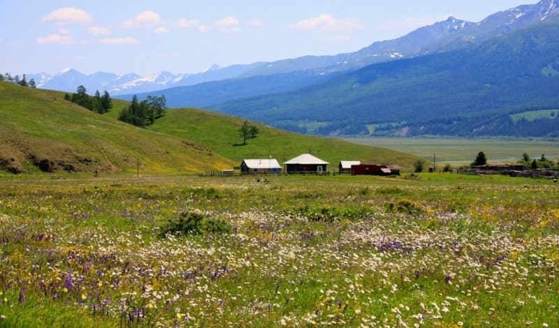
Adventure Tours from Markakol lake to Bukhtarma valley.
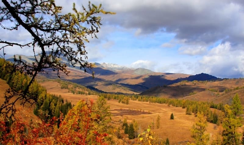
“Through the thicket of the forest, when we left it, magnificent views opened up: the entire Bukhtarma valley was before us. Finally, the real climb began, as the fur handlers had said beforehand, very difficult, especially for camels. The steepness is terrible, and the entire climb is littered with huge stones, over which the horses must climb. The ledge here is small and quite wide, but above the sheer wall there are two thousand feet. All those whose horses were weaker, or whose heads were spinning, dismounted. Having climbed up, we let the horses breathe and went across the plain, where, despite the noon, it was very cold; in many places there was snow all around. We passed a lake, a hundred fathoms long and 15 fathoms wide, lying in a fairly deep basin; ducks were swimming on it. They say here that this lake has no bottom; its edges are covered with a swamp; it would be a disaster to fall into this quagmire. Finally, we climbed up to the Burkhat Pass; as we climbed, there were some disheveled, low, crooked or simply lying coniferous trees."
L. K. Poltoratskaya. "A Trip Along Chinese Border from Altai to Tarbagatai." 1870.
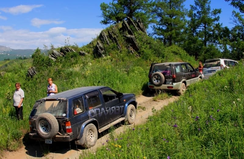
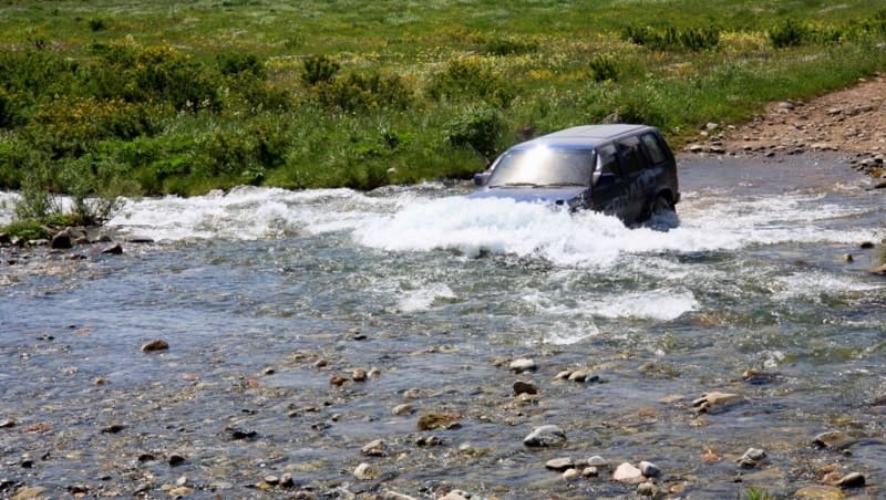
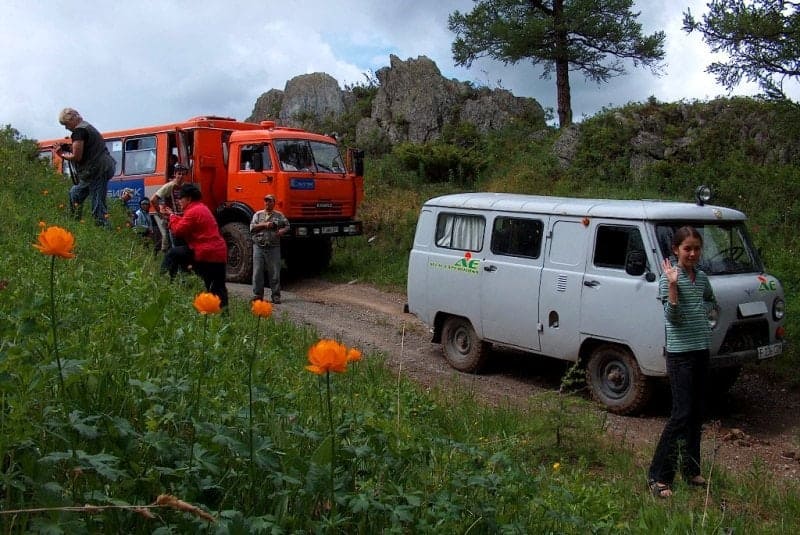
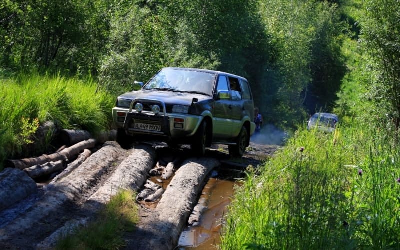
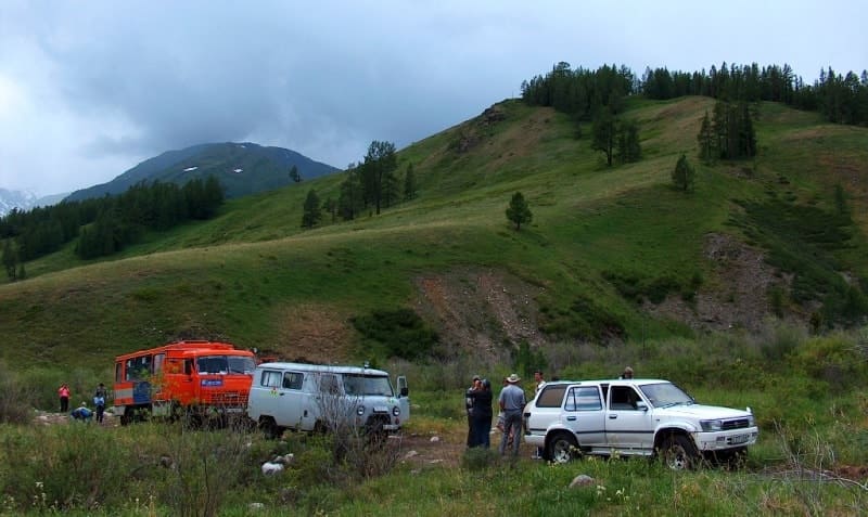
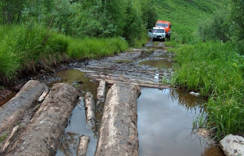
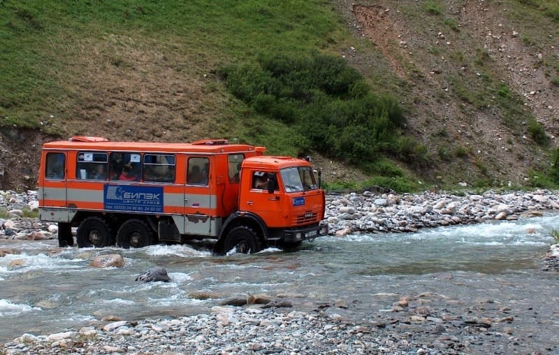
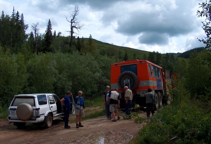
Jeep Tour on Austrian road Kazakh Altay.
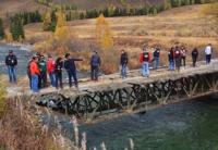
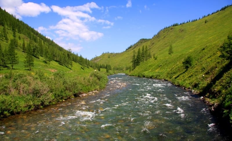
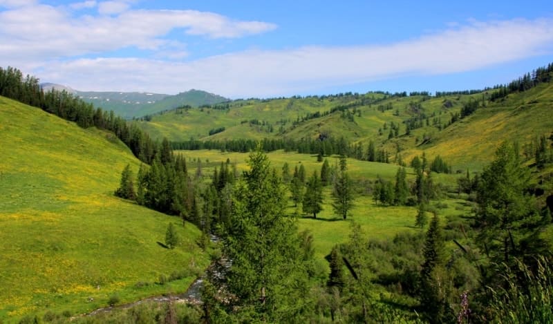
Alatay-Burkhat road (old name is Austrian, Old Austrian road) northern part of road is located on territory of Katon-Karagay National Nature Park, in Markakol and Katon-Karagay districts in East Kazakhstan region, connects village of Markakol with Bukhtarma River valley through Mramorny pass at 1371.1 meters above sea level, Alatay pass at 1792.4 meters above sea level and Burkhat pass at 2141.9 meters above sea level.
About name of Alatay-Burkhat road.
There is an opinion that on the territory of the current East Kazakhstan region (formerly the territory of the Semipalatinsk province of Russia) during the First World War from July 1914 to November 1918, a road was built by prisoners of war, which in some sources is called the Austrian or Old Austrian road.
There is no information about the construction of the road section from the Sorvenok River to the Bukhtarma River valley through the Burkhat Pass in local archives; apparently, they were in the archives of the USSR Ministry of Defense. Currently, obtaining and using this data requires special permission and considerable effort.
Unfortunately, at present, some media publications are unconfirmed and dubious materials from the Internet are used. There were even films made about the construction of the road by prisoners of war and unfounded speculations are given, without references to any documents or memories of specific people.
In 2005, on the shore of Lake Markakol near the village of Urunkhaika, I met a group of elderly fishermen sitting at an improvised table near a log hut. Since we came here to swim, given the sandy shore and our proximity to the fishermen, it was necessary to come up and say hello.
In a word, the vacationing fishermen turned out to be former border guards, one of whom served as the head of the outpost from the late 50s and early 60s of the XXth century near the village of Vladimirovka (now the village of Balyktygul) 32 kilometers northeast of the village of Urunkhaika.
After exchanging words, I was about to leave, but decided to ask a question that was always on the tip of my tongue:
- "Do you happen to know who and when built the so-called Austrian road from the bridge over the Sorvenok River to the Bukhtarma Valley." One of them immediately perked up and answered:
- "I know."
This man turned out to be the former head of the Vladimirovka outpost. He told me that the road was built by two engineering battalions using heavy equipment: bulldozers, special engineering machines and blasting operations. Given the proximity of the border with the People's Republic of China and the military confrontation, the military leadership of the border troops decided to build a road for rapid response in the event of an escalation of relations with the aggressive neighbor.
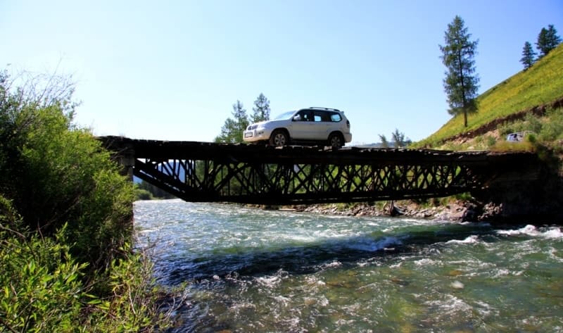
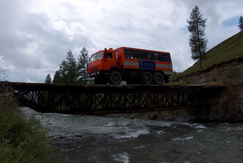
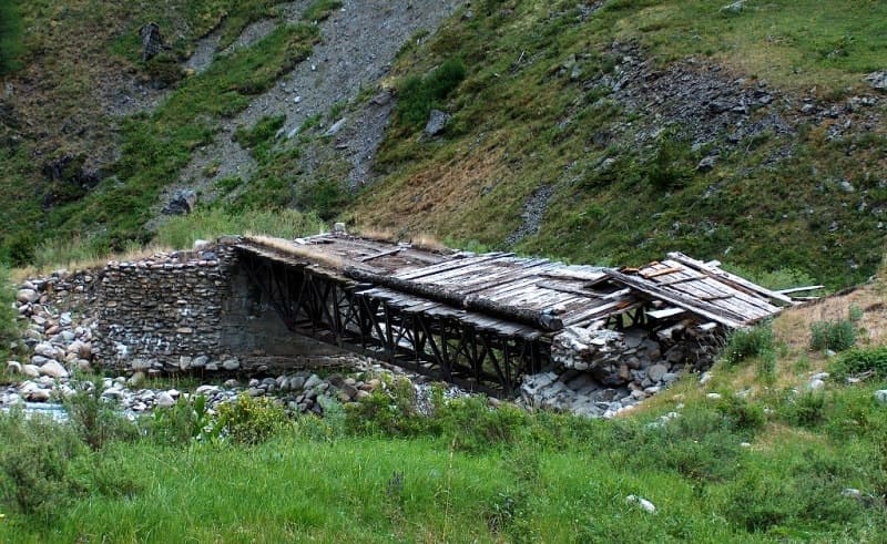
One battalion built the road from the main road between the villages of Urunkhaika and Bugumuz (formerly Sorvenok), the other from the Bukhtarma River valley. Metal bridges were transported on logs like sleds, which were towed by special, heavy tracked tractors.
The bridges were transported from the village of Alekseyevka (now Markakol) through the village of Urunkhaika and further to the Karakoba River. The former head of the outpost turned out to be a man of few words, I was embarrassed to ask his name and surname.
Of course, I explained the essence of my question, that I had been interested in this topic for many years. The construction and purpose of the road was intended for rapid response and solving problems of redeployment of personnel and military equipment, in the event of an escalation of relations with the Republic of China, which was taking place at that time.
The legend about the captured Austrians, unfortunately, remains on the Internet and in guidebooks. Its name appeared in the mid-90s of the XXth century from words and mentions in tourist routes and programs of two tour operators who began their work in tourism in the East Kazakhstan region.
With their light hand, this name was fixed among ignorant tourists and those who love beautiful legends. It was from their words that I first heard about this name in the early 90s. It is difficult to understand the need for such a road at the beginning of the XXth century, especially with the involvement of prisoners of war for construction, when there was no need for a road, given the lack of transport and the extremely low population density of the region.
In Altai at that time, the main movement was done on horses and camels, in the mountainous areas they moved only on horseback. It is difficult to imagine the purpose of building this road for sparsely populated villages, which only in the 80s of the XIX century passed from Chinese rule to Russia.
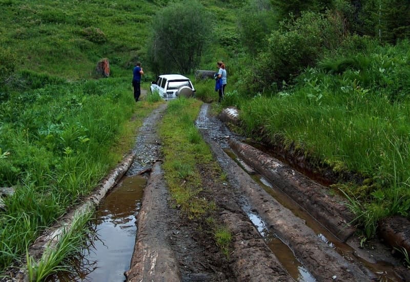
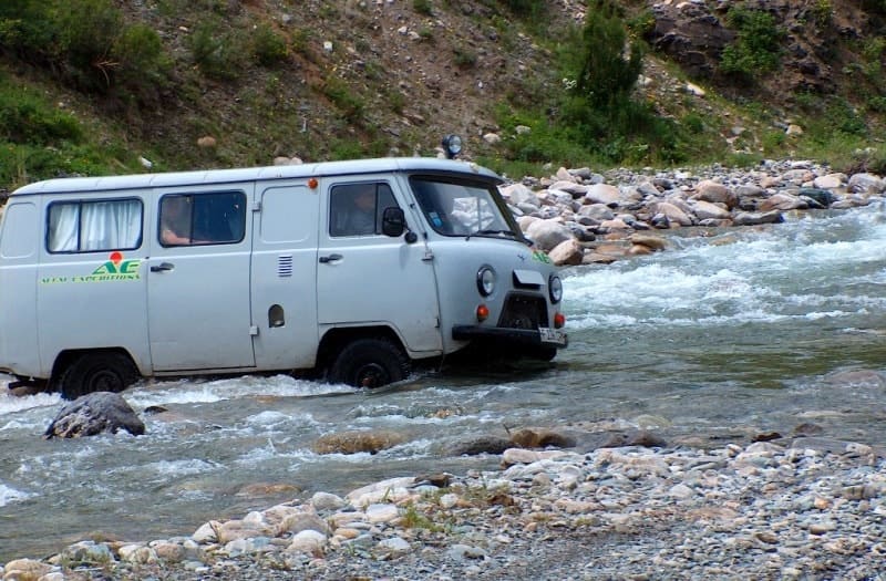
Where could metal bridges have come from in those distant times and how can one explain the transportation of 5 non-detachable bridges weighing tens of tons to the places of their installation. Even at the present time, rare cars of tourists and local residents, including border guards, drive along this road from the end of June to mid-September.
The rest of the time, this road lies under a meter-thick layer of snow, even until mid-June, the road is blocked by snow avalanches that no one clears. About labor intensity and manual work technology, in those distant times only a crowbar, a pick and a stretcher could be used, considering that there was no infrastructure for living in this area for the same prisoners of war.
It was a wild, almost inaccessible area. The first explorer to visit these places was G.S. Karelin, who explored the area in 1840 - 1841. G.S. Karelin went to the areas of modern Kazakhstan along the route: Semipalatinsk, Ayaguz, Tarbagatai, Semipalatinsk, Bukhtarma, Narym ridge, Sarytau mountains, Lake Markakol, Ust-Kamenogorsk, Ridder and Kryukovsky mines, Semitau mountains, Chingiztau, Arkat, Semipalatinsk. In 1843, Karelin G.S. again visited Markakol.
In the summer of 1863, Karl Struve and Grigory Potanin traveled to Lake Zaysan and the Black Irtysh river region to Lake Markakol. They described their journey in 1867 in the Proceedings of the Russian Geographical Society in the essay "Journey to Lake Zaysan and the Black Irtysh River Region to Lake Markakol and the Sarytau Mountains in the Summer of 1863".
In the 1870s, the geographer I. Ignatov wrote a description of the Bukhtarma and Black Irtysh river basins, Lake Markakol and the nearby mountains. In 1888, A. Suvorov visited Lake Markakol and left a work entitled "Fishing on Lake Markakul".
Bulletin of the Fishing Industry. 1888. No. 8 - 9. St. Petersburg, April 5, 1888. Through the Burkhat Pass to Lake Markakol, through its northern coast with an exit to the Kaldzhir River and further to Maiterek, traveled with her husband Lidiya K. Poltoratskaya. "A Trip Along the Chinese Border from Altai to Tarbagatai". Russian Herald. 1871. No. 6.
In 1895, the traveler and explorer V.V. Sapozhnikov visited the Kazakh part of Altai (Lake Rakhmanovskoye, Bukhtarma Valley). Unfortunately, the name Austrian or Old Austrian Road has been assigned to this area in some sources, without any evidence base for such a name.
In my opinion, the name of the road should reflect real facts, the peculiarity of natural attractions and the true history of the region. "Whoever does not know mathematics suffers financial losses, whoever does not know history pays with blood and loss of territory."
The beginning of the 1960s was marked by a significant aggravation of relations between China and the USSR, which led to an ideological and political split between the two largest communist states. In the early 1960s, several armed clashes occurred between the USSR and China on the border, on Damansky Island (Far East), including near Lake Zhalanashkol (Kazakhstan).
As a result, relations between the USSR and China deteriorated so much that in 1966 China actually announced its refusal to cooperate with the CPSU. This led to a serious split in the international communist movement and created a tense situation in the world.
It is well known that in the border areas in the Zhetysu, Almaty region, in the depths of the territories in the Uyghur, Kegen and Panfilov districts, in the 60s of the XXth century, heights and near the main roads were installed pillboxes (long-term firing point). I think the name “Alatay-Burkhat road” is much more appropriate.
Geographic coordinates of beginning of the Alatai-Burkhat road (between villages of Shyngystai and Enbek along the Katon-Karagai - Uryl highway): N49°10'47 E86°01'09
Geographic coordinates of Alatay-Burkhatskaya (middle of road): N49°00'55 E86°01'32
Geographic coordinates of end of Alatai-Burkhat road (at bridge over Sorvenok River): N48°53'10 E86°03'47
Authority and photos by:
Alexander Petrov.